While the Black Hills departure is scenic, the landing approach into Atlanta provides significantly more visual interest and landmark density. The combination of a major metropolitan skyline, multiple lakes, river valleys, and the dramatic urban-to-airport transition outweighs the modest mountain scenery of the takeoff. The right side captures more recognizable, named features and greater variety across the full flight duration.
Flown RCA to ATL? Did we get it right?
Flight Path
Rapid City to Atlanta is 1,234 miles (1,987 km), a flight of about 3 hours 5 minutes.
The flight path crosses the Great Plains and Mississippi River valley. Notable features include the Missouri River near Kansas City, the Ozark Plateau region of Missouri and Arkansas (gentle rolling terrain), and the transition into the Appalachian foothills as the aircraft approaches Tennessee and Georgia. The Mississippi River crossing occurs roughly at the midpoint and is visible as a wide, meandering waterway. The Ozarks provide subtle terrain relief compared to the flat plains of the northern route segment.
Great circle distance and headings ›


Phase by phase
Takeoff from RCA
LEFTRapid City sits at the eastern edge of the Black Hills, a modest but genuine mountain range visible during climb-out. Left side captures the forested ridges and valleys of the Black Hills immediately west and northwest of the airport, providing terrain relief absent on the right.
Landing at ATL
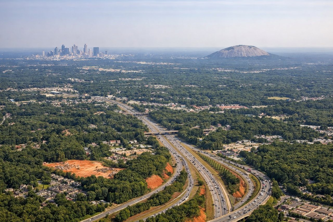
RIGHTThe approach to Atlanta from the northwest descends over the Piedmont region, revealing the city's sprawling metropolitan area, multiple lakes (Lake Lanier, Lake Allatoona visible to the north), and the Chattahoochee River valley. Right side captures the urban density and water features that define the Atlanta approach corridor.
Will your flight be in sunlight?
Pick a date and time in the Sun Map to watch the sun move across your whole flight.
About This Route
Which side of the plane should I sit on flying from Ellsworth Afb (RCA) to The William B Hartsfield Atlanta International (ATL)?
Sit on the Right side of the plane for the best views on flights from Rapid City to Atlanta. While the Black Hills departure is scenic, the landing approach into Atlanta provides significantly more visual interest and landmark density. The combination of a major metropolitan skyline, multiple lakes, river valleys, and the dramatic urban-to-airport transition outweighs the modest mountain scenery of the takeoff. The right side captures more recognizable, named features and greater variety across the full flight duration.
What can I see during takeoff from Ellsworth Afb in Rapid City?
During takeoff from Ellsworth Afb (RCA), sit on the Left side for the best views. Rapid City sits at the eastern edge of the Black Hills, a modest but genuine mountain range visible during climb-out. Left side captures the forested ridges and valleys of the Black Hills immediately west and northwest of the airport, providing terrain relief absent on the right. Notable sights include: Black Hills ridgelines, Harney Peak area, Rapid Creek valley, surrounding prairie transition zone.
What can I see when landing at The William B Hartsfield Atlanta International in Atlanta?
When landing at The William B Hartsfield Atlanta International (ATL), sit on the Right side for the best views. The approach to Atlanta from the northwest descends over the Piedmont region, revealing the city's sprawling metropolitan area, multiple lakes (Lake Lanier, Lake Allatoona visible to the north), and the Chattahoochee River valley. Right side captures the urban density and water features that define the Atlanta approach corridor. Notable sights include: Atlanta skyline and downtown core, Lake Lanier (north of city), Chattahoochee River, Hartsfield-Jackson airport runways and taxiway network.
How long is the flight from Rapid City to Atlanta?
The flight from Ellsworth Afb (RCA) to The William B Hartsfield Atlanta International (ATL) takes about 3 hours 5 minutes. The shortest flight path between them is 1,234 miles (1,987 km); winds and air traffic control usually add a few percent.
What does the Rapid City to Atlanta flight path pass over?
The flight path crosses the Great Plains and Mississippi River valley. Notable features include the Missouri River near Kansas City, the Ozark Plateau region of Missouri and Arkansas (gentle rolling terrain), and the transition into the Appalachian foothills as the aircraft approaches Tennessee and Georgia. The Mississippi River crossing occurs roughly at the midpoint and is visible as a wide, meandering waterway. The Ozarks provide subtle terrain relief compared to the flat plains of the northern route segment.