Rapid City to Charlotte is 1,324 miles (2,131 km), a flight of about 3 hours 15 minutes.
While the takeoff offers brief Black Hills views, the landing approach provides sustained scenic value with Charlotte's urban landscape and Piedmont geography. The left side captures the city's development pattern and the Catawba River valley more effectively than the right.
Flight Path
The flight path crosses the Missouri River valley near the South Dakota-Nebraska border, then traverses the Great Plains of Nebraska and Kansas with the Platte River visible in sections. As the aircraft moves southeast into Missouri and then toward the Appalachian foothills of North Carolina, the terrain gradually transitions from plains to rolling hills. The Mississippi River is visible during the eastern Missouri portion. The Ozark plateau creates subtle elevation changes in southern Missouri. By mid-flight over Tennessee and Kentucky, the landscape becomes increasingly forested with river valleys (Cumberland, Tennessee) becoming more pronounced as the aircraft approaches the Appalachian region.
Great circle distance and headings ›

.jpeg?width=600)
Phase by phase
Takeoff from RCA
RIGHTRight-side seats offer views of the Black Hills and surrounding high plains as the aircraft climbs eastward. The terrain rises noticeably west and northwest of Rapid City, creating immediate visual interest during the initial climb.
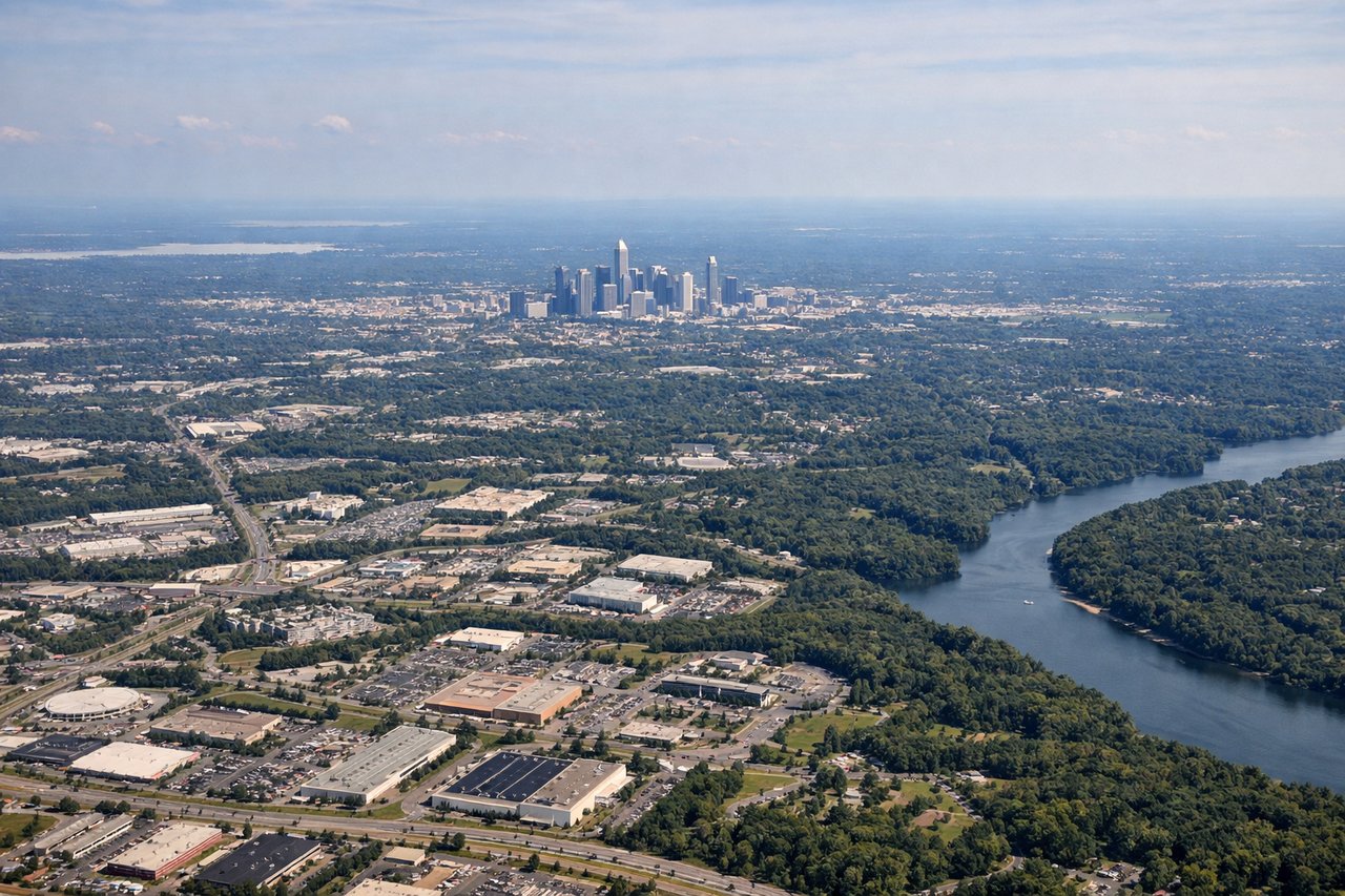
Landing at CLT
LEFTLeft-side seats provide views of the Piedmont region and Charlotte's urban landscape during descent. The city's skyline and surrounding suburban sprawl become visible 20-30 miles out, with the Catawba River valley offering geographic context.
Landmarks on this routeAll landmarks →
Will your flight be in sunlight?
Pick a date and time in the Sun Map to watch the sun move across your whole flight.
About This Route
Which side of the plane should I sit on flying from Ellsworth Afb (RCA) to Charlotte Douglas International (CLT)?
Sit on the Left side of the plane for the best views on flights from Rapid City to Charlotte. While the takeoff offers brief Black Hills views, the landing approach provides sustained scenic value with Charlotte's urban landscape and Piedmont geography. The left side captures the city's development pattern and the Catawba River valley more effectively than the right.
What can I see during takeoff from Ellsworth Afb in Rapid City?
During takeoff from Ellsworth Afb (RCA), sit on the Right side for the best views. Right-side seats offer views of the Black Hills and surrounding high plains as the aircraft climbs eastward. The terrain rises noticeably west and northwest of Rapid City, creating immediate visual interest during the initial climb. Notable sights include: Black Hills (western skyline), Harney Peak area, Belle Fourche River valley, High Plains plateau.
What can I see when landing at Charlotte Douglas International in Charlotte?
When landing at Charlotte Douglas International (CLT), sit on the Left side for the best views. Left-side seats provide views of the Piedmont region and Charlotte's urban landscape during descent. The city's skyline and surrounding suburban sprawl become visible 20-30 miles out, with the Catawba River valley offering geographic context. Notable sights include: Charlotte skyline and downtown district, Catawba River, Piedmont foothills, suburban development corridors.
How long is the flight from Rapid City to Charlotte?
The flight from Ellsworth Afb (RCA) to Charlotte Douglas International (CLT) takes about 3 hours 15 minutes. The shortest flight path between them is 1,324 miles (2,131 km); winds and air traffic control usually add a few percent.
What does the Rapid City to Charlotte flight path pass over?
The flight path crosses the Missouri River valley near the South Dakota-Nebraska border, then traverses the Great Plains of Nebraska and Kansas with the Platte River visible in sections. As the aircraft moves southeast into Missouri and then toward the Appalachian foothills of North Carolina, the terrain gradually transitions from plains to rolling hills. The Mississippi River is visible during the eastern Missouri portion. The Ozark plateau creates subtle elevation changes in southern Missouri. By mid-flight over Tennessee and Kentucky, the landscape becomes increasingly forested with river valleys (Cumberland, Tennessee) becoming more pronounced as the aircraft approaches the Appalachian region.