Charlotte to Rapid City is 1,324 miles (2,131 km), a flight of about 3 hours 30 minutes.
Left side wins both ends of the flight. During the cruise portion heading northwest, the left side also tracks closer to the Missouri River crossings in Missouri and the rolling Ozark terrain, while the right side faces open plains. Left is the clear choice for the full journey.
Flight Path
The flight crosses the Tennessee River valley, the Mississippi River near Memphis or St. Louis depending on routing, the Missouri Ozarks, the Missouri River in central Missouri, the Kansas Flint Hills grasslands, and the increasingly arid shortgrass prairie of western Kansas and Nebraska before the Black Hills come into view on descent into Rapid City.
Great circle distance and headings ›.jpeg?width=600)


Phase by phase
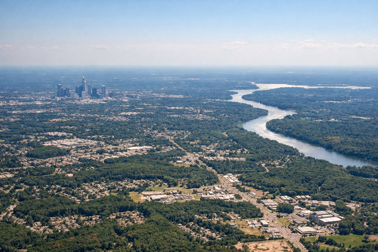
Takeoff from CLT
LEFTCLT's primary departure runways (18C/36C and 18L/36L) oriented north-south mean a westbound departure often involves a left turn toward the northwest. The left side picks up the Charlotte skyline and the Piedmont terrain rolling toward the Appalachian foothills. Right side faces east toward flat Carolina Piedmont with little of note.
Landing at RCA
LEFTEllsworth AFB runways are oriented roughly 13/31 (northwest-southeast). Arriving from the east on a westward approach, the left side faces south and picks up the Black Hills massif rising dramatically from the plains, including Harney Peak and the broader Black Hills uplift. The right side faces north toward open plains with less visual interest.
Landmarks on this routeAll landmarks →
Will your flight be in sunlight?
Pick a date and time in the Sun Map to watch the sun move across your whole flight.
About This Route
Which side of the plane should I sit on flying from Charlotte Douglas International (CLT) to Ellsworth Afb (RCA)?
Sit on the Left side of the plane for the best views on flights from Charlotte to Rapid City. Left side wins both ends of the flight. During the cruise portion heading northwest, the left side also tracks closer to the Missouri River crossings in Missouri and the rolling Ozark terrain, while the right side faces open plains. Left is the clear choice for the full journey.
What can I see during takeoff from Charlotte Douglas International in Charlotte?
During takeoff from Charlotte Douglas International (CLT), sit on the Left side for the best views. CLT's primary departure runways (18C/36C and 18L/36L) oriented north-south mean a westbound departure often involves a left turn toward the northwest. The left side picks up the Charlotte skyline and the Piedmont terrain rolling toward the Appalachian foothills. Right side faces east toward flat Carolina Piedmont with little of note. Notable sights include: Charlotte skyline, Lake Norman to the north, Crowders Mountain State Park to the west, Catawba River corridor.
What can I see when landing at Ellsworth Afb in Rapid City?
When landing at Ellsworth Afb (RCA), sit on the Left side for the best views. Ellsworth AFB runways are oriented roughly 13/31 (northwest-southeast). Arriving from the east on a westward approach, the left side faces south and picks up the Black Hills massif rising dramatically from the plains, including Harney Peak and the broader Black Hills uplift. The right side faces north toward open plains with less visual interest. Notable sights include: Black Hills uplift and ridgeline, Badlands National Park terrain to the southeast, Rapid City urban area, Belle Fourche River valley.
How long is the flight from Charlotte to Rapid City?
The flight from Charlotte Douglas International (CLT) to Ellsworth Afb (RCA) takes about 3 hours 30 minutes. The shortest flight path between them is 1,324 miles (2,131 km); winds and air traffic control usually add a few percent.
What does the Charlotte to Rapid City flight path pass over?
The flight crosses the Tennessee River valley, the Mississippi River near Memphis or St. Louis depending on routing, the Missouri Ozarks, the Missouri River in central Missouri, the Kansas Flint Hills grasslands, and the increasingly arid shortgrass prairie of western Kansas and Nebraska before the Black Hills come into view on descent into Rapid City.