While the departure offers Iceland's dramatic volcanic landscape, the landing approach into Ottawa provides more sustained and varied scenery—the Ottawa River system, Gatineau Hills, and Canada's capital region offer greater visual interest than the relatively uniform Atlantic crossing.
Flown RKV to YOW? Did we get it right?
Flight Path
Reykjavik to Ottawa is 2,403 miles (3,868 km), a flight of about 5 hours 45 minutes.
The flight crosses the North Atlantic at high altitude (typically 33,000-35,000 feet), passing over open ocean with no significant landmarks visible. The route generally follows a great circle path southwestward. Greenland's southern tip may be visible on clear days as a distant, ice-covered landmass on the left (north) side during the mid-flight portion, though it remains far below the horizon at cruise altitude. The approach to North America brings views of the Labrador coast and Maritime provinces before turning inland toward Ottawa.
Great circle distance and headings ›Phase by phase
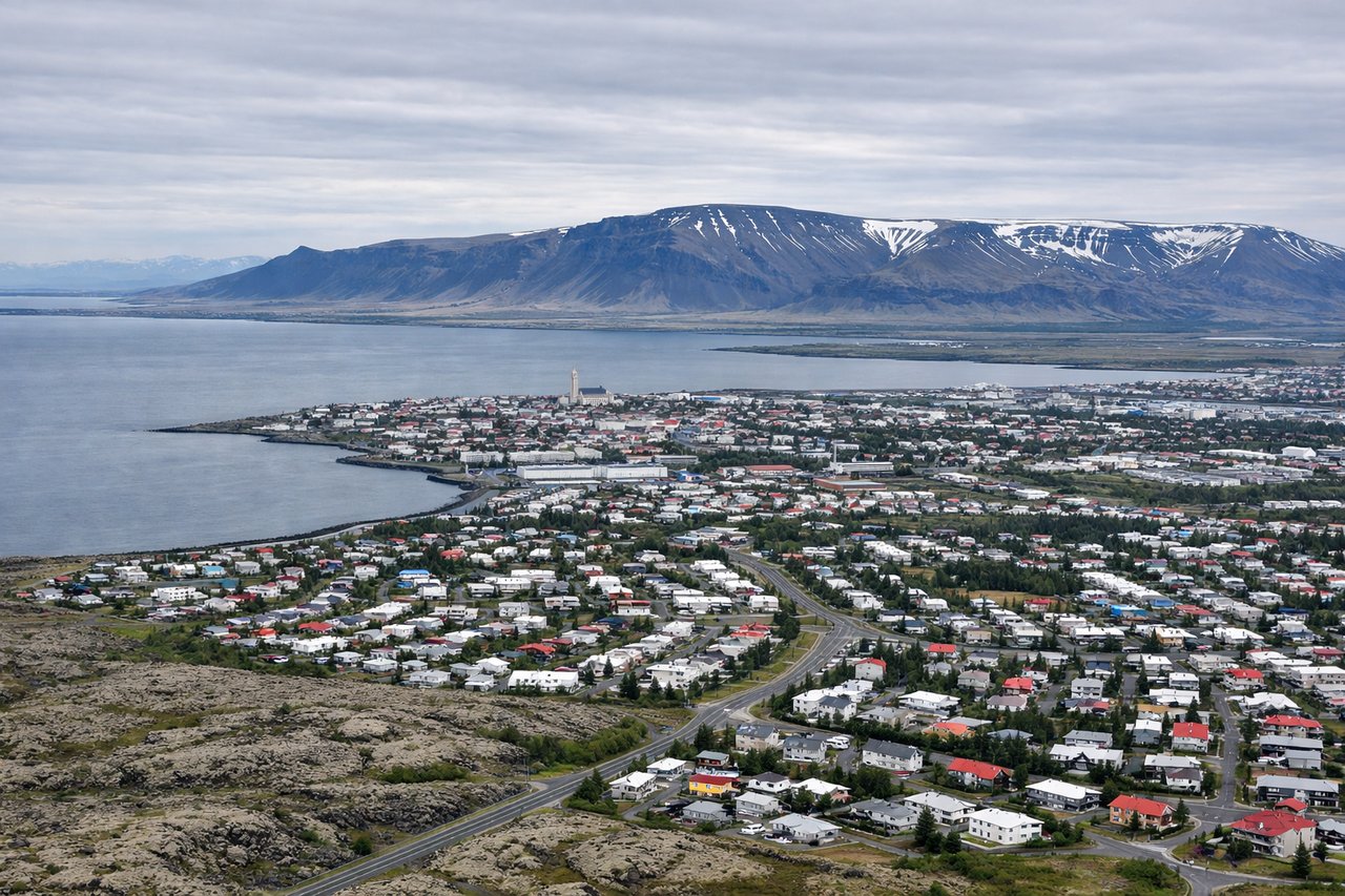
Takeoff from RKV
LEFTLeft seats offer views of Reykjavik's coastal geography and the approach to the Atlantic. You'll see the city sprawl along the coast and the darker volcanic terrain inland that characterizes Iceland's interior.
Landing at YOW
RIGHTRight seats provide excellent views during the approach to Ottawa. You'll see the Ottawa River, the Gatineau Hills across the river in Quebec, and the urban sprawl of Canada's capital region as you descend.
Will your flight be in sunlight?
Pick a date and time in the Sun Map to watch the sun move across your whole flight.
About This Route
Which side of the plane should I sit on flying from Reykjavik (RKV) to Ottawa Macdonald Cartier International (YOW)?
Sit on the Right side of the plane for the best views on flights from Reykjavik to Ottawa. While the departure offers Iceland's dramatic volcanic landscape, the landing approach into Ottawa provides more sustained and varied scenery—the Ottawa River system, Gatineau Hills, and Canada's capital region offer greater visual interest than the relatively uniform Atlantic crossing.
What can I see during takeoff from Reykjavik in Reykjavik?
During takeoff from Reykjavik (RKV), sit on the Left side for the best views. Left seats offer views of Reykjavik's coastal geography and the approach to the Atlantic. You'll see the city sprawl along the coast and the darker volcanic terrain inland that characterizes Iceland's interior. Notable sights include: Reykjavik city center and harbor, Atlantic coastline, volcanic lava fields inland, Esja mountain range to the north.
What can I see when landing at Ottawa Macdonald Cartier International in Ottawa?
When landing at Ottawa Macdonald Cartier International (YOW), sit on the Right side for the best views. Right seats provide excellent views during the approach to Ottawa. You'll see the Ottawa River, the Gatineau Hills across the river in Quebec, and the urban sprawl of Canada's capital region as you descend. Notable sights include: Ottawa River, Gatineau Hills, Ottawa city center and Parliament Hill area, Canadian Shield terrain.
How long is the flight from Reykjavik to Ottawa?
The flight from Reykjavik (RKV) to Ottawa Macdonald Cartier International (YOW) takes about 5 hours 45 minutes. The shortest flight path between them is 2,403 miles (3,868 km); winds and air traffic control usually add a few percent.
What does the Reykjavik to Ottawa flight path pass over?
The flight crosses the North Atlantic at high altitude (typically 33,000-35,000 feet), passing over open ocean with no significant landmarks visible. The route generally follows a great circle path southwestward. Greenland's southern tip may be visible on clear days as a distant, ice-covered landmass on the left (north) side during the mid-flight portion, though it remains far below the horizon at cruise altitude. The approach to North America brings views of the Labrador coast and Maritime provinces before turning inland toward Ottawa.