Santiago to Cuzco is 1,374 miles (2,211 km), a flight of about 3 hours 15 minutes.
For most of the roughly three-hour flight, the great-circle path runs close to the Chilean coastline before angling toward southern Peru, keeping the Andes and its volcanic peaks consistently on the right side while the left side mostly faces the flatter Pacific coastal desert. The right side also benefits from a stronger sustained mountain view during the Cusco approach, giving it the edge over the whole flight despite the left side's strong takeoff moment.
Flight Path
The route tracks north over Chile's Atacama Desert, passing near volcanic cones such as Licancabur and Lascar on the eastern horizon, then continues over the high Andean altiplano bordering Bolivia before angling into southern Peru near Arequipa, where El Misti and Chachani volcanoes are visible before the final turn toward Cusco.
Great circle distance and headings ›


.jpg?width=600)
Phase by phase
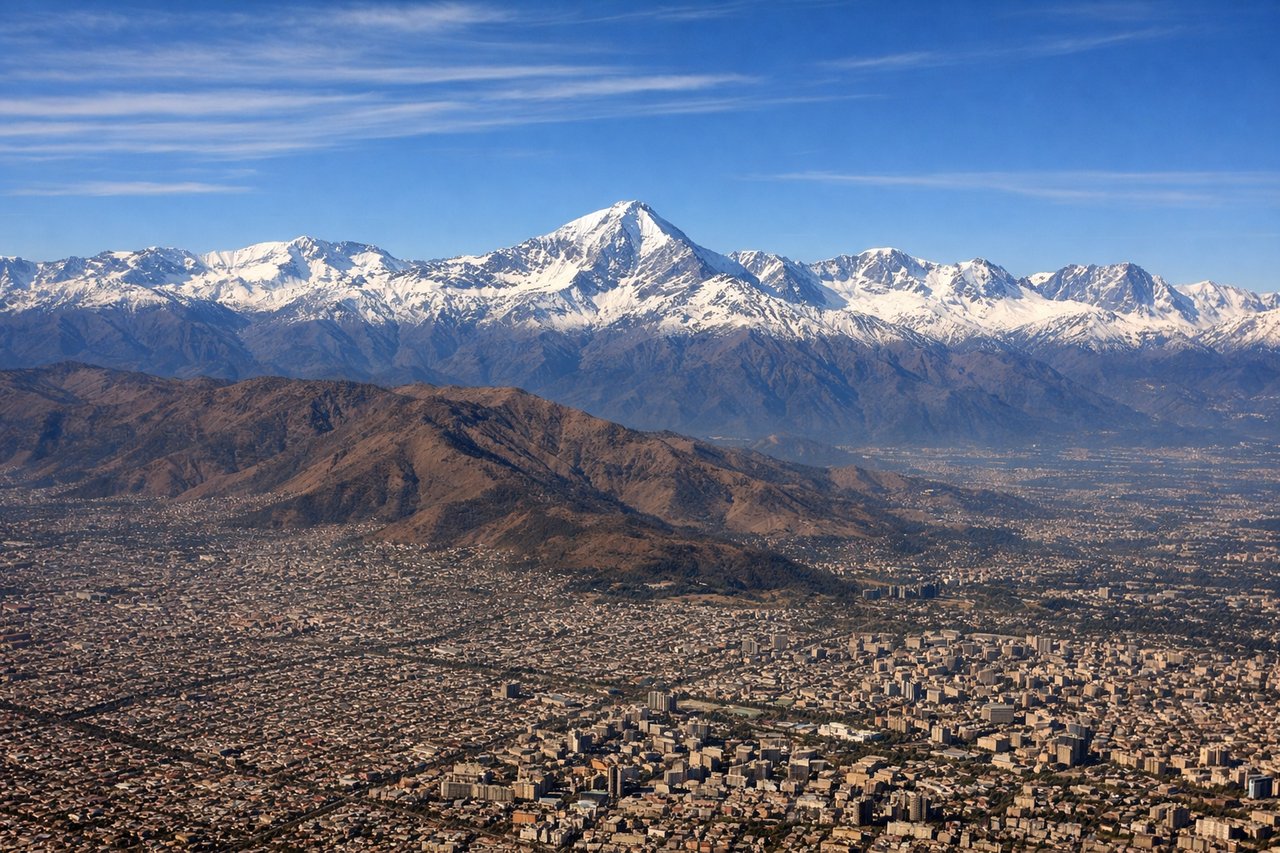
Takeoff from SCL
LEFTDeparting SCL to the south puts the main Andean crest right outside the left windows, with snow-capped peaks rising abruptly behind the Santiago basin. This is one of the most dramatic close-up mountain views of any airport departure in South America, before the aircraft turns north toward Peru.
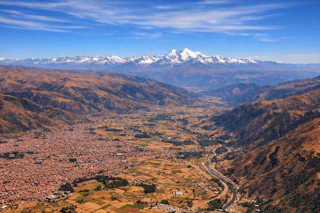
Landing at CUZ
RIGHTOn final approach into CUZ from the east, the aircraft descends along the Huatanay valley with the high Vilcanota range and terraced Andean slopes staying in view longer on the right side, while the left side is dominated by closer, less distinct ridgelines. The right side gives a better sustained look at the snow-capped peaks framing the Cusco valley.
Landmarks on this routeAll landmarks →
Will your flight be in sunlight?
Pick a date and time in the Sun Map to watch the sun move across your whole flight.
About This Route
Which side of the plane should I sit on flying from Arturo Merino Benitez International (SCL) to Velazco Astete (CUZ)?
Sit on the Right side of the plane for the best views on flights from Santiago to Cuzco. For most of the roughly three-hour flight, the great-circle path runs close to the Chilean coastline before angling toward southern Peru, keeping the Andes and its volcanic peaks consistently on the right side while the left side mostly faces the flatter Pacific coastal desert. The right side also benefits from a stronger sustained mountain view during the Cusco approach, giving it the edge over the whole flight despite the left side's strong takeoff moment.
What can I see during takeoff from Arturo Merino Benitez International in Santiago?
During takeoff from Arturo Merino Benitez International (SCL), sit on the Left side for the best views. Departing SCL to the south puts the main Andean crest right outside the left windows, with snow-capped peaks rising abruptly behind the Santiago basin. This is one of the most dramatic close-up mountain views of any airport departure in South America, before the aircraft turns north toward Peru. Notable sights include: Cerro El Plomo and the main Andes crest, the Maipo river valley, eastern Santiago boroughs (Las Condes/Providencia) framed against the mountains.
What can I see when landing at Velazco Astete in Cuzco?
When landing at Velazco Astete (CUZ), sit on the Right side for the best views. On final approach into CUZ from the east, the aircraft descends along the Huatanay valley with the high Vilcanota range and terraced Andean slopes staying in view longer on the right side, while the left side is dominated by closer, less distinct ridgelines. The right side gives a better sustained look at the snow-capped peaks framing the Cusco valley. Notable sights include: Vilcanota mountain range on the horizon, terraced Andean hillsides typical of the Sacred Valley region, the Huatanay valley floor with Cusco's red-tiled rooftops coming into view.
How long is the flight from Santiago to Cuzco?
The flight from Arturo Merino Benitez International (SCL) to Velazco Astete (CUZ) takes about 3 hours 15 minutes. The shortest flight path between them is 1,374 miles (2,211 km); winds and air traffic control usually add a few percent.
What does the Santiago to Cuzco flight path pass over?
The route tracks north over Chile's Atacama Desert, passing near volcanic cones such as Licancabur and Lascar on the eastern horizon, then continues over the high Andean altiplano bordering Bolivia before angling into southern Peru near Arequipa, where El Misti and Chachani volcanoes are visible before the final turn toward Cusco.