Seattle to San Jose is 697 miles (1,122 km), a flight of about 1 hour 55 minutes.
The left side tracks the Cascade volcanic chain and, later, the Bay Area terrain, offering a continuous sequence of named landmarks — Rainier, St. Helens, Hood, Shasta, and finally the Bay salt ponds and Diablo Range — while the right side mostly overlooks the flat, less distinctive Willamette and Sacramento Valleys.
Flight Path
The route's midpoint falls over far Northern California near Mount Shasta and Mount Lassen, with the Sacramento Valley opening up to the south as the aircraft continues toward the Bay Area.
Great circle distance and headings ›


Phase by phase
Takeoff from SEA
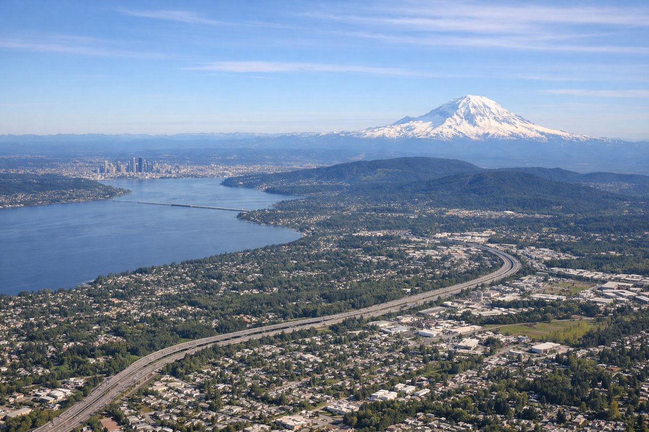
LEFTDeparting SEA to the south, the climb-out puts Mount Rainier's massive snow-capped bulk directly ahead-left over the Cascade foothills, while Seattle's skyline slides behind. It's one of the most striking mountain views available right off the runway on any US domestic route.
Landing at SJC
LEFTOn the descent into SJC, the approach path crosses the southern end of San Francisco Bay, giving left-side passengers a view of the reddish-brown salt evaporation ponds, the East Bay hills, and Mount Diablo rising in the distance before the turn onto final approach over the South Bay's tech campuses.
Landmarks on this routeAll landmarks →
Will your flight be in sunlight?
Pick a date and time in the Sun Map to watch the sun move across your whole flight.
About This Route
Which side of the plane should I sit on flying from Seattle Tacoma International (SEA) to Norman Y Mineta San Jose International (SJC)?
Sit on the Left side of the plane for the best views on flights from Seattle to San Jose. The left side tracks the Cascade volcanic chain and, later, the Bay Area terrain, offering a continuous sequence of named landmarks — Rainier, St. Helens, Hood, Shasta, and finally the Bay salt ponds and Diablo Range — while the right side mostly overlooks the flat, less distinctive Willamette and Sacramento Valleys.
What can I see during takeoff from Seattle Tacoma International in Seattle?
During takeoff from Seattle Tacoma International (SEA), sit on the Left side for the best views. Departing SEA to the south, the climb-out puts Mount Rainier's massive snow-capped bulk directly ahead-left over the Cascade foothills, while Seattle's skyline slides behind. It's one of the most striking mountain views available right off the runway on any US domestic route. Notable sights include: Mount Rainier, Cascade foothills, Lake Washington, Green River Valley.
What can I see when landing at Norman Y Mineta San Jose International in San Jose?
When landing at Norman Y Mineta San Jose International (SJC), sit on the Left side for the best views. On the descent into SJC, the approach path crosses the southern end of San Francisco Bay, giving left-side passengers a view of the reddish-brown salt evaporation ponds, the East Bay hills, and Mount Diablo rising in the distance before the turn onto final approach over the South Bay's tech campuses. Notable sights include: San Francisco Bay salt ponds, Mount Diablo, Diablo Range foothills, San Jose's Silicon Valley grid.
How long is the flight from Seattle to San Jose?
The flight from Seattle Tacoma International (SEA) to Norman Y Mineta San Jose International (SJC) takes about 1 hour 55 minutes. The shortest flight path between them is 697 miles (1,122 km); winds and air traffic control usually add a few percent.
What does the Seattle to San Jose flight path pass over?
The route's midpoint falls over far Northern California near Mount Shasta and Mount Lassen, with the Sacramento Valley opening up to the south as the aircraft continues toward the Bay Area.