The left side tracks the Cascade volcanic chain and Sierra Nevada foothills for most of the route, offering dramatic peaks like Rainier, St Helens, and Shasta, while the right side mostly overlooks the flatter Willamette Valley and distant, less distinct coastal ranges.
Flown SEA to SMF? Did we get it right?
Flight Path
Seattle to Sacramento is 606 miles (975 km), a flight of about 1 hour 45 minutes.
Cascade Range volcanic peaks including Mount Hood and Mount Shasta, Oregon's Willamette Valley, and the upper Sacramento Valley
Great circle distance and headings ›


Phase by phase
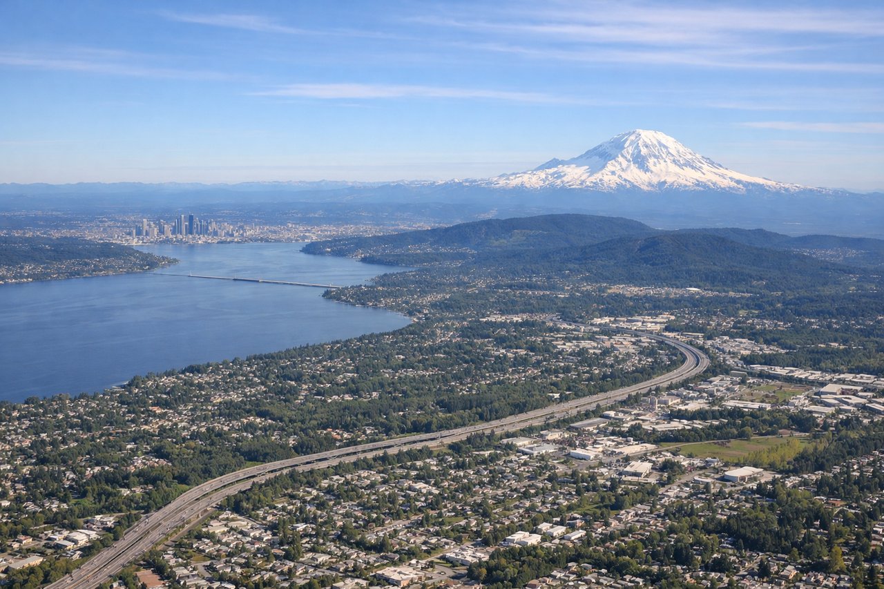
Takeoff from SEA
LEFTSouthbound departures from SEA's 16 runways put Mount Rainier's massive glaciated cone directly off the left side almost immediately after takeoff, one of the most recognizable peaks in North America. As the climb continues south, Mount St Helens and Mount Adams also come into view on the same side.
Landing at SMF
LEFTOn approach into Sacramento from the north, the Sierra Nevada foothills and, on clear days, the distant snow-covered profile of Mount Shasta remain visible off the left side before the descent levels out over the flat Sacramento Valley farmland.
Will your flight be in sunlight?
Pick a date and time in the Sun Map to watch the sun move across your whole flight.
About This Route
Which side of the plane should I sit on flying from Seattle Tacoma International (SEA) to Sacramento International (SMF)?
Sit on the Left side of the plane for the best views on flights from Seattle to Sacramento. The left side tracks the Cascade volcanic chain and Sierra Nevada foothills for most of the route, offering dramatic peaks like Rainier, St Helens, and Shasta, while the right side mostly overlooks the flatter Willamette Valley and distant, less distinct coastal ranges.
What can I see during takeoff from Seattle Tacoma International in Seattle?
During takeoff from Seattle Tacoma International (SEA), sit on the Left side for the best views. Southbound departures from SEA's 16 runways put Mount Rainier's massive glaciated cone directly off the left side almost immediately after takeoff, one of the most recognizable peaks in North America. As the climb continues south, Mount St Helens and Mount Adams also come into view on the same side. Notable sights include: Mount Rainier, Mount St Helens, Mount Adams, Puget Sound shoreline.
What can I see when landing at Sacramento International in Sacramento?
When landing at Sacramento International (SMF), sit on the Left side for the best views. On approach into Sacramento from the north, the Sierra Nevada foothills and, on clear days, the distant snow-covered profile of Mount Shasta remain visible off the left side before the descent levels out over the flat Sacramento Valley farmland. Notable sights include: Sierra Nevada foothills, Sacramento River, Sacramento Valley farmland, distant Mount Shasta silhouette.
How long is the flight from Seattle to Sacramento?
The flight from Seattle Tacoma International (SEA) to Sacramento International (SMF) takes about 1 hour 45 minutes. The shortest flight path between them is 606 miles (975 km); winds and air traffic control usually add a few percent.
What does the Seattle to Sacramento flight path pass over?
Cascade Range volcanic peaks including Mount Hood and Mount Shasta, Oregon's Willamette Valley, and the upper Sacramento Valley