The left side wins overall because the SFO departure offers the most visually spectacular moment of the flight — the San Francisco Bay, the city skyline, and the Peninsula all at once during climb-out. The landing view on the right is excellent, but the left side also tracks the Pacific coastline of Central America and Colombia during cruise, offering consistent coastal and Andean views throughout the flight.
Flown SFO to BOG? Did we get it right?
Flight Path
San Francisco to Bogota is 3,789 miles (6,098 km), a flight of about 8 hours 30 minutes.
The route tracks south-southeast over the Pacific Ocean off the Mexican coast, passing within view of the Baja California Peninsula early in the flight. The aircraft crosses over Central America — Guatemala, El Salvador, and Costa Rica — where volcanic peaks of the Central American volcanic arc are visible on clear days. The Colombian coast and the beginning of the Andes cordillera appear in the final hour before descent into Bogota.
Great circle distance and headings ›


Phase by phase
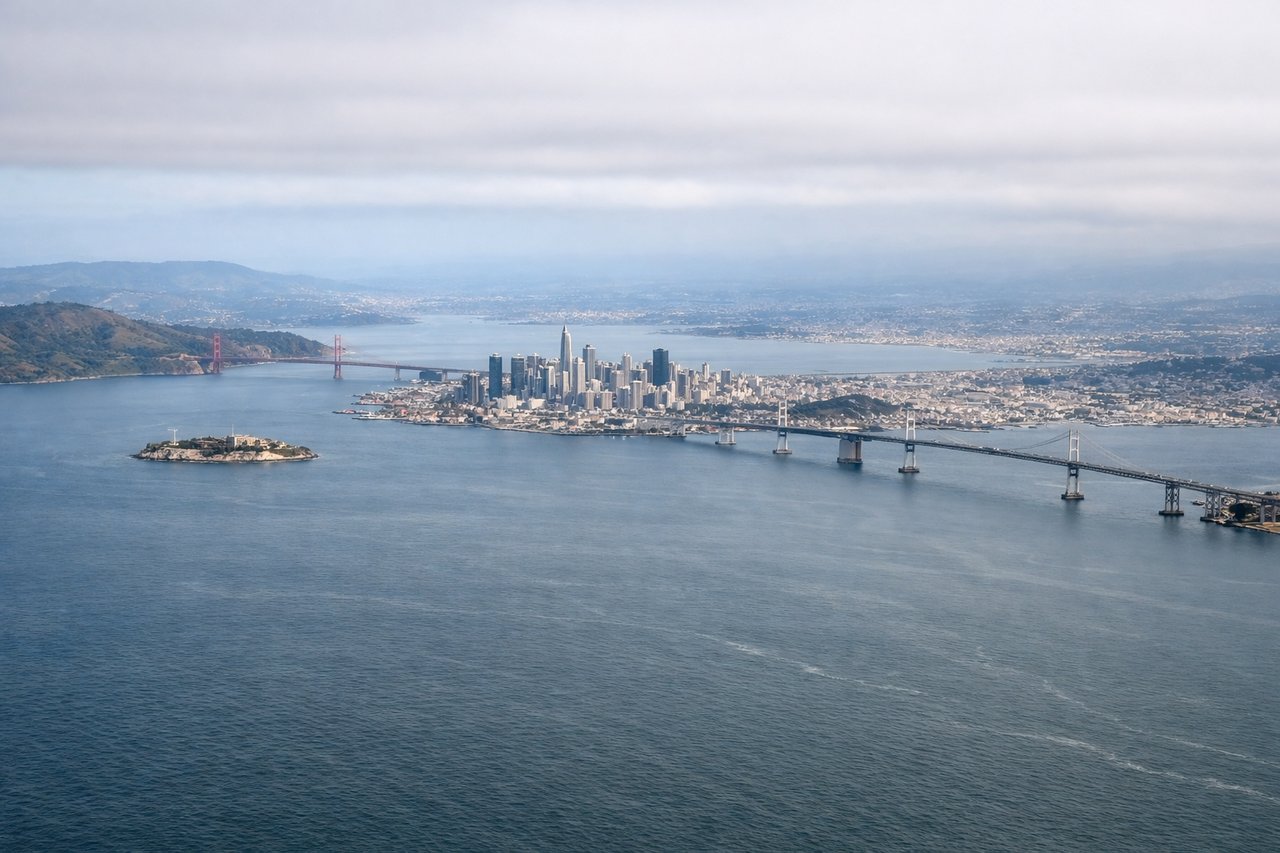
Takeoff from SFO
LEFTSFO's primary departure runways (28L/28R) head west over the Bay before turning south. A left/south-facing seat captures the San Francisco Peninsula, the city skyline, and the Santa Cruz Mountains as the aircraft climbs and banks southward. The right side faces the East Bay hills and Oakland, which is less dramatic.
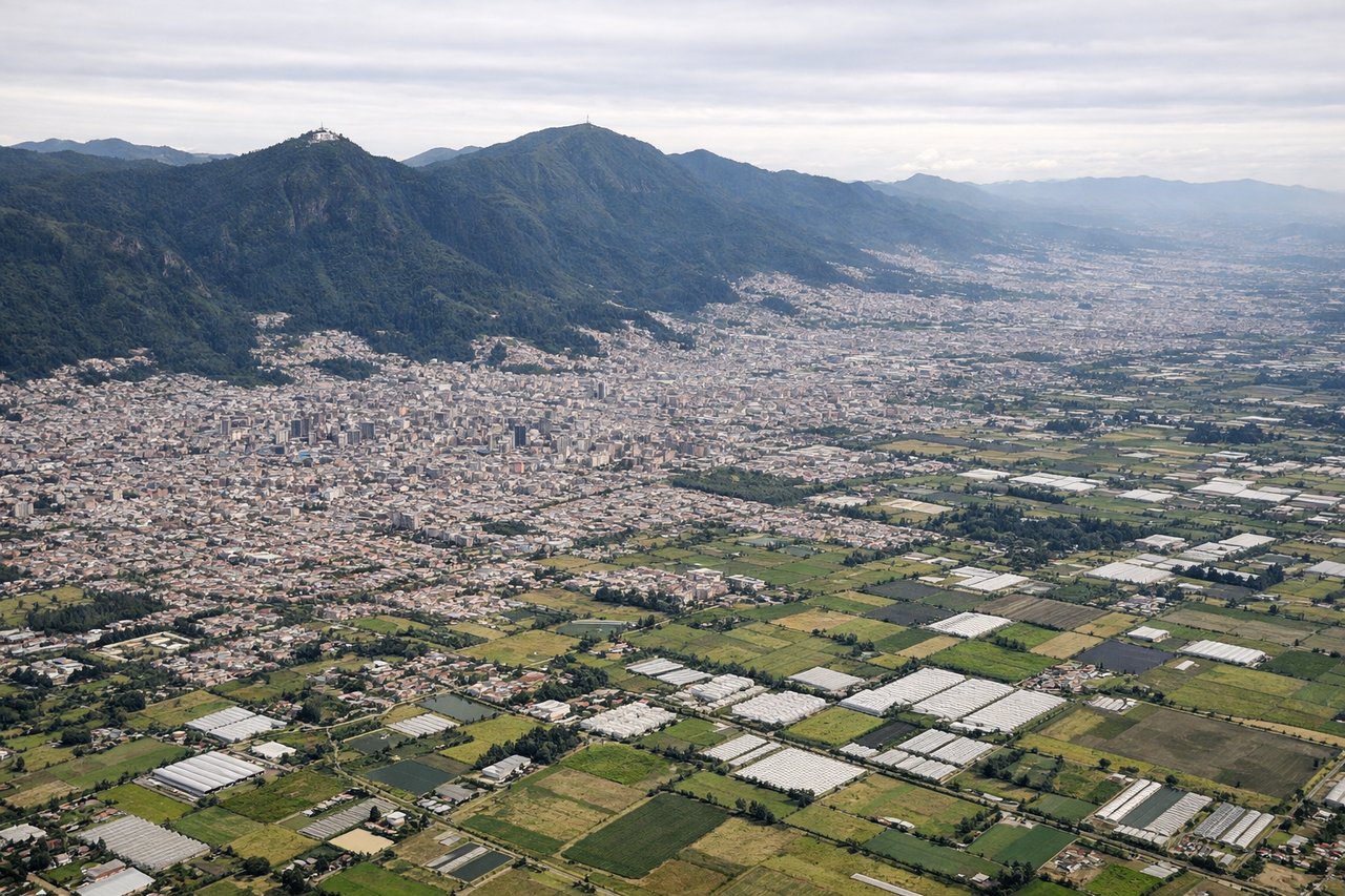
Landing at BOG
RIGHTEl Dorado International sits on the Bogota savanna at 8,360 feet elevation. Aircraft typically approach from the north on runway 13R/13L, tracking southeast. A right/west-facing seat gives a clear view of the Andes cordillera rising dramatically above the savanna, with the city of Bogota spread across the plateau below. The left side faces east toward the lower llanos plains.
Will your flight be in sunlight?
Pick a date and time in the Sun Map to watch the sun move across your whole flight.
About This Route
Which side of the plane should I sit on flying from San Francisco International (SFO) to Eldorado International (BOG)?
Sit on the Left side of the plane for the best views on flights from San Francisco to Bogota. The left side wins overall because the SFO departure offers the most visually spectacular moment of the flight — the San Francisco Bay, the city skyline, and the Peninsula all at once during climb-out. The landing view on the right is excellent, but the left side also tracks the Pacific coastline of Central America and Colombia during cruise, offering consistent coastal and Andean views throughout the flight.
What can I see during takeoff from San Francisco International in San Francisco?
During takeoff from San Francisco International (SFO), sit on the Left side for the best views. SFO's primary departure runways (28L/28R) head west over the Bay before turning south. A left/south-facing seat captures the San Francisco Peninsula, the city skyline, and the Santa Cruz Mountains as the aircraft climbs and banks southward. The right side faces the East Bay hills and Oakland, which is less dramatic. Notable sights include: San Francisco Bay and the Bay Bridge, San Francisco city skyline and the grid of the Peninsula, San Mateo Bridge stretching across the Bay, Santa Cruz Mountains ridge line to the southwest.
What can I see when landing at Eldorado International in Bogota?
When landing at Eldorado International (BOG), sit on the Right side for the best views. El Dorado International sits on the Bogota savanna at 8,360 feet elevation. Aircraft typically approach from the north on runway 13R/13L, tracking southeast. A right/west-facing seat gives a clear view of the Andes cordillera rising dramatically above the savanna, with the city of Bogota spread across the plateau below. The left side faces east toward the lower llanos plains. Notable sights include: The Eastern Cordillera of the Andes rising steeply above the Bogota savanna, the urban sprawl of Bogota across the high plateau, Monserrate and Guadalupe peaks on the ridge immediately east of the city, the flat green savanna of the Sabana de Bogota.
How long is the flight from San Francisco to Bogota?
The flight from San Francisco International (SFO) to Eldorado International (BOG) takes about 8 hours 30 minutes. The shortest flight path between them is 3,789 miles (6,098 km); winds and air traffic control usually add a few percent.
What does the San Francisco to Bogota flight path pass over?
The route tracks south-southeast over the Pacific Ocean off the Mexican coast, passing within view of the Baja California Peninsula early in the flight. The aircraft crosses over Central America — Guatemala, El Salvador, and Costa Rica — where volcanic peaks of the Central American volcanic arc are visible on clear days. The Colombian coast and the beginning of the Andes cordillera appear in the final hour before descent into Bogota.