The San Francisco Bay departure with the Golden Gate Bridge and Marin Headlands provides more dramatic and recognizable urban-geographic contrast than Canberra's inland approach. Both sides score equally for the full flight due to the 13+ hour duration being dominated by featureless Pacific Ocean (5+ hours each direction), but the takeoff experience on the left side is significantly more scenic and memorable than the landing approach on the right.
Flown SFO to CBR? Did we get it right?
Flight Path
San Francisco to Canberra is 7,571 miles (12,185 km), a flight of about 13 hours 25 minutes.
The flight crosses the entire Pacific Ocean with minimal visible landmarks. Approximately 6-7 hours into the flight, the aircraft passes south of Hawaii (not visible on typical routing). The route then crosses open ocean for the remainder of the Pacific crossing. Upon approaching Australia, the eastern coastline becomes visible, including the New South Wales coast and the Great Dividing Range inland. The final descent into Canberra crosses the Blue Mountains and the Australian Capital Territory plateau.
Great circle distance and headings ›Phase by phase
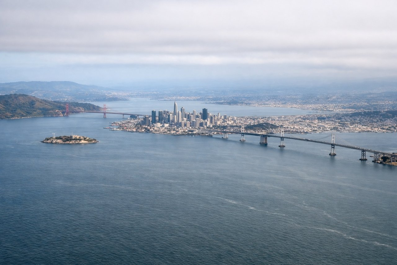
Takeoff from SFO
LEFTLeft side (north) captures San Francisco Bay, the Golden Gate Bridge area, and Marin Headlands during the initial climb-out from eastern runways. Right side faces inland toward the East Bay hills with less dramatic urban-water contrast.
Landing at CBR
RIGHTRight side (east) offers views of the Australian Capital Territory's inland geography during descent and approach to Canberra. The terrain shows the transition from coastal ranges to the inland plateau, with Lake Burley Griffin visible near the airport. Left side faces westward toward the Blue Mountains and open terrain with less distinctive features during final approach.
Will your flight be in sunlight?
Pick a date and time in the Sun Map to watch the sun move across your whole flight.
About This Route
Which side of the plane should I sit on flying from San Francisco International (SFO) to Canberra (CBR)?
Sit on the Left side of the plane for the best views on flights from San Francisco to Canberra. The San Francisco Bay departure with the Golden Gate Bridge and Marin Headlands provides more dramatic and recognizable urban-geographic contrast than Canberra's inland approach. Both sides score equally for the full flight due to the 13+ hour duration being dominated by featureless Pacific Ocean (5+ hours each direction), but the takeoff experience on the left side is significantly more scenic and memorable than the landing approach on the right.
What can I see during takeoff from San Francisco International in San Francisco?
During takeoff from San Francisco International (SFO), sit on the Left side for the best views. Left side (north) captures San Francisco Bay, the Golden Gate Bridge area, and Marin Headlands during the initial climb-out from eastern runways. Right side faces inland toward the East Bay hills with less dramatic urban-water contrast. Notable sights include: San Francisco Bay, Golden Gate Bridge, Marin Headlands, Oakland/Berkeley shoreline.
What can I see when landing at Canberra in Canberra?
When landing at Canberra (CBR), sit on the Right side for the best views. Right side (east) offers views of the Australian Capital Territory's inland geography during descent and approach to Canberra. The terrain shows the transition from coastal ranges to the inland plateau, with Lake Burley Griffin visible near the airport. Left side faces westward toward the Blue Mountains and open terrain with less distinctive features during final approach. Notable sights include: Lake Burley Griffin, Canberra city grid, Brindabella Range, Australian Capital Territory plateau.
How long is the flight from San Francisco to Canberra?
The flight from San Francisco International (SFO) to Canberra (CBR) takes about 13 hours 25 minutes. The shortest flight path between them is 7,571 miles (12,185 km); winds and air traffic control usually add a few percent.
What does the San Francisco to Canberra flight path pass over?
The flight crosses the entire Pacific Ocean with minimal visible landmarks. Approximately 6-7 hours into the flight, the aircraft passes south of Hawaii (not visible on typical routing). The route then crosses open ocean for the remainder of the Pacific crossing. Upon approaching Australia, the eastern coastline becomes visible, including the New South Wales coast and the Great Dividing Range inland. The final descent into Canberra crosses the Blue Mountains and the Australian Capital Territory plateau.