The left side offers the stronger bookends of the flight — San Francisco Bay and skyline at departure, and Lake Norman with the Charlotte skyline at arrival — plus a generally better vantage on the southern Rocky Mountain front range during cruise, given the route's track south of Denver.
Flown SFO to CLT? Did we get it right?
Flight Path
San Francisco to Charlotte is 2,291 miles (3,687 km), a flight of about 4 hours 50 minutes.
Sierra Nevada, Great Basin desert of Nevada, southern Rocky Mountains near the Colorado-Kansas border, Great Plains, Mississippi River valley, and the Blue Ridge Mountains approaching North Carolina
Great circle distance and headings ›


Phase by phase
Takeoff from SFO
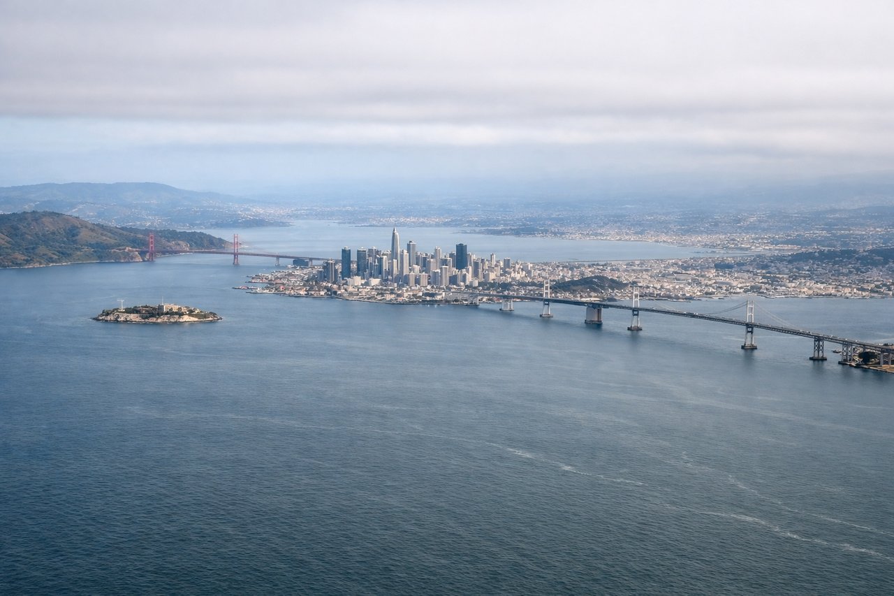
LEFTDeparting SFO on the eastbound runway heading, the climb-out passes directly over San Francisco Bay, putting the San Francisco skyline, the Bay Bridge, and the Berkeley/Oakland hills on the left side of the aircraft as it climbs. The right side mostly shows the flatter South Bay and Silicon Valley suburbs, which are far less distinctive from altitude.
Landing at CLT
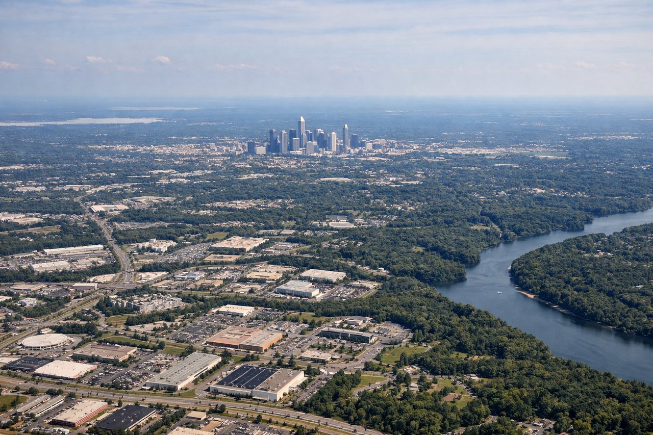
LEFTOn the common south-flow arrival into CLT, aircraft descend from the west and turn to align with the north-south runways, bringing Charlotte's uptown skyline and the sprawling Lake Norman shoreline into view on the left side during the final turn. The right side during this same turn faces mostly rural Piedmont farmland with fewer landmarks.
Will your flight be in sunlight?
Pick a date and time in the Sun Map to watch the sun move across your whole flight.
About This Route
Which side of the plane should I sit on flying from San Francisco International (SFO) to Charlotte Douglas International (CLT)?
Sit on the Left side of the plane for the best views on flights from San Francisco to Charlotte. The left side offers the stronger bookends of the flight — San Francisco Bay and skyline at departure, and Lake Norman with the Charlotte skyline at arrival — plus a generally better vantage on the southern Rocky Mountain front range during cruise, given the route's track south of Denver.
What can I see during takeoff from San Francisco International in San Francisco?
During takeoff from San Francisco International (SFO), sit on the Left side for the best views. Departing SFO on the eastbound runway heading, the climb-out passes directly over San Francisco Bay, putting the San Francisco skyline, the Bay Bridge, and the Berkeley/Oakland hills on the left side of the aircraft as it climbs. The right side mostly shows the flatter South Bay and Silicon Valley suburbs, which are far less distinctive from altitude. Notable sights include: San Francisco skyline, Bay Bridge, Oakland/Berkeley hills, Mount Diablo.
What can I see when landing at Charlotte Douglas International in Charlotte?
When landing at Charlotte Douglas International (CLT), sit on the Left side for the best views. On the common south-flow arrival into CLT, aircraft descend from the west and turn to align with the north-south runways, bringing Charlotte's uptown skyline and the sprawling Lake Norman shoreline into view on the left side during the final turn. The right side during this same turn faces mostly rural Piedmont farmland with fewer landmarks. Notable sights include: Charlotte uptown skyline, Lake Norman, Catawba River, Piedmont foothills.
How long is the flight from San Francisco to Charlotte?
The flight from San Francisco International (SFO) to Charlotte Douglas International (CLT) takes about 4 hours 50 minutes. The shortest flight path between them is 2,291 miles (3,687 km); winds and air traffic control usually add a few percent.
What does the San Francisco to Charlotte flight path pass over?
Sierra Nevada, Great Basin desert of Nevada, southern Rocky Mountains near the Colorado-Kansas border, Great Plains, Mississippi River valley, and the Blue Ridge Mountains approaching North Carolina