San Francisco to West Chicago is 1,824 miles (2,936 km), a flight of about 4 hours 15 minutes.
While the landing approach to Chicago offers impressive urban views, the takeoff from SFO with the Golden Gate Bridge, bay, and Marin Headlands provides more consistently dramatic natural scenery. Left-side seats capture the most iconic landmarks on this route.
Flight Path
The flight path crosses the Sierra Nevada mountains (visible as a distant ridge of peaks running north-south roughly 1.5 hours into flight), then the Great Basin with sparse desert terrain, followed by the Rocky Mountains in Colorado/Wyoming, and finally the flat agricultural plains of Iowa and Illinois. The most visually striking midpoint feature is the Sierra Nevada range, particularly if visible on the left side during morning departure. The transition from California's coastal mountains to the interior basin and then to the Rockies shows dramatic elevation and terrain changes.
Great circle distance and headings ›


Phase by phase
Takeoff from SFO
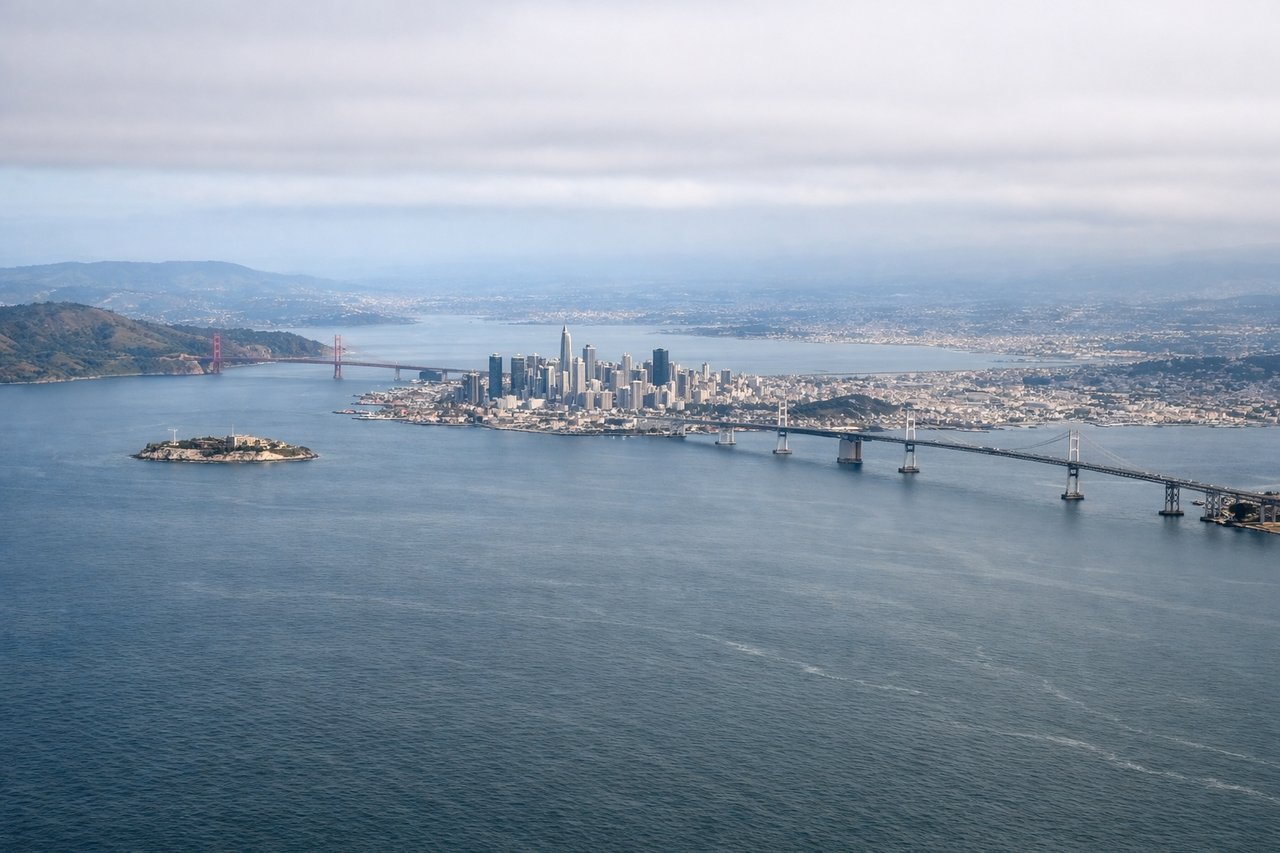
LEFTLeft-side seats offer views of the San Francisco Bay, Golden Gate Bridge, and the Marin Headlands as you climb out northwestward. Right side faces inland hills with less dramatic scenery.
Landing at DPA
RIGHTRight-side seats provide views of Chicago's downtown skyline and Lake Michigan as you descend toward DPA. The city's distinctive high-rise cluster and the lake's vast expanse are striking from the east approach.
Landmarks on this routeAll landmarks →
Will your flight be in sunlight?
Pick a date and time in the Sun Map to watch the sun move across your whole flight.
About This Route
Which side of the plane should I sit on flying from San Francisco International (SFO) to Du Page (DPA)?
Sit on the Left side of the plane for the best views on flights from San Francisco to West Chicago. While the landing approach to Chicago offers impressive urban views, the takeoff from SFO with the Golden Gate Bridge, bay, and Marin Headlands provides more consistently dramatic natural scenery. Left-side seats capture the most iconic landmarks on this route.
What can I see during takeoff from San Francisco International in San Francisco?
During takeoff from San Francisco International (SFO), sit on the Left side for the best views. Left-side seats offer views of the San Francisco Bay, Golden Gate Bridge, and the Marin Headlands as you climb out northwestward. Right side faces inland hills with less dramatic scenery. Notable sights include: San Francisco Bay, Golden Gate Bridge, Marin Headlands, San Francisco Peninsula.
What can I see when landing at Du Page in West Chicago?
When landing at Du Page (DPA), sit on the Right side for the best views. Right-side seats provide views of Chicago's downtown skyline and Lake Michigan as you descend toward DPA. The city's distinctive high-rise cluster and the lake's vast expanse are striking from the east approach. Notable sights include: Lake Michigan, Chicago downtown skyline, Illinois prairie, Des Plaines River valley.
How long is the flight from San Francisco to West Chicago?
The flight from San Francisco International (SFO) to Du Page (DPA) takes about 4 hours 15 minutes. The shortest flight path between them is 1,824 miles (2,936 km); winds and air traffic control usually add a few percent.
What does the San Francisco to West Chicago flight path pass over?
The flight path crosses the Sierra Nevada mountains (visible as a distant ridge of peaks running north-south roughly 1.5 hours into flight), then the Great Basin with sparse desert terrain, followed by the Rocky Mountains in Colorado/Wyoming, and finally the flat agricultural plains of Iowa and Illinois. The most visually striking midpoint feature is the Sierra Nevada range, particularly if visible on the left side during morning departure. The transition from California's coastal mountains to the interior basin and then to the Rockies shows dramatic elevation and terrain changes.