The takeoff views from SFO are more dramatic and iconic than the landing approach to Eugene. The Bay Area's water, bridges, and coastal mountains provide superior scenery during the first 20-30 minutes of flight, which typically offers the clearest visibility before climbing to cruise altitude.
Flown SFO to EUG? Did we get it right?
Flight Path
San Francisco to Eugene is 452 miles (727 km), a flight of about 1 hour 15 minutes.
The flight path northbound from SFO passes over the Diablo Range and Mount Diablo (visible on the right/east side during climb), then transitions over the Sacramento Valley foothills. As the aircraft turns northeast toward Eugene, the Sierra Nevada foothills and eventually the Cascade Range come into view on the right. The Willamette Valley becomes visible approximately 30 minutes before landing, with the valley's agricultural patchwork and forest coverage dominating the landscape.
Great circle distance and headings ›

Phase by phase
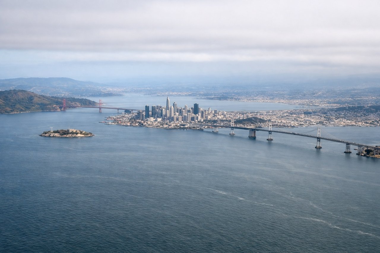
Takeoff from SFO
LEFTLeft side offers immediate views of the San Francisco Bay, Golden Gate Bridge area, and the Marin Headlands as you climb northward out of SFO. Right side faces inland toward the peninsula and East Bay hills with less dramatic scenery during initial climb.
Landing at EUG
RIGHTRight side provides views of the Cascade Range and surrounding valleys during descent into Eugene. The approach typically comes from the south/southwest, making the right side ideal for seeing the volcanic peaks and forested terrain that characterize the region.
Will your flight be in sunlight?
Pick a date and time in the Sun Map to watch the sun move across your whole flight.
About This Route
Which side of the plane should I sit on flying from San Francisco International (SFO) to Eugene Airport (EUG)?
Sit on the Left side of the plane for the best views on flights from San Francisco to Eugene. The takeoff views from SFO are more dramatic and iconic than the landing approach to Eugene. The Bay Area's water, bridges, and coastal mountains provide superior scenery during the first 20-30 minutes of flight, which typically offers the clearest visibility before climbing to cruise altitude.
What can I see during takeoff from San Francisco International in San Francisco?
During takeoff from San Francisco International (SFO), sit on the Left side for the best views. Left side offers immediate views of the San Francisco Bay, Golden Gate Bridge area, and the Marin Headlands as you climb northward out of SFO. Right side faces inland toward the peninsula and East Bay hills with less dramatic scenery during initial climb. Notable sights include: San Francisco Bay, Golden Gate Bridge, Marin Headlands, Mount Tamalpais.
What can I see when landing at Eugene Airport in Eugene?
When landing at Eugene Airport (EUG), sit on the Right side for the best views. Right side provides views of the Cascade Range and surrounding valleys during descent into Eugene. The approach typically comes from the south/southwest, making the right side ideal for seeing the volcanic peaks and forested terrain that characterize the region. Notable sights include: Cascade Range peaks, Willamette Valley, Spencer Butte, Coburg Hills.
How long is the flight from San Francisco to Eugene?
The flight from San Francisco International (SFO) to Eugene Airport (EUG) takes about 1 hour 15 minutes. The shortest flight path between them is 452 miles (727 km); winds and air traffic control usually add a few percent.
What does the San Francisco to Eugene flight path pass over?
The flight path northbound from SFO passes over the Diablo Range and Mount Diablo (visible on the right/east side during climb), then transitions over the Sacramento Valley foothills. As the aircraft turns northeast toward Eugene, the Sierra Nevada foothills and eventually the Cascade Range come into view on the right. The Willamette Valley becomes visible approximately 30 minutes before landing, with the valley's agricultural patchwork and forest coverage dominating the landscape.