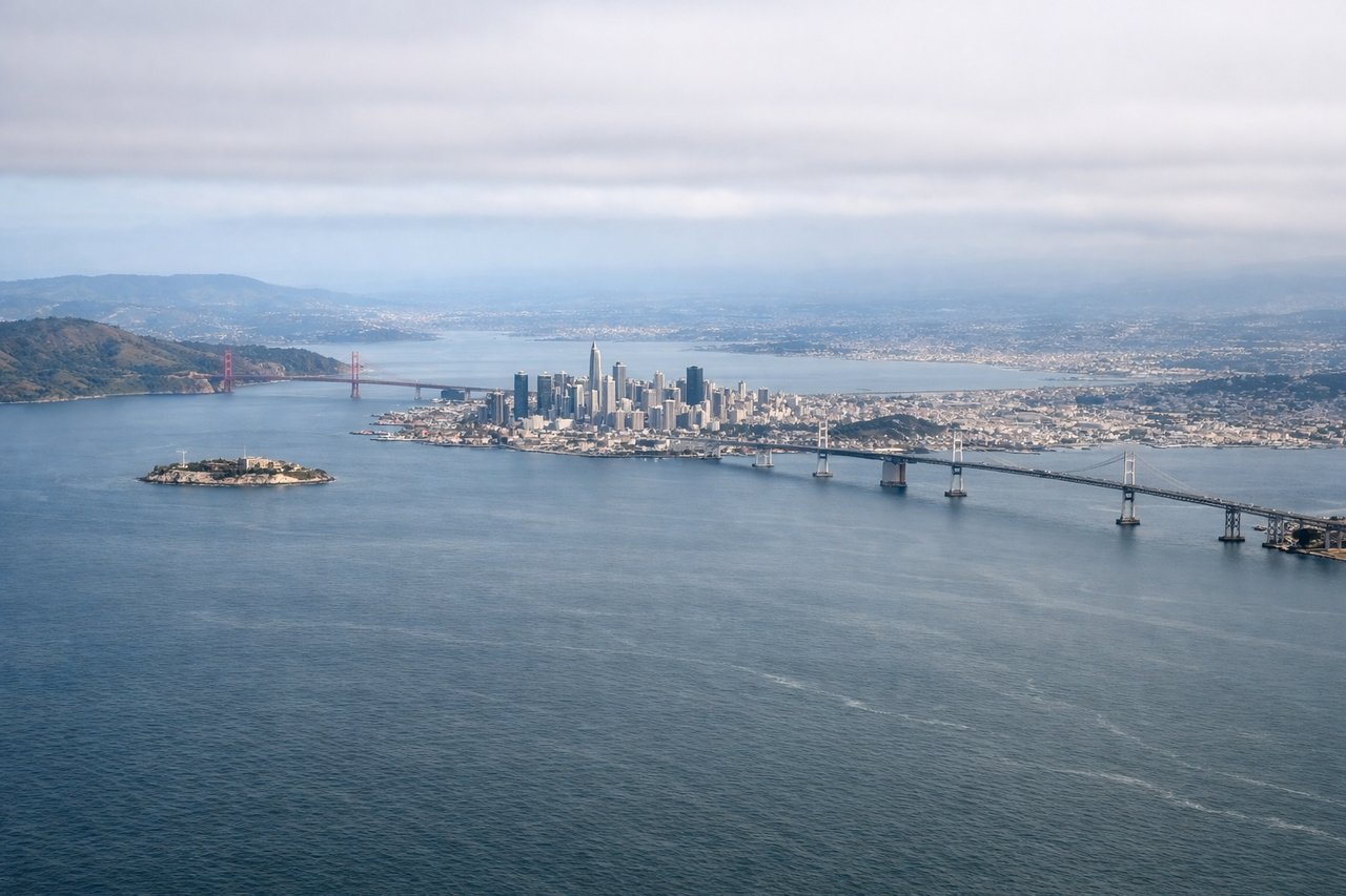
The left side delivers the most dramatic single moment of the flight — the sweeping view of San Francisco Bay and the city skyline during departure. The landing views on the right are interesting but the flat valley and hazy Sierra foothills are less spectacular. Left wins on the strength of the SFO departure alone.
Flight Path
The flight tracks southeast across the southern San Francisco Bay, then cuts over the Diablo Range's lower ridges near Pacheco Pass or the Altamont corridor, before descending into the flat San Joaquin Valley. The Diablo Range crossing offers brief views of rolling brown hills and the valley opening up dramatically ahead. The San Joaquin Valley itself is a vast flat agricultural plain with ruler-straight roads and irrigation canals visible from altitude.
Great circle distance and headings ›Phase by phase
Takeoff from SFO
LEFTSFO's primary departure runways (28L/28R) send aircraft westward over the bay before turning southeast. The left side gets San Francisco Bay, the city skyline, and the peninsula as the aircraft banks south. Right side faces the open Pacific and suburban sprawl.
Landing at FAT
RIGHTFresno's primary arrival runways (29L/29R) bring aircraft in from the east-southeast, meaning the right side faces north toward the Sierra Nevada foothills and Kings Canyon direction. Left side looks south over flat agricultural San Joaquin Valley with little visual interest.
Landmarks on this routeAll landmarks →
Will your flight be in sunlight?
See exactly which side of the plane gets sun and shade at your departure time.
About This Route
Which side of the plane should I sit on flying from San Francisco International (SFO) to Fresno Yosemite International (FAT)?
Sit on the Left side of the plane for the best views on flights from San Francisco to Fresno. The left side delivers the most dramatic single moment of the flight — the sweeping view of San Francisco Bay and the city skyline during departure. The landing views on the right are interesting but the flat valley and hazy Sierra foothills are less spectacular. Left wins on the strength of the SFO departure alone.
What can I see during takeoff from San Francisco International in San Francisco?
During takeoff from San Francisco International (SFO), sit on the Left side for the best views. SFO's primary departure runways (28L/28R) send aircraft westward over the bay before turning southeast. The left side gets San Francisco Bay, the city skyline, and the peninsula as the aircraft banks south. Right side faces the open Pacific and suburban sprawl. Notable sights include: San Francisco Bay, SF city skyline and downtown, San Mateo Bridge, Peninsula hills.
What can I see when landing at Fresno Yosemite International in Fresno?
When landing at Fresno Yosemite International (FAT), sit on the Right side for the best views. Fresno's primary arrival runways (29L/29R) bring aircraft in from the east-southeast, meaning the right side faces north toward the Sierra Nevada foothills and Kings Canyon direction. Left side looks south over flat agricultural San Joaquin Valley with little visual interest. Notable sights include: Sierra Nevada foothills, San Joaquin Valley agricultural grid, Kings River corridor, Fresno urban area.
How long is the flight from San Francisco to Fresno?
The flight from San Francisco International (SFO) to Fresno Yosemite International (FAT) takes Approximately 45-55 minutes.
What does the San Francisco to Fresno flight path pass over?
The flight tracks southeast across the southern San Francisco Bay, then cuts over the Diablo Range's lower ridges near Pacheco Pass or the Altamont corridor, before descending into the flat San Joaquin Valley. The Diablo Range crossing offers brief views of rolling brown hills and the valley opening up dramatically ahead. The San Joaquin Valley itself is a vast flat agricultural plain with ruler-straight roads and irrigation canals visible from altitude.