The right side delivers a consistently stronger visual arc: San Francisco Bay and the Peninsula at takeoff, the California coastline and Gulf of California at cruise, and the Popocatepetl-Iztaccihuatl volcano pair framing the descent into Mexico City. The left side is dominated by inland desert and plateau terrain with fewer standout features.
Flown SFO to MEX? Did we get it right?
Flight Path
San Francisco to Mexico City is 1,882 miles (3,029 km), a flight of about 4 hours 25 minutes.
Gulf of California (Sea of Cortez) near the Sonoran coast, with the Baja California peninsula visible to the west and the Sierra Madre Occidental foothills beginning to rise to the east.
Great circle distance and headings ›


Phase by phase

Takeoff from SFO
RIGHTDeparting SFO to the southeast, the right side looks out over San Francisco Bay and the Peninsula, with San Bruno Mountain and the coastline toward Pacifica sliding into view as the aircraft climbs and turns south. The left side mainly shows the flatter East Bay hills across the water, which is less visually dynamic.
Landing at MEX
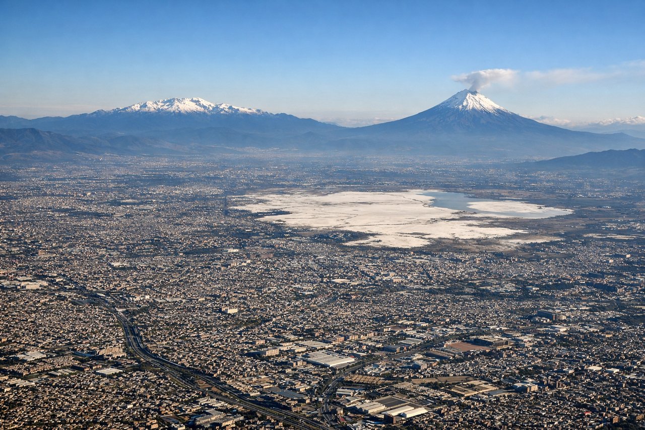
RIGHTOn the approach into Mexico City from the southwest, the right side faces southeast toward the Valley of Mexico's edge, where the snow-capped volcanoes Popocatepetl and Iztaccihuatl rise above the basin haze. The left side faces the flatter northwestern rim of the valley, which is far less dramatic.
Will your flight be in sunlight?
Pick a date and time in the Sun Map to watch the sun move across your whole flight.
About This Route
Which side of the plane should I sit on flying from San Francisco International (SFO) to Licenciado Benito Juarez International (MEX)?
Sit on the Right side of the plane for the best views on flights from San Francisco to Mexico City. The right side delivers a consistently stronger visual arc: San Francisco Bay and the Peninsula at takeoff, the California coastline and Gulf of California at cruise, and the Popocatepetl-Iztaccihuatl volcano pair framing the descent into Mexico City. The left side is dominated by inland desert and plateau terrain with fewer standout features.
What can I see during takeoff from San Francisco International in San Francisco?
During takeoff from San Francisco International (SFO), sit on the Right side for the best views. Departing SFO to the southeast, the right side looks out over San Francisco Bay and the Peninsula, with San Bruno Mountain and the coastline toward Pacifica sliding into view as the aircraft climbs and turns south. The left side mainly shows the flatter East Bay hills across the water, which is less visually dynamic. Notable sights include: San Francisco Bay, San Bruno Mountain, Peninsula coastline near Pacifica, San Francisco skyline in the distance.
What can I see when landing at Licenciado Benito Juarez International in Mexico City?
When landing at Licenciado Benito Juarez International (MEX), sit on the Right side for the best views. On the approach into Mexico City from the southwest, the right side faces southeast toward the Valley of Mexico's edge, where the snow-capped volcanoes Popocatepetl and Iztaccihuatl rise above the basin haze. The left side faces the flatter northwestern rim of the valley, which is far less dramatic. Notable sights include: Popocatepetl volcano, Iztaccihuatl volcano, Ajusco mountain range, Valley of Mexico basin.
How long is the flight from San Francisco to Mexico City?
The flight from San Francisco International (SFO) to Licenciado Benito Juarez International (MEX) takes about 4 hours 25 minutes. The shortest flight path between them is 1,882 miles (3,029 km); winds and air traffic control usually add a few percent.
What does the San Francisco to Mexico City flight path pass over?
Gulf of California (Sea of Cortez) near the Sonoran coast, with the Baja California peninsula visible to the west and the Sierra Madre Occidental foothills beginning to rise to the east.