While the SFO departure favors the left side for the Bay Area skyline, the right side wins overall because the Mount Shasta view on arrival is the single most dramatic landmark on this route, outweighing the urban departure scenery.
Flown SFO to MFR? Did we get it right?
Flight Path
San Francisco to Medford is 330 miles (530 km), a flight of about 1 hour 25 minutes.
Sacramento Valley farmland, Sutter Buttes, foothills of the Sierra Nevada and Cascade Range as the route approaches southern Oregon
Great circle distance and headings ›

Phase by phase
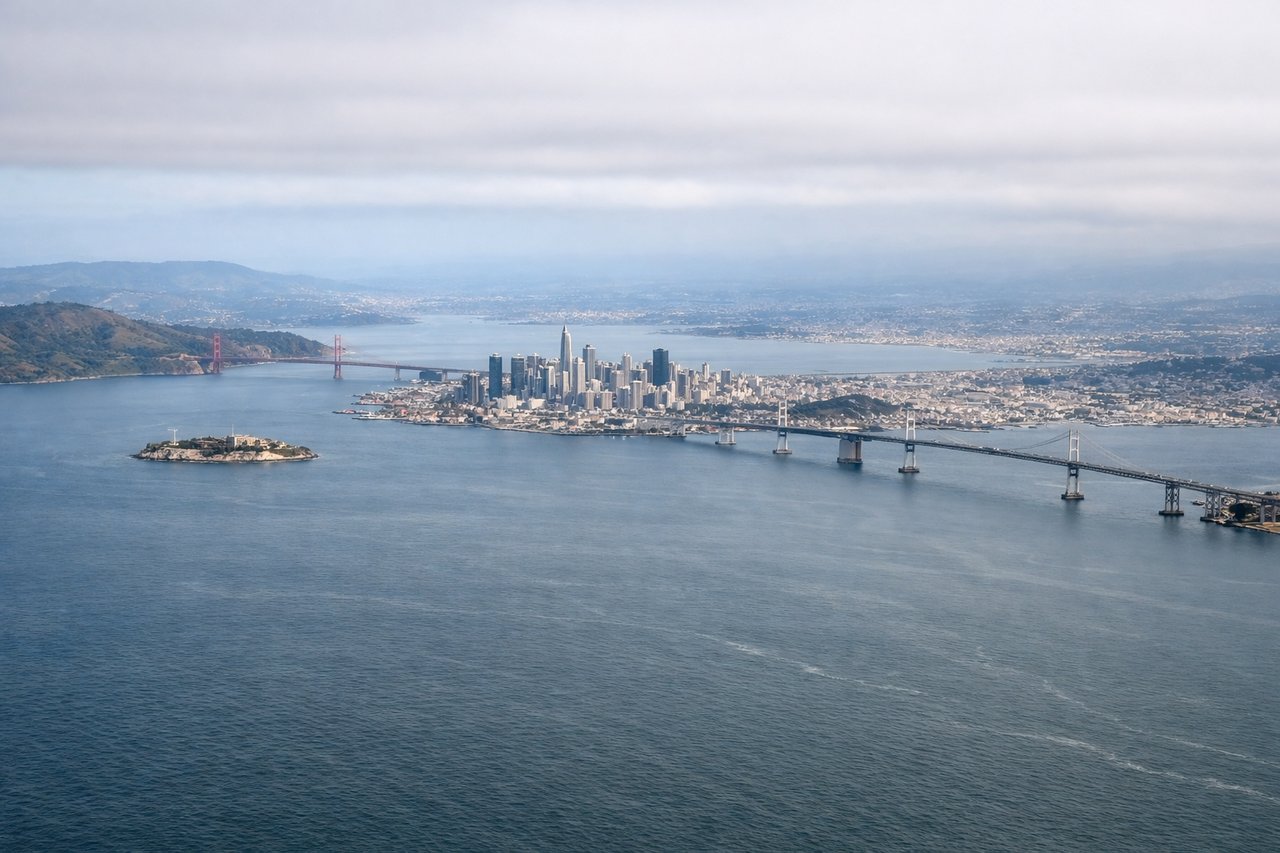
Takeoff from SFO
LEFTDeparting SFO's eastern runways, the aircraft banks north and passengers on the left get a sweeping view of the San Francisco skyline, the Bay, and the Golden Gate Bridge before the coastline recedes behind. The right side mostly shows the East Bay hills and suburban sprawl, less distinctive.
Landing at MFR
RIGHTOn approach into Medford, the descent path from the south gives right-side passengers a dramatic view of snow-capped Mount Shasta and the southern Cascade Range, a much more striking sight than the flatter Rogue Valley farmland visible on the left.
Will your flight be in sunlight?
Pick a date and time in the Sun Map to watch the sun move across your whole flight.
About This Route
Which side of the plane should I sit on flying from San Francisco International (SFO) to Rogue Valley International-Medford Airport (MFR)?
Sit on the Right side of the plane for the best views on flights from San Francisco to Medford. While the SFO departure favors the left side for the Bay Area skyline, the right side wins overall because the Mount Shasta view on arrival is the single most dramatic landmark on this route, outweighing the urban departure scenery.
What can I see during takeoff from San Francisco International in San Francisco?
During takeoff from San Francisco International (SFO), sit on the Left side for the best views. Departing SFO's eastern runways, the aircraft banks north and passengers on the left get a sweeping view of the San Francisco skyline, the Bay, and the Golden Gate Bridge before the coastline recedes behind. The right side mostly shows the East Bay hills and suburban sprawl, less distinctive. Notable sights include: San Francisco skyline, San Francisco Bay, Golden Gate Bridge, Marin Headlands.
What can I see when landing at Rogue Valley International-Medford Airport in Medford?
When landing at Rogue Valley International-Medford Airport (MFR), sit on the Right side for the best views. On approach into Medford, the descent path from the south gives right-side passengers a dramatic view of snow-capped Mount Shasta and the southern Cascade Range, a much more striking sight than the flatter Rogue Valley farmland visible on the left. Notable sights include: Mount Shasta, Cascade Range foothills, Rogue Valley, Siskiyou Mountains.
How long is the flight from San Francisco to Medford?
The flight from San Francisco International (SFO) to Rogue Valley International-Medford Airport (MFR) takes about 1 hour 25 minutes. The shortest flight path between them is 330 miles (530 km); winds and air traffic control usually add a few percent.
What does the San Francisco to Medford flight path pass over?
Sacramento Valley farmland, Sutter Buttes, foothills of the Sierra Nevada and Cascade Range as the route approaches southern Oregon