San Francisco to Oaxaca is 2,110 miles (3,396 km), a flight of about 5 hours.
The takeoff scenery from SFO is more visually distinctive and iconic than the landing approach into Oaxaca. The Golden Gate Bridge, San Francisco Bay, and Marin Headlands provide unmatched scenic value during the first 15-20 minutes of flight, which outweighs the landing views of the Sierra Madre.
Flight Path
The flight path crosses the Central Valley of California (agricultural flatlands), then transitions over the Sierra Nevada foothills. South of California, the route passes over the Baja California Peninsula (desert terrain with sparse vegetation), then crosses the Pacific coast near Sinaloa, Mexico. The descent into Oaxaca approaches from the northwest, crossing the Sierra Madre Occidental foothills before reaching the Oaxaca Valley. The most notable midpoint feature is the transition from California's green agricultural landscape to Mexico's drier, more mountainous terrain around the Sinaloa-Durango region.
Great circle distance and headings ›


_(cropped).jpg?width=600)

Phase by phase
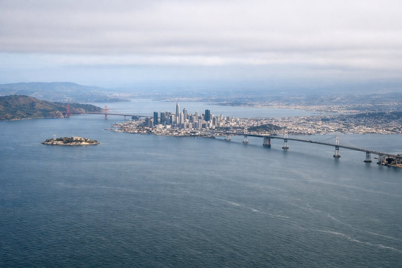
Takeoff from SFO
LEFTLeft seats face west and southwest during the initial climb-out, capturing the San Francisco Bay, Golden Gate Bridge, and the Marin Headlands. Right seats look inland toward the East Bay hills with less dramatic scenery.
Landing at OAX
RIGHTRight seats face east and northeast during the approach into Oaxaca, providing views of the Sierra Madre del Sur mountains and the Oaxaca Valley. Left seats look toward the Pacific coast with less distinctive terrain.
Landmarks on this routeAll landmarks →
Will your flight be in sunlight?
Pick a date and time in the Sun Map to watch the sun move across your whole flight.
About This Route
Which side of the plane should I sit on flying from San Francisco International (SFO) to Xoxocotlan International (OAX)?
Sit on the Left side of the plane for the best views on flights from San Francisco to Oaxaca. The takeoff scenery from SFO is more visually distinctive and iconic than the landing approach into Oaxaca. The Golden Gate Bridge, San Francisco Bay, and Marin Headlands provide unmatched scenic value during the first 15-20 minutes of flight, which outweighs the landing views of the Sierra Madre.
What can I see during takeoff from San Francisco International in San Francisco?
During takeoff from San Francisco International (SFO), sit on the Left side for the best views. Left seats face west and southwest during the initial climb-out, capturing the San Francisco Bay, Golden Gate Bridge, and the Marin Headlands. Right seats look inland toward the East Bay hills with less dramatic scenery. Notable sights include: San Francisco Bay (immediate view), Golden Gate Bridge (visible as a thin orange line spanning the strait), Marin Headlands (dark ridgeline to the north), Pacific Ocean (western horizon).
What can I see when landing at Xoxocotlan International in Oaxaca?
When landing at Xoxocotlan International (OAX), sit on the Right side for the best views. Right seats face east and northeast during the approach into Oaxaca, providing views of the Sierra Madre del Sur mountains and the Oaxaca Valley. Left seats look toward the Pacific coast with less distinctive terrain. Notable sights include: Sierra Madre del Sur (prominent mountain range to the east), Oaxaca Valley (flat basin), Xoxocotlan airport (visible as a cleared runway area), surrounding agricultural fields and small towns.
How long is the flight from San Francisco to Oaxaca?
The flight from San Francisco International (SFO) to Xoxocotlan International (OAX) takes about 5 hours. The shortest flight path between them is 2,110 miles (3,396 km); winds and air traffic control usually add a few percent.
What does the San Francisco to Oaxaca flight path pass over?
The flight path crosses the Central Valley of California (agricultural flatlands), then transitions over the Sierra Nevada foothills. South of California, the route passes over the Baja California Peninsula (desert terrain with sparse vegetation), then crosses the Pacific coast near Sinaloa, Mexico. The descent into Oaxaca approaches from the northwest, crossing the Sierra Madre Occidental foothills before reaching the Oaxaca Valley. The most notable midpoint feature is the transition from California's green agricultural landscape to Mexico's drier, more mountainous terrain around the Sinaloa-Durango region.