San Francisco to Omaha is 1,430 miles (2,301 km), a flight of about 3 hours 15 minutes.
Left side wins both ends of the flight. The San Francisco Bay departure is one of the most visually rewarding in the US, and the Missouri River and Omaha approach on the left is far more interesting than flat Iowa farmland on the right. Midway through the flight both sides see similar Great Basin and Rocky Mountain terrain.
Flight Path
After departing the Bay Area the route crosses the Sierra Nevada range over the Tahoe region, then the Great Basin desert of Nevada and Utah with its dry lake beds and basin-and-range topography. Over central Utah and Colorado the southern Rockies are visible, including the Wasatch Range and Colorado Plateau. The route then crosses the high plains of Nebraska — flat, heavily irrigated agricultural land with center-pivot irrigation circles visible from altitude — before descending into Omaha along the Missouri River valley.
Great circle distance and headings ›

.jpg?width=600)
Phase by phase
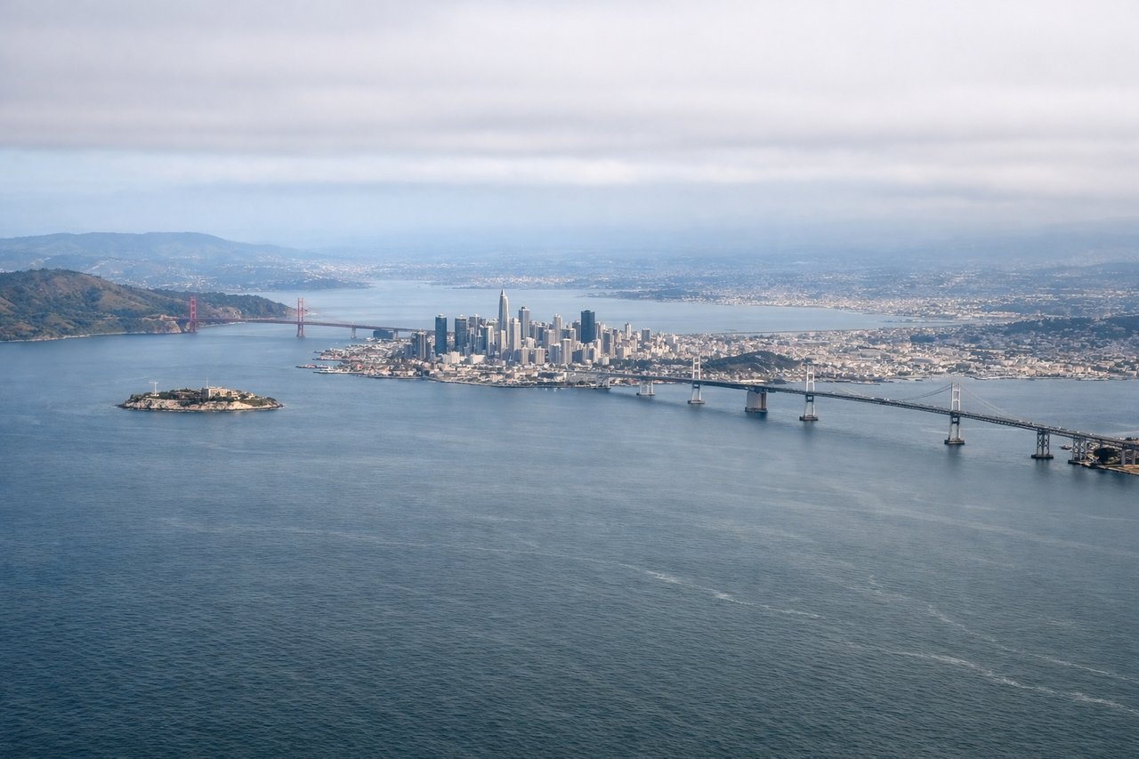
Takeoff from SFO
LEFTSFO's primary departure runways (28L/28R) head west then aircraft turn northeast toward Omaha. A left-side seat captures San Francisco Bay, the city skyline, and the Bay Bridge as you climb out. The right side faces south toward the peninsula with less dramatic scenery.
Landing at OMA
LEFTEppley Airfield's primary arrival runway 32 brings aircraft in from the southeast heading northwest. A left-side seat looks southwest toward downtown Omaha and the Missouri River as you descend, giving a clear view of the river bend and the city grid. The right side faces northeast over flat Iowa farmland with little of interest.
Landmarks on this routeAll landmarks →
Will your flight be in sunlight?
Pick a date and time in the Sun Map to watch the sun move across your whole flight.
About This Route
Which side of the plane should I sit on flying from San Francisco International (SFO) to Eppley Afld (OMA)?
Sit on the Left side of the plane for the best views on flights from San Francisco to Omaha. Left side wins both ends of the flight. The San Francisco Bay departure is one of the most visually rewarding in the US, and the Missouri River and Omaha approach on the left is far more interesting than flat Iowa farmland on the right. Midway through the flight both sides see similar Great Basin and Rocky Mountain terrain.
What can I see during takeoff from San Francisco International in San Francisco?
During takeoff from San Francisco International (SFO), sit on the Left side for the best views. SFO's primary departure runways (28L/28R) head west then aircraft turn northeast toward Omaha. A left-side seat captures San Francisco Bay, the city skyline, and the Bay Bridge as you climb out. The right side faces south toward the peninsula with less dramatic scenery. Notable sights include: San Francisco Bay, Bay Bridge, San Francisco city skyline, Marin Headlands and Golden Gate Bridge to the north.
What can I see when landing at Eppley Afld in Omaha?
When landing at Eppley Afld (OMA), sit on the Left side for the best views. Eppley Airfield's primary arrival runway 32 brings aircraft in from the southeast heading northwest. A left-side seat looks southwest toward downtown Omaha and the Missouri River as you descend, giving a clear view of the river bend and the city grid. The right side faces northeast over flat Iowa farmland with little of interest. Notable sights include: Missouri River, downtown Omaha skyline, Council Bluffs Iowa across the river, Omaha's street grid.
How long is the flight from San Francisco to Omaha?
The flight from San Francisco International (SFO) to Eppley Afld (OMA) takes about 3 hours 15 minutes. The shortest flight path between them is 1,430 miles (2,301 km); winds and air traffic control usually add a few percent.
What does the San Francisco to Omaha flight path pass over?
After departing the Bay Area the route crosses the Sierra Nevada range over the Tahoe region, then the Great Basin desert of Nevada and Utah with its dry lake beds and basin-and-range topography. Over central Utah and Colorado the southern Rockies are visible, including the Wasatch Range and Colorado Plateau. The route then crosses the high plains of Nebraska — flat, heavily irrigated agricultural land with center-pivot irrigation circles visible from altitude — before descending into Omaha along the Missouri River valley.