The right side wins because the cruise phase tracks close to the Cascade volcanic chain — Mount Shasta, Mount Hood, Mount St. Helens, and Mount Rainier are all visible on that side — and the Rainier view on final approach into Sea-Tac is one of the most dramatic landings on this route, outweighing the Bay Area takeoff view on the left.
Flown SFO to SEA? Did we get it right?
Flight Path
San Francisco to Seattle is 679 miles (1,093 km), a flight of about 2 hours 5 minutes.
Mount Shasta near the Oregon-California border, the Cascade Range volcanoes including Mount McLoughlin and the Three Sisters, the Willamette Valley around Eugene and Portland, and Mount Hood and Mount St. Helens as the route approaches Washington state
Great circle distance and headings ›


Phase by phase
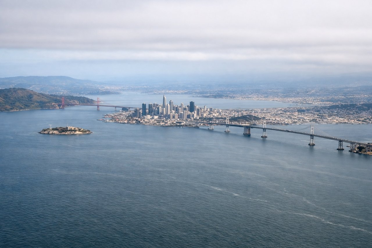
Takeoff from SFO
LEFTSFO departures to the north typically roll on runway 10, climbing east over the Bay before banking left toward the Central Valley. That left turn puts San Francisco's skyline, the Bay Bridge, and Alcatraz directly below the left-side windows, with the Golden Gate and Marin Headlands sliding into view as the bank continues.
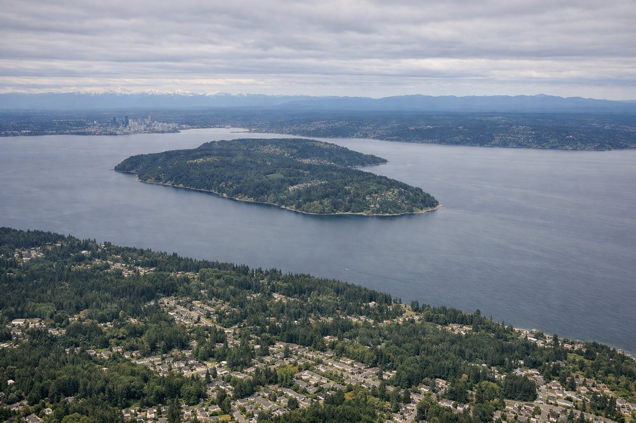
Landing at SEA
RIGHTSea-Tac arrivals from the south fly up the I-5 corridor before turning onto final approach, and on the east side of the aircraft Mount Rainier dominates the horizon the entire time. Lake Washington and the downtown Seattle skyline also unfold below on that side as the descent continues.
Will your flight be in sunlight?
Pick a date and time in the Sun Map to watch the sun move across your whole flight.
About This Route
Which side of the plane should I sit on flying from San Francisco International (SFO) to Seattle Tacoma International (SEA)?
Sit on the Right side of the plane for the best views on flights from San Francisco to Seattle. The right side wins because the cruise phase tracks close to the Cascade volcanic chain — Mount Shasta, Mount Hood, Mount St. Helens, and Mount Rainier are all visible on that side — and the Rainier view on final approach into Sea-Tac is one of the most dramatic landings on this route, outweighing the Bay Area takeoff view on the left.
What can I see during takeoff from San Francisco International in San Francisco?
During takeoff from San Francisco International (SFO), sit on the Left side for the best views. SFO departures to the north typically roll on runway 10, climbing east over the Bay before banking left toward the Central Valley. That left turn puts San Francisco's skyline, the Bay Bridge, and Alcatraz directly below the left-side windows, with the Golden Gate and Marin Headlands sliding into view as the bank continues. Notable sights include: San Francisco skyline, Bay Bridge, Alcatraz Island, Golden Gate Bridge.
What can I see when landing at Seattle Tacoma International in Seattle?
When landing at Seattle Tacoma International (SEA), sit on the Right side for the best views. Sea-Tac arrivals from the south fly up the I-5 corridor before turning onto final approach, and on the east side of the aircraft Mount Rainier dominates the horizon the entire time. Lake Washington and the downtown Seattle skyline also unfold below on that side as the descent continues. Notable sights include: Mount Rainier, Lake Washington, Seattle skyline, Cascade foothills.
How long is the flight from San Francisco to Seattle?
The flight from San Francisco International (SFO) to Seattle Tacoma International (SEA) takes about 2 hours 5 minutes. The shortest flight path between them is 679 miles (1,093 km); winds and air traffic control usually add a few percent.
What does the San Francisco to Seattle flight path pass over?
Mount Shasta near the Oregon-California border, the Cascade Range volcanoes including Mount McLoughlin and the Three Sisters, the Willamette Valley around Eugene and Portland, and Mount Hood and Mount St. Helens as the route approaches Washington state