Left side scores higher due to superior takeoff scenery (San Francisco Bay, Golden Gate Bridge, urban waterfront) and equally dramatic landing approach into the mountain valley. The full flight experience on the left includes iconic Bay Area landmarks during departure and the scenic Wood River Valley descent, providing more visual variety and recognizable features than the right side.
Flown SFO to SUN? Did we get it right?
Flight Path
San Francisco to Hailey is 587 miles (945 km), a flight of about 1 hour 15 minutes.
Sierra Nevada foothills, Lake Tahoe basin (south of direct route), Mono Basin, Owens Valley, Long Valley Caldera, Inyo Mountains, White Mountains, Nevada high desert, Toiyabe Range, Monitor Range, Toquima Range, Shoshone Mountains, Smoky Mountains, central Nevada basin-and-range terrain, Jarbidge Mountains, Bruneau River canyon system, Owyhee Plateau, final approach through Wood River Valley between Sawtooth and Pioneer ranges
Great circle distance and headings ›

Phase by phase
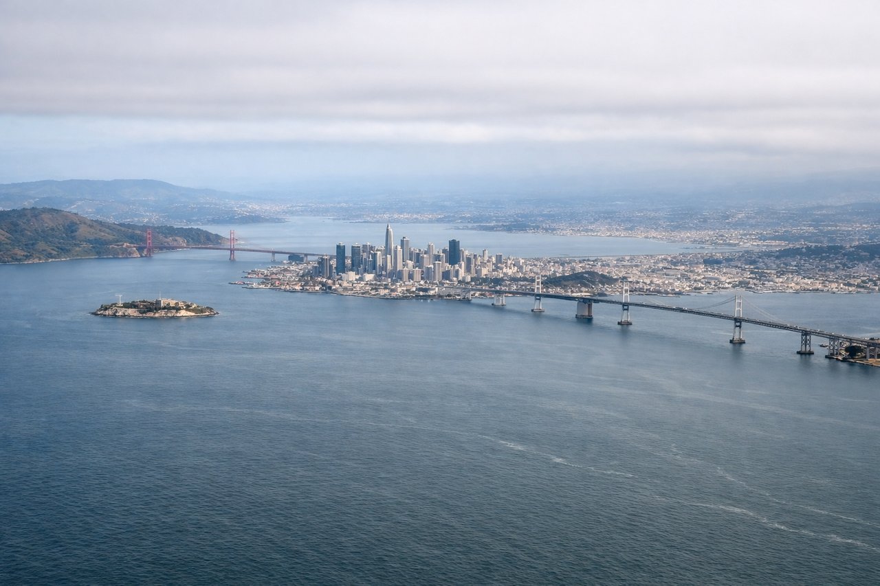
Takeoff from SFO
LEFTLeft side captures the San Francisco Bay, Golden Gate Bridge area, and Marin Headlands during eastbound departure climb. Right side faces inland hills with less dramatic urban-water contrast.
Landing at SUN
LEFTLeft side offers the most dramatic approach into the Wood River Valley, with the Sawtooth Range and Pioneer Mountains framing the descent. Right side shows similar mountains but from a less favorable angle for viewing the valley floor and approach corridor.
Will your flight be in sunlight?
Pick a date and time in the Sun Map to watch the sun move across your whole flight.
About This Route
Which side of the plane should I sit on flying from San Francisco International (SFO) to Friedman Memorial Airport (SUN)?
Sit on the Left side of the plane for the best views on flights from San Francisco to Hailey. Left side scores higher due to superior takeoff scenery (San Francisco Bay, Golden Gate Bridge, urban waterfront) and equally dramatic landing approach into the mountain valley. The full flight experience on the left includes iconic Bay Area landmarks during departure and the scenic Wood River Valley descent, providing more visual variety and recognizable features than the right side.
What can I see during takeoff from San Francisco International in San Francisco?
During takeoff from San Francisco International (SFO), sit on the Left side for the best views. Left side captures the San Francisco Bay, Golden Gate Bridge area, and Marin Headlands during eastbound departure climb. Right side faces inland hills with less dramatic urban-water contrast. Notable sights include: San Francisco Bay, Golden Gate Bridge, Marin Headlands, Oakland Hills.
What can I see when landing at Friedman Memorial Airport in Hailey?
When landing at Friedman Memorial Airport (SUN), sit on the Left side for the best views. Left side offers the most dramatic approach into the Wood River Valley, with the Sawtooth Range and Pioneer Mountains framing the descent. Right side shows similar mountains but from a less favorable angle for viewing the valley floor and approach corridor. Notable sights include: Sawtooth Range, Pioneer Mountains, Wood River Valley, Hailey town.
How long is the flight from San Francisco to Hailey?
The flight from San Francisco International (SFO) to Friedman Memorial Airport (SUN) takes about 1 hour 15 minutes. The shortest flight path between them is 587 miles (945 km); winds and air traffic control usually add a few percent.
What does the San Francisco to Hailey flight path pass over?
Sierra Nevada foothills, Lake Tahoe basin (south of direct route), Mono Basin, Owens Valley, Long Valley Caldera, Inyo Mountains, White Mountains, Nevada high desert, Toiyabe Range, Monitor Range, Toquima Range, Shoshone Mountains, Smoky Mountains, central Nevada basin-and-range terrain, Jarbidge Mountains, Bruneau River canyon system, Owyhee Plateau, final approach through Wood River Valley between Sawtooth and Pioneer ranges