The left side wins overall due to the spectacular San Francisco Bay departure view, which is one of the most dramatic urban-water takeoff panoramas in US aviation. The landing advantage on the right is real but more modest. Left side also tracks the southern Sierra Nevada and Mojave Desert features during cruise at a slight advantage depending on routing.
Flight Path
The flight typically routes southeast over the Central Valley of California, then crosses the southern Sierra Nevada or Tehachapi Mountains, traverses the Mojave Desert and Sonoran Desert of Arizona, passes over the Phoenix metro area, crosses southern New Mexico and west Texas, then tracks across the Gulf Coast states through Louisiana, Mississippi, and Alabama before descending into Florida. The Mississippi River crossing near Baton Rouge and the Florida panhandle coastline are the most visually notable mid-flight features.
Great circle distance and headings ›


.jpeg?width=600)
.jpg?width=600)
.jpg?width=600)

Phase by phase
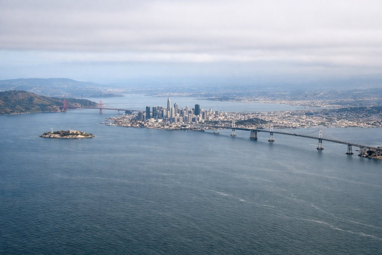
Takeoff from SFO
LEFTSFO departures heading east or southeast on runways 28L/28R initially swing over the Bay. Left side gets San Francisco Bay, the city skyline, and the Bay Bridge clearly visible during climb-out. Right side faces the peninsula suburbs and hills with less dramatic scenery.
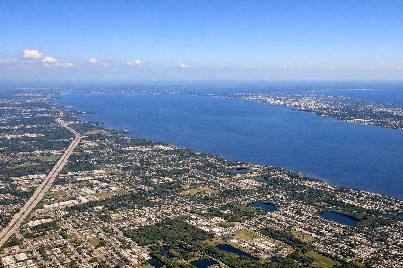
Landing at TPA
RIGHTTPA arrivals typically approach from the east or northeast on runway 19R/19L heading south. The right side faces west over Tampa Bay, giving clear views of the bay's open water, the Sunshine Skyway Bridge, and the St. Petersburg peninsula. Left side faces inland over suburban Tampa with less distinctive scenery.
Landmarks on this routeAll landmarks →
Will your flight be in sunlight?
See exactly which side of the plane gets sun and shade at your departure time.
About This Route
Which side of the plane should I sit on flying from San Francisco International (SFO) to Tampa International (TPA)?
Sit on the Left side of the plane for the best views on flights from San Francisco to Tampa. The left side wins overall due to the spectacular San Francisco Bay departure view, which is one of the most dramatic urban-water takeoff panoramas in US aviation. The landing advantage on the right is real but more modest. Left side also tracks the southern Sierra Nevada and Mojave Desert features during cruise at a slight advantage depending on routing.
What can I see during takeoff from San Francisco International in San Francisco?
During takeoff from San Francisco International (SFO), sit on the Left side for the best views. SFO departures heading east or southeast on runways 28L/28R initially swing over the Bay. Left side gets San Francisco Bay, the city skyline, and the Bay Bridge clearly visible during climb-out. Right side faces the peninsula suburbs and hills with less dramatic scenery. Notable sights include: San Francisco Bay, Bay Bridge, San Francisco city skyline, San Mateo Bridge.
What can I see when landing at Tampa International in Tampa?
When landing at Tampa International (TPA), sit on the Right side for the best views. TPA arrivals typically approach from the east or northeast on runway 19R/19L heading south. The right side faces west over Tampa Bay, giving clear views of the bay's open water, the Sunshine Skyway Bridge, and the St. Petersburg peninsula. Left side faces inland over suburban Tampa with less distinctive scenery. Notable sights include: Tampa Bay, Sunshine Skyway Bridge, St. Petersburg peninsula, Hillsborough Bay.
How long is the flight from San Francisco to Tampa?
The flight from San Francisco International (SFO) to Tampa International (TPA) takes Approximately 4 hours 45 minutes to 5 hours 15 minutes.
What does the San Francisco to Tampa flight path pass over?
The flight typically routes southeast over the Central Valley of California, then crosses the southern Sierra Nevada or Tehachapi Mountains, traverses the Mojave Desert and Sonoran Desert of Arizona, passes over the Phoenix metro area, crosses southern New Mexico and west Texas, then tracks across the Gulf Coast states through Louisiana, Mississippi, and Alabama before descending into Florida. The Mississippi River crossing near Baton Rouge and the Florida panhandle coastline are the most visually notable mid-flight features.