Left side scores higher due to consistent mountain scenery throughout the flight: the Wasatch Range dominates the SLC departure, the flight path crosses the Uinta Basin and approaches the Front Range, and Pikes Peak and Colorado Springs provide a dramatic landing sequence. Right side offers only flat terrain and open plains with minimal visual variety or landmark density.
Flown SLC to COS? Did we get it right?
Flight Path
Salt Lake City to Colorado Springs is 410 miles (660 km), a flight of about 1 hour 15 minutes.
Uinta Basin (oil and gas fields visible as geometric patterns), Book Cliffs to the north, Tavaputs Plateau, transition from Utah's high desert to Colorado's Front Range foothills, multiple ridgelines of the Front Range approaching COS
Great circle distance and headings ›Phase by phase
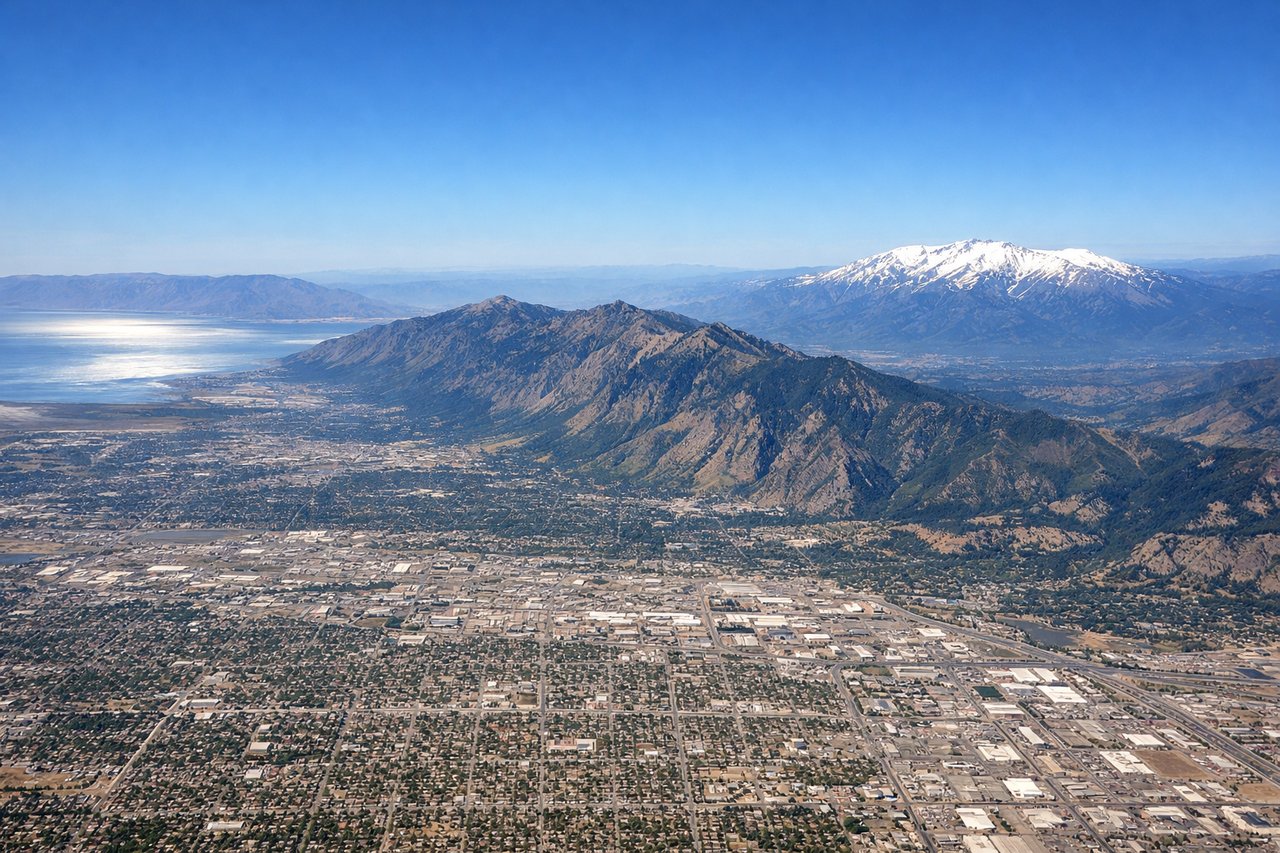
Takeoff from SLC
LEFTLeft side captures the Wasatch Range immediately east of SLC during northbound or southbound departure, with dramatic peaks rising 6,000–8,000 feet above the valley floor. Right side faces the flat Salt Lake Valley and western desert with minimal terrain drama.
Landing at COS
LEFTLeft side on approach to COS reveals the Front Range and Pikes Peak (14,115 ft) rising dramatically from the plains, plus the city of Colorado Springs nestled at the mountain base. Right side shows only flat eastern Colorado plains with minimal visual interest.
Will your flight be in sunlight?
Pick a date and time in the Sun Map to watch the sun move across your whole flight.
About This Route
Which side of the plane should I sit on flying from Salt Lake City International (SLC) to City Of Colorado Springs Muni (COS)?
Sit on the Left side of the plane for the best views on flights from Salt Lake City to Colorado Springs. Left side scores higher due to consistent mountain scenery throughout the flight: the Wasatch Range dominates the SLC departure, the flight path crosses the Uinta Basin and approaches the Front Range, and Pikes Peak and Colorado Springs provide a dramatic landing sequence. Right side offers only flat terrain and open plains with minimal visual variety or landmark density.
What can I see during takeoff from Salt Lake City International in Salt Lake City?
During takeoff from Salt Lake City International (SLC), sit on the Left side for the best views. Left side captures the Wasatch Range immediately east of SLC during northbound or southbound departure, with dramatic peaks rising 6,000–8,000 feet above the valley floor. Right side faces the flat Salt Lake Valley and western desert with minimal terrain drama. Notable sights include: Wasatch Range peaks (including Mount Olympus and Lone Peak to the north), Great Salt Lake shoreline to the northwest, Salt Lake Valley floor.
What can I see when landing at City Of Colorado Springs Muni in Colorado Springs?
When landing at City Of Colorado Springs Muni (COS), sit on the Left side for the best views. Left side on approach to COS reveals the Front Range and Pikes Peak (14,115 ft) rising dramatically from the plains, plus the city of Colorado Springs nestled at the mountain base. Right side shows only flat eastern Colorado plains with minimal visual interest. Notable sights include: Pikes Peak and the Front Range, Colorado Springs city sprawl, Garden of the Gods rock formations (visible as reddish outcrops near the city), Cheyenne Mountain.
How long is the flight from Salt Lake City to Colorado Springs?
The flight from Salt Lake City International (SLC) to City Of Colorado Springs Muni (COS) takes about 1 hour 15 minutes. The shortest flight path between them is 410 miles (660 km); winds and air traffic control usually add a few percent.
What does the Salt Lake City to Colorado Springs flight path pass over?
Uinta Basin (oil and gas fields visible as geometric patterns), Book Cliffs to the north, Tavaputs Plateau, transition from Utah's high desert to Colorado's Front Range foothills, multiple ridgelines of the Front Range approaching COS