Salt Lake City to Guaymas is 888 miles (1,429 km), a flight of about 2 hours 15 minutes.
The takeoff view of the Wasatch Range is more dramatic and geographically distinctive than the landing approach. The right side captures the most visually striking terrain on this route.
Flight Path
The flight path crosses the Great Basin and Nevada desert terrain, passing east of the Sierra Nevada range (visible as a distant ridge line to the west around cruise altitude). The Colorado Plateau's high desert dominates the midpoint. Near the Arizona-Mexico border, the terrain transitions to lower Sonoran Desert with scattered mountains. The flight descends gradually toward the coastal plain approaching the Sea of Cortez.
Great circle distance and headings ›


.jpeg?width=600)

Phase by phase
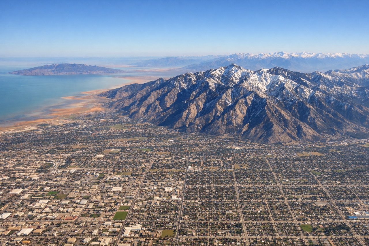
Takeoff from SLC
RIGHTSLC typically departs northbound (Runways 16L/R) or southbound (Runways 34L/R). Right-side seats capture the Wasatch Range's dramatic eastern escarpment immediately after takeoff, with the Oquirrh Mountains visible to the west across the valley. The contrast between the two ranges is striking from altitude.
Landing at GYM
LEFTApproaching GYM from the north typically uses Runway 24 (westbound final). Left-side seats provide views of the Guaymas harbor and the Sea of Cortez coastline during descent. The water body and coastal geography are distinctive and visible from 5,000-10,000 feet on approach.
Landmarks on this routeAll landmarks →
Will your flight be in sunlight?
Pick a date and time in the Sun Map to watch the sun move across your whole flight.
About This Route
Which side of the plane should I sit on flying from Salt Lake City International (SLC) to General Jose Maria Yanez International (GYM)?
Sit on the Right side of the plane for the best views on flights from Salt Lake City to Guaymas. The takeoff view of the Wasatch Range is more dramatic and geographically distinctive than the landing approach. The right side captures the most visually striking terrain on this route.
What can I see during takeoff from Salt Lake City International in Salt Lake City?
During takeoff from Salt Lake City International (SLC), sit on the Right side for the best views. SLC typically departs northbound (Runways 16L/R) or southbound (Runways 34L/R). Right-side seats capture the Wasatch Range's dramatic eastern escarpment immediately after takeoff, with the Oquirrh Mountains visible to the west across the valley. The contrast between the two ranges is striking from altitude. Notable sights include: Wasatch Range (east), Oquirrh Mountains (west), Great Salt Lake (north, visible as a large inland water body), Salt Lake Valley floor (urban grid below).
What can I see when landing at General Jose Maria Yanez International in Guaymas?
When landing at General Jose Maria Yanez International (GYM), sit on the Left side for the best views. Approaching GYM from the north typically uses Runway 24 (westbound final). Left-side seats provide views of the Guaymas harbor and the Sea of Cortez coastline during descent. The water body and coastal geography are distinctive and visible from 5,000-10,000 feet on approach. Notable sights include: Sea of Cortez (Gulf of California), Guaymas harbor and bay, Sonoran Desert terrain (inland), coastal mountain ridges.
How long is the flight from Salt Lake City to Guaymas?
The flight from Salt Lake City International (SLC) to General Jose Maria Yanez International (GYM) takes about 2 hours 15 minutes. The shortest flight path between them is 888 miles (1,429 km); winds and air traffic control usually add a few percent.
What does the Salt Lake City to Guaymas flight path pass over?
The flight path crosses the Great Basin and Nevada desert terrain, passing east of the Sierra Nevada range (visible as a distant ridge line to the west around cruise altitude). The Colorado Plateau's high desert dominates the midpoint. Near the Arizona-Mexico border, the terrain transitions to lower Sonoran Desert with scattered mountains. The flight descends gradually toward the coastal plain approaching the Sea of Cortez.