Salt Lake City to Helena is 402 miles (647 km), a flight of about 1 hour 10 minutes.
Right side captures the most dramatic scenery during takeoff with the Wasatch Range, which is the flight's most visually striking feature. While left side offers good landing views, the takeoff experience on the right outweighs the landing advantage on the left for this relatively short northern flight.
Flight Path
During the northbound flight at cruise altitude, passengers will see the transition from the Wasatch Range and Great Salt Lake region into the broader intermountain basin. The flight path typically passes over or near the Bear Lake area (on the Utah-Idaho border), and the terrain becomes progressively more open with scattered mountain ranges (Bannock Range, Beaverhead Mountains) visible to the east. The landscape transitions from the densely populated Wasatch Front to the sparsely populated high desert and mountain valleys of central Idaho and western Montana. The Bear River valley may be visible as a linear feature running north-south. As the aircraft approaches Helena, the Rocky Mountain terrain becomes more pronounced again with the ranges surrounding the Helena Valley becoming increasingly distinct.
Great circle distance and headings ›
.jpg?width=600)
Phase by phase
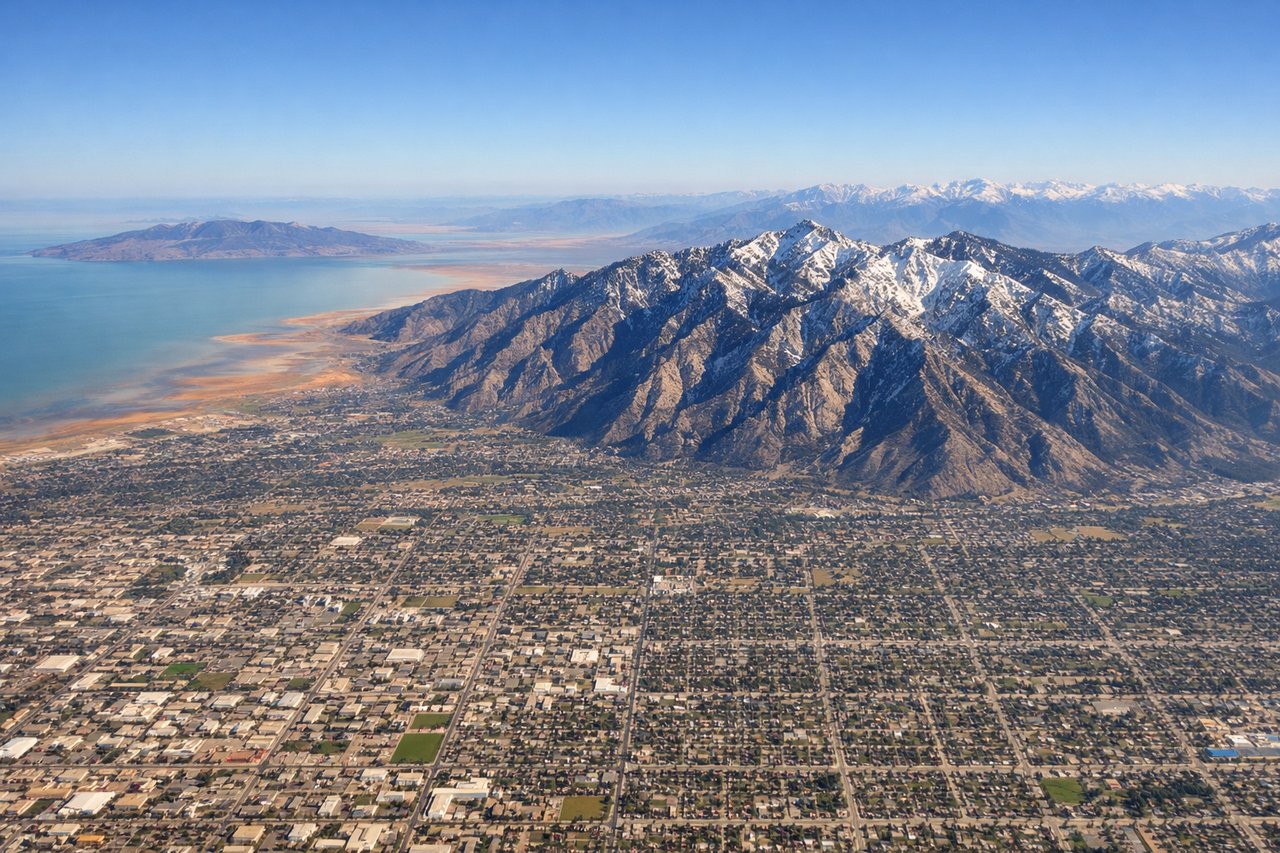
Takeoff from SLC
RIGHTRight side offers immediate views of the Wasatch Range as the aircraft climbs northward out of Salt Lake City. The mountains rise dramatically to the east and northeast of the airport, creating a striking backdrop during the initial climb phase.
Landing at HLN
LEFTLeft side provides excellent views of the Helena Valley and surrounding mountains during descent into Helena Regional Airport. The approach from the south offers clear sightlines to the Prickly Pear Valley and the mountain ranges that frame Helena.
Landmarks on this routeAll landmarks →
Will your flight be in sunlight?
Pick a date and time in the Sun Map to watch the sun move across your whole flight.
About This Route
Which side of the plane should I sit on flying from Salt Lake City International (SLC) to Helena Rgnl (HLN)?
Sit on the Right side of the plane for the best views on flights from Salt Lake City to Helena. Right side captures the most dramatic scenery during takeoff with the Wasatch Range, which is the flight's most visually striking feature. While left side offers good landing views, the takeoff experience on the right outweighs the landing advantage on the left for this relatively short northern flight.
What can I see during takeoff from Salt Lake City International in Salt Lake City?
During takeoff from Salt Lake City International (SLC), sit on the Right side for the best views. Right side offers immediate views of the Wasatch Range as the aircraft climbs northward out of Salt Lake City. The mountains rise dramatically to the east and northeast of the airport, creating a striking backdrop during the initial climb phase. Notable sights include: Wasatch Range (east), Great Salt Lake (west, visible in distance), Salt Lake City urban grid (directly below during climb), Antelope Island (visible in Great Salt Lake to the northwest).
What can I see when landing at Helena Rgnl in Helena?
When landing at Helena Rgnl (HLN), sit on the Left side for the best views. Left side provides excellent views of the Helena Valley and surrounding mountains during descent into Helena Regional Airport. The approach from the south offers clear sightlines to the Prickly Pear Valley and the mountain ranges that frame Helena. Notable sights include: Rocky Mountains (visible in multiple ridges around Helena), Prickly Pear Valley (the broad valley floor below), Helena city (visible as urban development in the valley), Last Chance Gulch area (the canyon that runs through Helena's downtown).
How long is the flight from Salt Lake City to Helena?
The flight from Salt Lake City International (SLC) to Helena Rgnl (HLN) takes about 1 hour 10 minutes. The shortest flight path between them is 402 miles (647 km); winds and air traffic control usually add a few percent.
What does the Salt Lake City to Helena flight path pass over?
During the northbound flight at cruise altitude, passengers will see the transition from the Wasatch Range and Great Salt Lake region into the broader intermountain basin. The flight path typically passes over or near the Bear Lake area (on the Utah-Idaho border), and the terrain becomes progressively more open with scattered mountain ranges (Bannock Range, Beaverhead Mountains) visible to the east. The landscape transitions from the densely populated Wasatch Front to the sparsely populated high desert and mountain valleys of central Idaho and western Montana. The Bear River valley may be visible as a linear feature running north-south. As the aircraft approaches Helena, the Rocky Mountain terrain becomes more pronounced again with the ranges surrounding the Helena Valley becoming increasingly distinct.