Right-side seats win for the full journey: dramatic Wasatch Range views during SLC departure, followed by the distinctive Gulf Coast geography and Galveston Bay during IAH approach. Left side offers less compelling scenery on both legs.
Flown SLC to IAH? Did we get it right?
Flight Path
Salt Lake City to Houston is 1,195 miles (1,923 km), a flight of about 3 hours.
The flight path crosses the Colorado Plateau and Canyonlands region (Utah/Colorado border), then transitions into the High Plains of New Mexico and the Texas Panhandle. Notable midpoint landmarks include the San Juan Mountains (visible to the southeast around 90 minutes into flight), the Rio Grande valley near the New Mexico-Texas border, and the Llano Estacado (Staked Plains) of the Texas Panhandle. The landscape transitions from high desert and canyonlands to increasingly flat, arid plains as the flight progresses southeast toward the Gulf.
Great circle distance and headings ›

Phase by phase
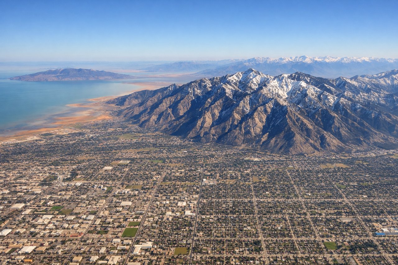
Takeoff from SLC
RIGHTRight-side seats offer views of the Wasatch Range immediately after departure. Aircraft climbing eastbound from SLC typically bank right over the mountains, giving excellent close-range views of the peaks and valleys that define the Salt Lake Valley's eastern boundary.
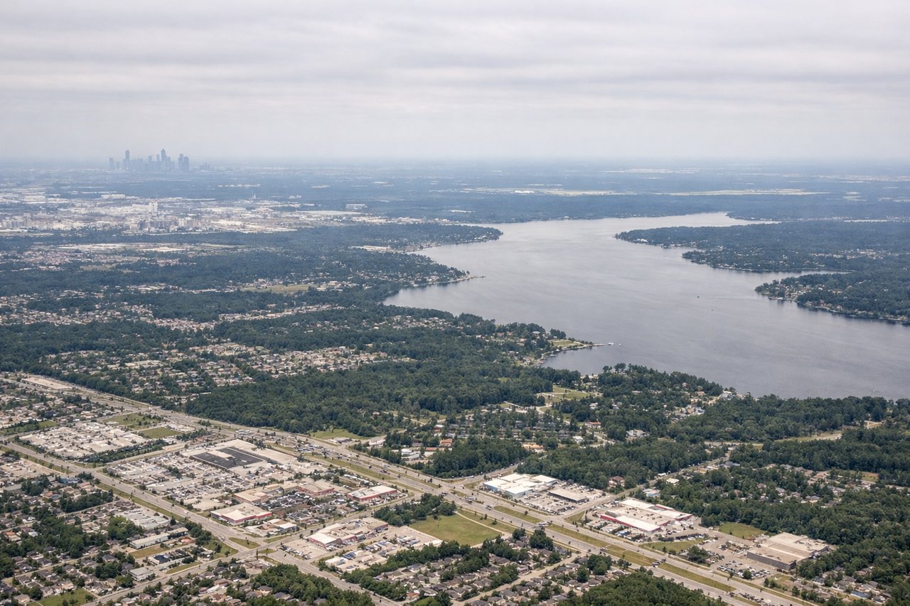
Landing at IAH
RIGHTRight-side seats capture the approach over the Gulf Coastal Plain and Galveston Bay area. Aircraft descending into IAH from the northwest typically pass over Galveston Bay and the coastal wetlands, which are visually distinctive and mark the final descent phase into Houston.
Will your flight be in sunlight?
Pick a date and time in the Sun Map to watch the sun move across your whole flight.
About This Route
Which side of the plane should I sit on flying from Salt Lake City International (SLC) to George Bush Intcntl Houston (IAH)?
Sit on the Right side of the plane for the best views on flights from Salt Lake City to Houston. Right-side seats win for the full journey: dramatic Wasatch Range views during SLC departure, followed by the distinctive Gulf Coast geography and Galveston Bay during IAH approach. Left side offers less compelling scenery on both legs.
What can I see during takeoff from Salt Lake City International in Salt Lake City?
During takeoff from Salt Lake City International (SLC), sit on the Right side for the best views. Right-side seats offer views of the Wasatch Range immediately after departure. Aircraft climbing eastbound from SLC typically bank right over the mountains, giving excellent close-range views of the peaks and valleys that define the Salt Lake Valley's eastern boundary. Notable sights include: Wasatch Range (Mount Olympus, Mount Timp visible on clear days), Great Salt Lake to the northwest, Salt Lake Valley urban grid below, Oquirrh Mountains to the west.
What can I see when landing at George Bush Intcntl Houston in Houston?
When landing at George Bush Intcntl Houston (IAH), sit on the Right side for the best views. Right-side seats capture the approach over the Gulf Coastal Plain and Galveston Bay area. Aircraft descending into IAH from the northwest typically pass over Galveston Bay and the coastal wetlands, which are visually distinctive and mark the final descent phase into Houston. Notable sights include: Galveston Bay (with Galveston Island barrier island), Houston Ship Channel and industrial waterfront, Trinity River delta, coastal marshlands and bayou systems.
How long is the flight from Salt Lake City to Houston?
The flight from Salt Lake City International (SLC) to George Bush Intcntl Houston (IAH) takes about 3 hours. The shortest flight path between them is 1,195 miles (1,923 km); winds and air traffic control usually add a few percent.
What does the Salt Lake City to Houston flight path pass over?
The flight path crosses the Colorado Plateau and Canyonlands region (Utah/Colorado border), then transitions into the High Plains of New Mexico and the Texas Panhandle. Notable midpoint landmarks include the San Juan Mountains (visible to the southeast around 90 minutes into flight), the Rio Grande valley near the New Mexico-Texas border, and the Llano Estacado (Staked Plains) of the Texas Panhandle. The landscape transitions from high desert and canyonlands to increasingly flat, arid plains as the flight progresses southeast toward the Gulf.