The takeoff view of the Wasatch Range is geographically dramatic and unique to SLC—a major advantage over the relatively flat landing approach into Indianapolis. Left seats capture the most distinctive visual geography of this route.
Flown SLC to IND? Did we get it right?
Flight Path
Salt Lake City to Indianapolis is 1,352 miles (2,175 km), a flight of about 3 hours 15 minutes.
The flight path crosses the Uinta Mountains (northeast of SLC), then traverses the high plains of Wyoming and Nebraska. The Green River valley is visible early in the flight. By midpoint, you're over the Nebraska panhandle with minimal dramatic terrain—mostly agricultural land and scattered reservoirs. The Missouri River becomes visible in the final hour as you approach Indiana, marking the transition from the Great Plains to the Corn Belt.
Great circle distance and headings ›

Phase by phase
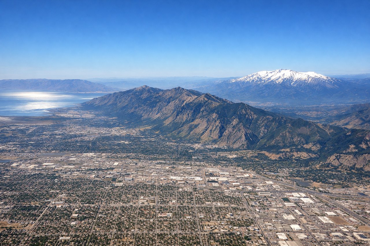
Takeoff from SLC
LEFTSLC typically departs westbound (Runways 16L/R) or eastbound (Runways 34L/R). Left seats offer the best view of the Wasatch Range's dramatic peaks immediately east of the airport during climb-out, and you'll see the Great Salt Lake to the northwest as you gain altitude.
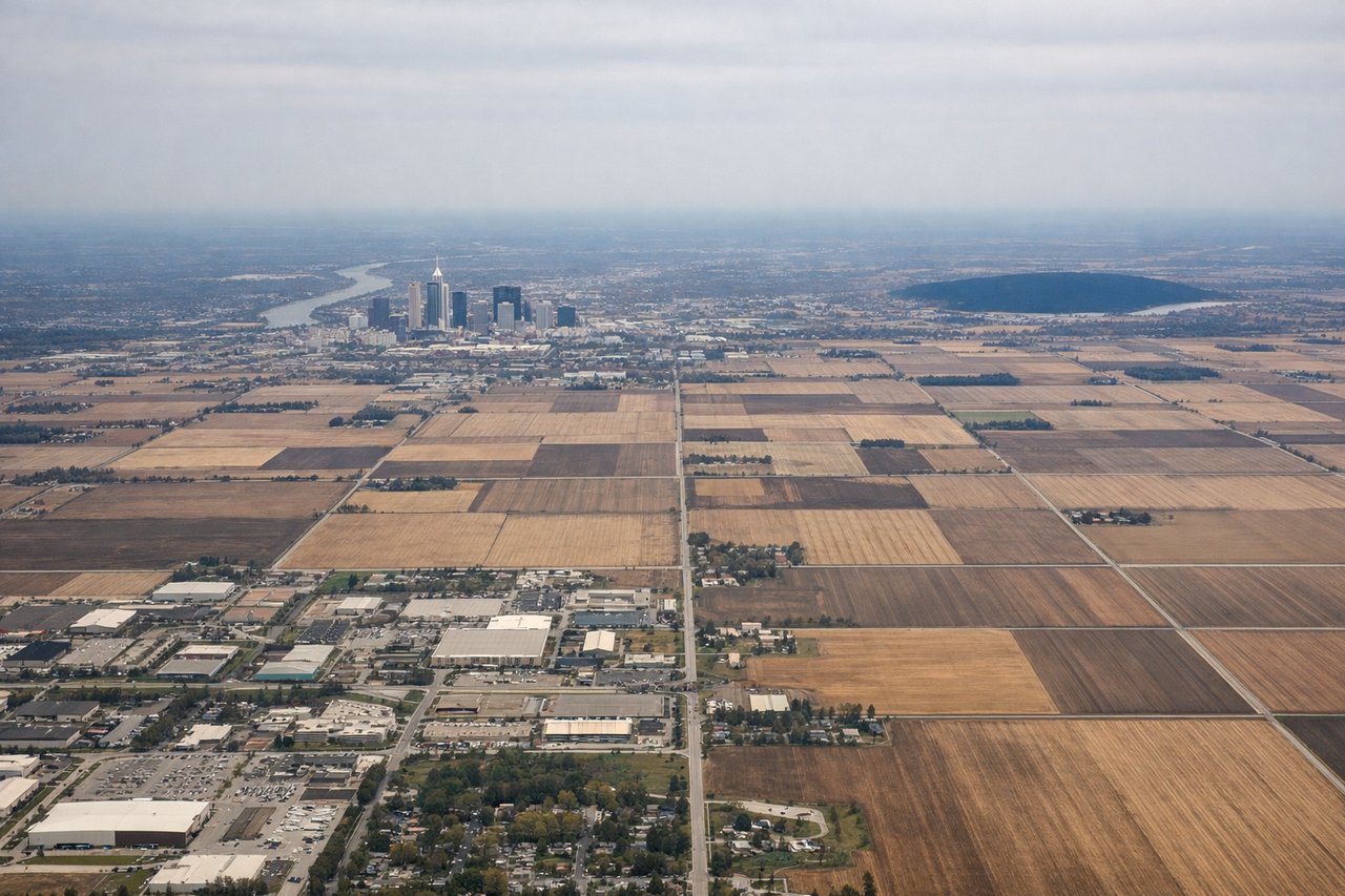
Landing at IND
RIGHTIND typically uses Runways 05L/R (northeast approach) or 23L/R (southwest approach). Right seats provide the best view during descent into Indianapolis, particularly the White River valley and downtown Indianapolis skyline as you approach from the west or northwest. The terrain is relatively flat, so the city itself becomes the primary visual reference.
Will your flight be in sunlight?
Pick a date and time in the Sun Map to watch the sun move across your whole flight.
About This Route
Which side of the plane should I sit on flying from Salt Lake City International (SLC) to Indianapolis International (IND)?
Sit on the Left side of the plane for the best views on flights from Salt Lake City to Indianapolis. The takeoff view of the Wasatch Range is geographically dramatic and unique to SLC—a major advantage over the relatively flat landing approach into Indianapolis. Left seats capture the most distinctive visual geography of this route.
What can I see during takeoff from Salt Lake City International in Salt Lake City?
During takeoff from Salt Lake City International (SLC), sit on the Left side for the best views. SLC typically departs westbound (Runways 16L/R) or eastbound (Runways 34L/R). Left seats offer the best view of the Wasatch Range's dramatic peaks immediately east of the airport during climb-out, and you'll see the Great Salt Lake to the northwest as you gain altitude. Notable sights include: Wasatch Range (immediately adjacent east), Great Salt Lake (northwest, visible within first 5 minutes), Salt Lake Valley floor (directly below), Antelope Island (in the lake, northwest quadrant).
What can I see when landing at Indianapolis International in Indianapolis?
When landing at Indianapolis International (IND), sit on the Right side for the best views. IND typically uses Runways 05L/R (northeast approach) or 23L/R (southwest approach). Right seats provide the best view during descent into Indianapolis, particularly the White River valley and downtown Indianapolis skyline as you approach from the west or northwest. The terrain is relatively flat, so the city itself becomes the primary visual reference. Notable sights include: White River (curves through downtown Indianapolis), downtown Indianapolis skyline (visible 15-20 miles out), Indianapolis Motor Speedway (distinctive oval, northwest of downtown), Eagle Creek Reservoir (west of airport).
How long is the flight from Salt Lake City to Indianapolis?
The flight from Salt Lake City International (SLC) to Indianapolis International (IND) takes about 3 hours 15 minutes. The shortest flight path between them is 1,352 miles (2,175 km); winds and air traffic control usually add a few percent.
What does the Salt Lake City to Indianapolis flight path pass over?
The flight path crosses the Uinta Mountains (northeast of SLC), then traverses the high plains of Wyoming and Nebraska. The Green River valley is visible early in the flight. By midpoint, you're over the Nebraska panhandle with minimal dramatic terrain—mostly agricultural land and scattered reservoirs. The Missouri River becomes visible in the final hour as you approach Indiana, marking the transition from the Great Plains to the Corn Belt.