While takeoff offers superior Wasatch Range views from the left, the landing approach provides more dramatic visual contrast and is more reliably visible. Right seats capture the Everglades-to-urban transition, which is geographically more distinctive than the departure sequence.
Flown SLC to MIA? Did we get it right?
Flight Path
Salt Lake City to Miami is 2,086 miles (3,357 km), a flight of about 4 hours 15 minutes.
The flight path crosses the Mississippi River valley (visible around 2 hours into flight), then transitions over the Gulf of Mexico. Notable landmarks include the Mississippi River's meanders near Memphis, the Tennessee River valley, and the Gulf Coast near the Florida Panhandle. The Gulf crossing offers open water views with occasional cumulus cloud formations. No major mountain ranges are visible in the midpoint; the terrain transitions from Appalachian foothills to coastal lowlands.
Great circle distance and headings ›


Phase by phase
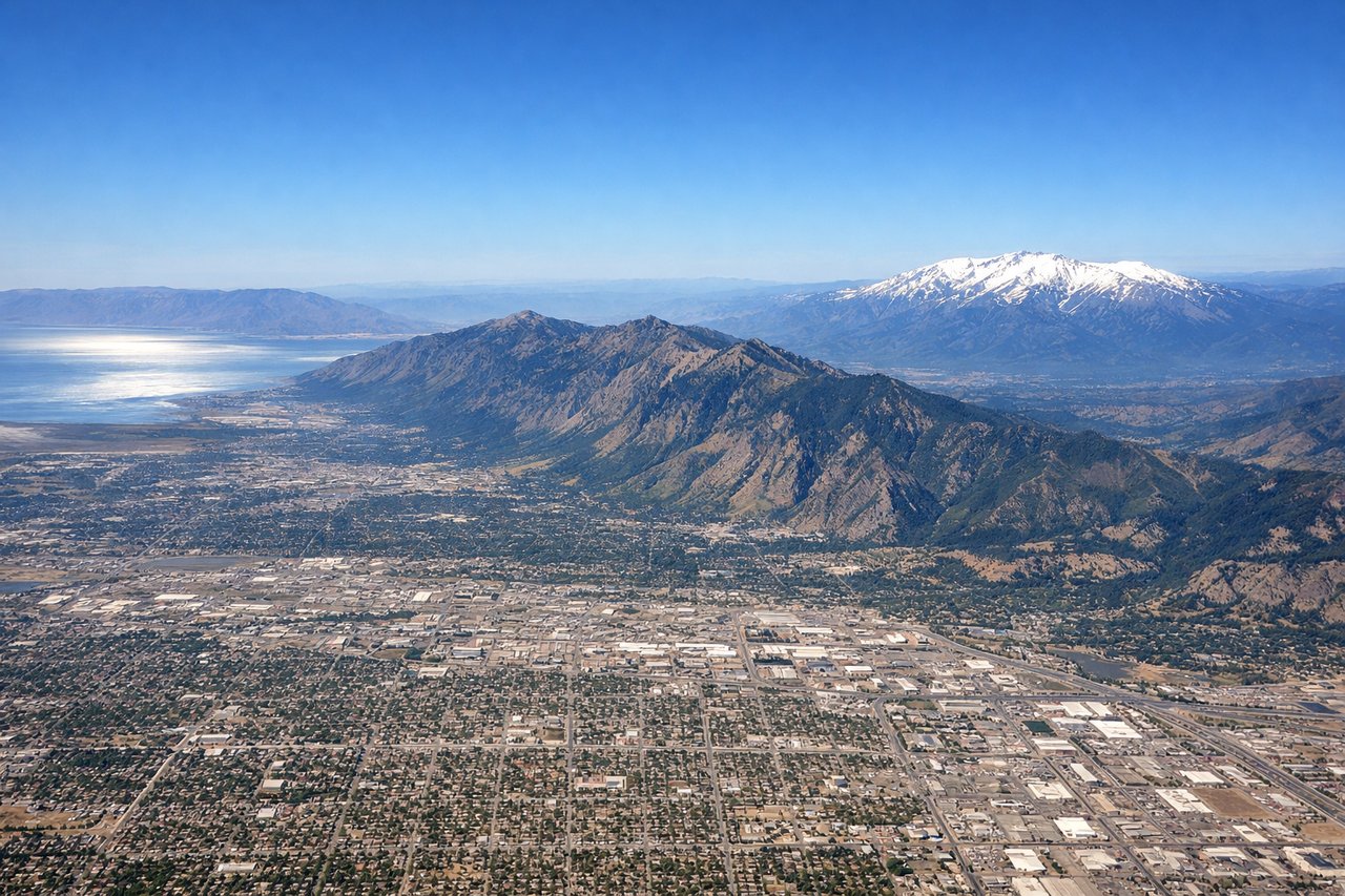
Takeoff from SLC
LEFTSLC typically departs north or south depending on wind. Left seats offer views of the Wasatch Range's dramatic eastern escarpment rising directly from the Salt Lake Valley floor. The contrast between urban sprawl and 11,000-foot peaks is striking during climb-out.
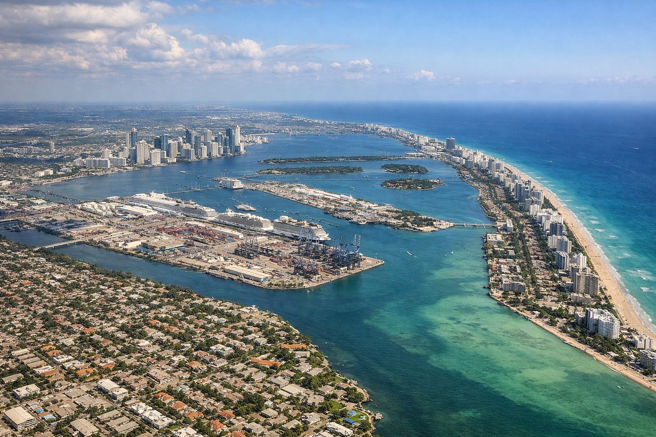
Landing at MIA
RIGHTApproaching MIA typically uses runways 08L/08R or 09L/09R (eastbound) depending on wind. Right seats capture the transition from the Everglades' vast wetland expanse to Biscayne Bay's turquoise water and Miami's downtown skyline. The contrast between wilderness and urban density is dramatic.
Will your flight be in sunlight?
Pick a date and time in the Sun Map to watch the sun move across your whole flight.
About This Route
Which side of the plane should I sit on flying from Salt Lake City International (SLC) to Miami International (MIA)?
Sit on the Right side of the plane for the best views on flights from Salt Lake City to Miami. While takeoff offers superior Wasatch Range views from the left, the landing approach provides more dramatic visual contrast and is more reliably visible. Right seats capture the Everglades-to-urban transition, which is geographically more distinctive than the departure sequence.
What can I see during takeoff from Salt Lake City International in Salt Lake City?
During takeoff from Salt Lake City International (SLC), sit on the Left side for the best views. SLC typically departs north or south depending on wind. Left seats offer views of the Wasatch Range's dramatic eastern escarpment rising directly from the Salt Lake Valley floor. The contrast between urban sprawl and 11,000-foot peaks is striking during climb-out. Notable sights include: Wasatch Range (especially Mount Olympus and Lone Peak to the north), Great Salt Lake's eastern shoreline, Salt Lake Valley urban grid, Oquirrh Mountains to the west.
What can I see when landing at Miami International in Miami?
When landing at Miami International (MIA), sit on the Right side for the best views. Approaching MIA typically uses runways 08L/08R or 09L/09R (eastbound) depending on wind. Right seats capture the transition from the Everglades' vast wetland expanse to Biscayne Bay's turquoise water and Miami's downtown skyline. The contrast between wilderness and urban density is dramatic. Notable sights include: Everglades wetlands (sawgrass marshes and tree islands), Biscayne Bay with its shallow turquoise water, Miami downtown skyline and port, Key Biscayne and the barrier islands.
How long is the flight from Salt Lake City to Miami?
The flight from Salt Lake City International (SLC) to Miami International (MIA) takes about 4 hours 15 minutes. The shortest flight path between them is 2,086 miles (3,357 km); winds and air traffic control usually add a few percent.
What does the Salt Lake City to Miami flight path pass over?
The flight path crosses the Mississippi River valley (visible around 2 hours into flight), then transitions over the Gulf of Mexico. Notable landmarks include the Mississippi River's meanders near Memphis, the Tennessee River valley, and the Gulf Coast near the Florida Panhandle. The Gulf crossing offers open water views with occasional cumulus cloud formations. No major mountain ranges are visible in the midpoint; the terrain transitions from Appalachian foothills to coastal lowlands.