The right side wins overall because the Wasatch Range departure delivers sustained, close-up mountain drama that outweighs the brief but pleasant Minneapolis skyline view on landing; the long cruise portion over Wyoming, Nebraska, and South Dakota is largely flat and similar on both sides.
Flown SLC to MSP? Did we get it right?
Flight Path
Salt Lake City to Minneapolis is 989 miles (1,592 km), a flight of about 2 hours 20 minutes.
Southern Wyoming high desert near Rock Springs and Rawlins, the Nebraska Panhandle and Sandhills, and the South Dakota prairie, with the Black Hills occasionally visible as a distant highland to the north on clear days.
Great circle distance and headings ›


Phase by phase
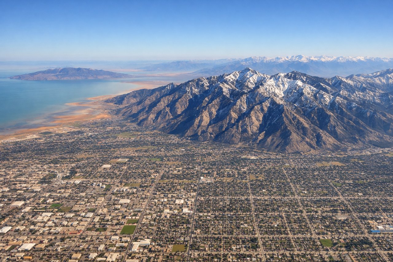
Takeoff from SLC
RIGHTDeparting SLC to the south before turning onto the ENE course toward Minneapolis, the right side faces the Wasatch Front, where peaks rise abruptly more than 6,000 feet above the valley floor just east of the runway. This is the most dramatic terrain of the entire route and it's visible for several minutes during climb-out.
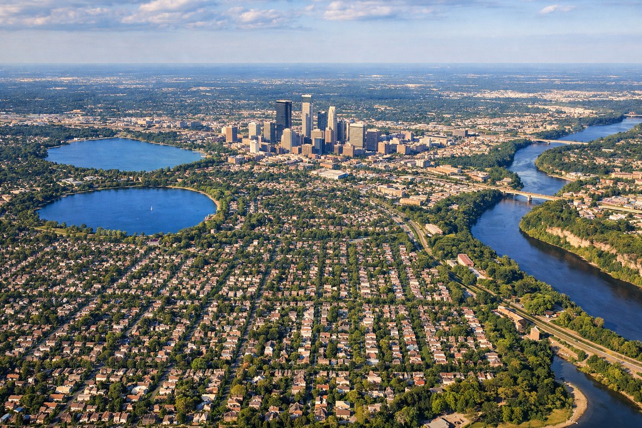
Landing at MSP
LEFTOn the northwest approach into MSP's parallel runways, the flight path passes directly over central Minneapolis, putting the downtown skyline, the Chain of Lakes, and the Mississippi River on the left side of the aircraft during final descent. This urban and water scenery is the most visually distinct feature of an otherwise flat approach.
Will your flight be in sunlight?
Pick a date and time in the Sun Map to watch the sun move across your whole flight.
About This Route
Which side of the plane should I sit on flying from Salt Lake City International (SLC) to Minneapolis St Paul International (MSP)?
Sit on the Right side of the plane for the best views on flights from Salt Lake City to Minneapolis. The right side wins overall because the Wasatch Range departure delivers sustained, close-up mountain drama that outweighs the brief but pleasant Minneapolis skyline view on landing; the long cruise portion over Wyoming, Nebraska, and South Dakota is largely flat and similar on both sides.
What can I see during takeoff from Salt Lake City International in Salt Lake City?
During takeoff from Salt Lake City International (SLC), sit on the Right side for the best views. Departing SLC to the south before turning onto the ENE course toward Minneapolis, the right side faces the Wasatch Front, where peaks rise abruptly more than 6,000 feet above the valley floor just east of the runway. This is the most dramatic terrain of the entire route and it's visible for several minutes during climb-out. Notable sights include: Wasatch Range, Mount Olympus, Twin Peaks and Lone Peak, Traverse Mountains/Utah Valley.
What can I see when landing at Minneapolis St Paul International in Minneapolis?
When landing at Minneapolis St Paul International (MSP), sit on the Left side for the best views. On the northwest approach into MSP's parallel runways, the flight path passes directly over central Minneapolis, putting the downtown skyline, the Chain of Lakes, and the Mississippi River on the left side of the aircraft during final descent. This urban and water scenery is the most visually distinct feature of an otherwise flat approach. Notable sights include: Minneapolis downtown skyline, Chain of Lakes (Lake Calhoun/Bde Maka Ska), Mississippi River, St. Paul in the distance.
How long is the flight from Salt Lake City to Minneapolis?
The flight from Salt Lake City International (SLC) to Minneapolis St Paul International (MSP) takes about 2 hours 20 minutes. The shortest flight path between them is 989 miles (1,592 km); winds and air traffic control usually add a few percent.
What does the Salt Lake City to Minneapolis flight path pass over?
Southern Wyoming high desert near Rock Springs and Rawlins, the Nebraska Panhandle and Sandhills, and the South Dakota prairie, with the Black Hills occasionally visible as a distant highland to the north on clear days.