The right side captures the Great Salt Lake at departure and the San Francisco Bay/skyline on arrival, giving it two strong scenic bookends compared to the left side's largely open desert and mountain-shadow views.
Flown SLC to OAK? Did we get it right?
Flight Path
Salt Lake City to Oakland is 587 miles (945 km), a flight of about 1 hour 55 minutes.
Great Basin desert terrain of Nevada, the Ruby Mountains and other isolated desert ranges, and the eastern flank of the Sierra Nevada near Lake Tahoe before descent into the Bay Area
Great circle distance and headings ›


Phase by phase
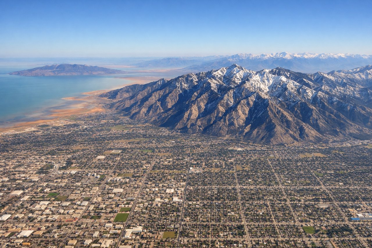
Takeoff from SLC
RIGHTDeparting SLC westbound, the Great Salt Lake and its salt flats spread out to the north, directly on the right side of the aircraft during initial climb. The Wasatch Range falls behind quickly, but the lake's stark white shoreline and causeway remain visible for several minutes.
Landing at OAK
RIGHTOn approach into OAK from the east, the aircraft descends over the northern East Bay hills before lining up for the westward-facing runways, giving right-side passengers views of Berkeley and the Bay Bridge with San Francisco's skyline beyond the water.
Will your flight be in sunlight?
Pick a date and time in the Sun Map to watch the sun move across your whole flight.
About This Route
Which side of the plane should I sit on flying from Salt Lake City International (SLC) to Metropolitan Oakland International (OAK)?
Sit on the Right side of the plane for the best views on flights from Salt Lake City to Oakland. The right side captures the Great Salt Lake at departure and the San Francisco Bay/skyline on arrival, giving it two strong scenic bookends compared to the left side's largely open desert and mountain-shadow views.
What can I see during takeoff from Salt Lake City International in Salt Lake City?
During takeoff from Salt Lake City International (SLC), sit on the Right side for the best views. Departing SLC westbound, the Great Salt Lake and its salt flats spread out to the north, directly on the right side of the aircraft during initial climb. The Wasatch Range falls behind quickly, but the lake's stark white shoreline and causeway remain visible for several minutes. Notable sights include: Great Salt Lake, Antelope Island, Bonneville Salt Flats (distant), Oquirrh Mountains.
What can I see when landing at Metropolitan Oakland International in Oakland?
When landing at Metropolitan Oakland International (OAK), sit on the Right side for the best views. On approach into OAK from the east, the aircraft descends over the northern East Bay hills before lining up for the westward-facing runways, giving right-side passengers views of Berkeley and the Bay Bridge with San Francisco's skyline beyond the water. Notable sights include: San Francisco Bay, Bay Bridge, Berkeley Hills, San Francisco skyline.
How long is the flight from Salt Lake City to Oakland?
The flight from Salt Lake City International (SLC) to Metropolitan Oakland International (OAK) takes about 1 hour 55 minutes. The shortest flight path between them is 587 miles (945 km); winds and air traffic control usually add a few percent.
What does the Salt Lake City to Oakland flight path pass over?
Great Basin desert terrain of Nevada, the Ruby Mountains and other isolated desert ranges, and the eastern flank of the Sierra Nevada near Lake Tahoe before descent into the Bay Area