While the Wasatch takeoff is dramatic, the right side's cruise-phase view of the Grand Canyon's South Rim and Colorado River gorge is the single most spectacular feature on this route, giving that side the edge for the full flight even though its takeoff and landing scenery are milder.
Flight Path
Grand Canyon National Park South Rim, Colorado River gorge, Kaibab Plateau, San Francisco Peaks near Flagstaff
Great circle distance and headings ›

.jpeg?width=600)
Phase by phase
Takeoff from SLC
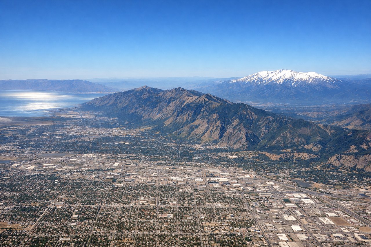
LEFTDeparting SLC southbound, the Wasatch Range rises immediately on the left with Mount Olympus, Twin Peaks, and the mouths of Big and Little Cottonwood Canyons clearly visible during the initial climb. The right side only offers the flatter Oquirrh Mountains and a receding, distant glimpse of the Great Salt Lake.
Landing at PHX
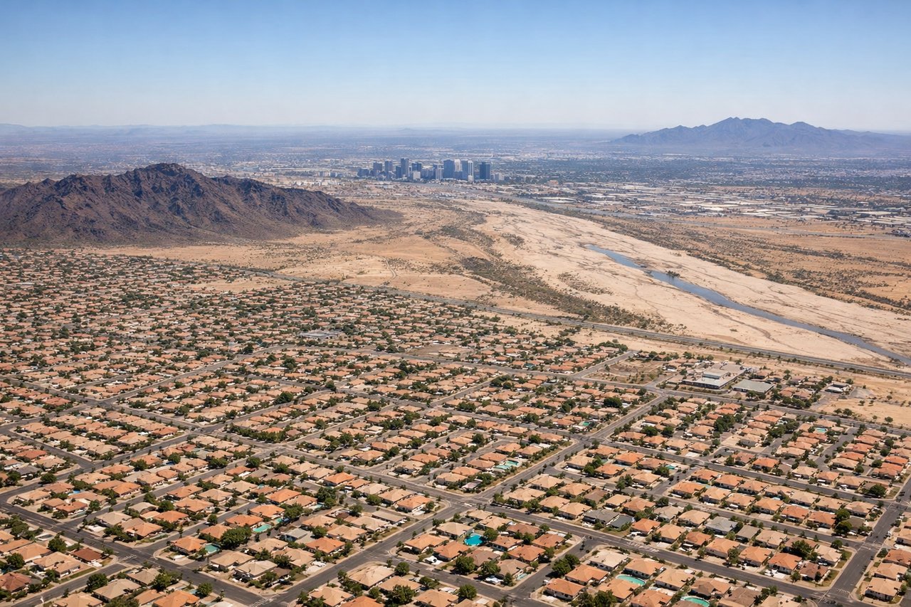
LEFTOn descent into PHX from the north, the jagged profile of the Superstition Mountains and Four Peaks stands out to the east over the Salt River Valley, a much more distinctive skyline than the low, eroded Estrella and White Tank ranges visible to the west. The reddish desert ridgelines contrast sharply with the green irrigated grid of the Phoenix suburbs below.
Landmarks on this routeAll landmarks →
Will your flight be in sunlight?
See exactly which side of the plane gets sun and shade at your departure time.
About This Route
Which side of the plane should I sit on flying from Salt Lake City International (SLC) to Phoenix Sky Harbor International (PHX)?
Sit on the Right side of the plane for the best views on flights from Salt Lake City to Phoenix. While the Wasatch takeoff is dramatic, the right side's cruise-phase view of the Grand Canyon's South Rim and Colorado River gorge is the single most spectacular feature on this route, giving that side the edge for the full flight even though its takeoff and landing scenery are milder.
What can I see during takeoff from Salt Lake City International in Salt Lake City?
During takeoff from Salt Lake City International (SLC), sit on the Left side for the best views. Departing SLC southbound, the Wasatch Range rises immediately on the left with Mount Olympus, Twin Peaks, and the mouths of Big and Little Cottonwood Canyons clearly visible during the initial climb. The right side only offers the flatter Oquirrh Mountains and a receding, distant glimpse of the Great Salt Lake. Notable sights include: Mount Olympus, Twin Peaks, Big Cottonwood Canyon, Salt Lake Valley floor.
What can I see when landing at Phoenix Sky Harbor International in Phoenix?
When landing at Phoenix Sky Harbor International (PHX), sit on the Left side for the best views. On descent into PHX from the north, the jagged profile of the Superstition Mountains and Four Peaks stands out to the east over the Salt River Valley, a much more distinctive skyline than the low, eroded Estrella and White Tank ranges visible to the west. The reddish desert ridgelines contrast sharply with the green irrigated grid of the Phoenix suburbs below. Notable sights include: Superstition Mountains, Four Peaks, Salt River Valley, Phoenix suburban grid.
How long is the flight from Salt Lake City to Phoenix?
The flight from Salt Lake City International (SLC) to Phoenix Sky Harbor International (PHX) takes 1h 35m.
What does the Salt Lake City to Phoenix flight path pass over?
Grand Canyon National Park South Rim, Colorado River gorge, Kaibab Plateau, San Francisco Peaks near Flagstaff