While takeoff offers the Wasatch Range's drama, the landing view of Pittsburgh's three-river confluence and downtown skyline is more visually distinctive and geographically significant. Right seats capture this iconic geography on approach.
Flown SLC to PIT? Did we get it right?
Flight Path
Salt Lake City to Pittsburgh is 1,655 miles (2,664 km), a flight of about 4 hours 15 minutes.
The flight path crosses the Rocky Mountains (visible from both sides during climb to cruise altitude around 35,000 feet), then transitions over the Great Plains. Notable midpoint geography includes the Colorado Front Range (west of Denver), the High Plains of eastern Colorado and Wyoming, and eventually the Appalachian plateau as the aircraft descends toward Pittsburgh. The Ohio River valley becomes visible during the final descent phase.
Great circle distance and headings ›


Phase by phase
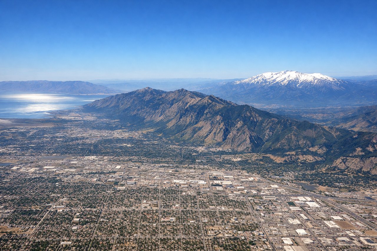
Takeoff from SLC
LEFTSLC typically departs westbound (Runway 16L/R or 34L/R depending on wind). Left seats face north initially, capturing the Wasatch Range's dramatic eastern escarpment and the Great Salt Lake's northern arm before the turn eastward.
Landing at PIT
RIGHTPIT typically lands eastbound (Runway 28L/R). Right seats face south during approach, offering views of the Monongahela River's dramatic confluence with the Allegheny River, the Point State Park peninsula, and downtown Pittsburgh's Golden Triangle district nestled between the rivers.
Will your flight be in sunlight?
Pick a date and time in the Sun Map to watch the sun move across your whole flight.
About This Route
Which side of the plane should I sit on flying from Salt Lake City International (SLC) to Pittsburgh International (PIT)?
Sit on the Right side of the plane for the best views on flights from Salt Lake City to Pittsburgh. While takeoff offers the Wasatch Range's drama, the landing view of Pittsburgh's three-river confluence and downtown skyline is more visually distinctive and geographically significant. Right seats capture this iconic geography on approach.
What can I see during takeoff from Salt Lake City International in Salt Lake City?
During takeoff from Salt Lake City International (SLC), sit on the Left side for the best views. SLC typically departs westbound (Runway 16L/R or 34L/R depending on wind). Left seats face north initially, capturing the Wasatch Range's dramatic eastern escarpment and the Great Salt Lake's northern arm before the turn eastward. Notable sights include: Wasatch Range (immediately adjacent to airport), Great Salt Lake (northwest), Antelope Island (visible in lake), Oquirrh Mountains (west across the lake).
What can I see when landing at Pittsburgh International in Pittsburgh?
When landing at Pittsburgh International (PIT), sit on the Right side for the best views. PIT typically lands eastbound (Runway 28L/R). Right seats face south during approach, offering views of the Monongahela River's dramatic confluence with the Allegheny River, the Point State Park peninsula, and downtown Pittsburgh's Golden Triangle district nestled between the rivers. Notable sights include: Monongahela River (prominent in approach), Allegheny River (confluence visible), Point State Park (triangular peninsula), Downtown Pittsburgh skyline (Golden Triangle).
How long is the flight from Salt Lake City to Pittsburgh?
The flight from Salt Lake City International (SLC) to Pittsburgh International (PIT) takes about 4 hours 15 minutes. The shortest flight path between them is 1,655 miles (2,664 km); winds and air traffic control usually add a few percent.
What does the Salt Lake City to Pittsburgh flight path pass over?
The flight path crosses the Rocky Mountains (visible from both sides during climb to cruise altitude around 35,000 feet), then transitions over the Great Plains. Notable midpoint geography includes the Colorado Front Range (west of Denver), the High Plains of eastern Colorado and Wyoming, and eventually the Appalachian plateau as the aircraft descends toward Pittsburgh. The Ohio River valley becomes visible during the final descent phase.