Right seats capture the dramatic Wasatch Range departure and maintain better views throughout the southbound flight path over Utah and Arizona terrain. While left seats excel at landing, the takeoff experience is more visually rewarding.
Flown SLC to PVR? Did we get it right?
Flight Path
Salt Lake City to Puerto Vallarta is 1,444 miles (2,325 km), a flight of about 3 hours 45 minutes.
The flight path crosses central Utah (Sevier Plateau, Fishlake National Forest visible as dark forested areas), then Arizona (Mogollon Rim, Colorado Plateau with visible canyon systems), before descending into Sonora, Mexico. The transition from high desert to tropical Pacific coast is gradual, with the Sierra Madre Occidental becoming increasingly prominent as you approach the coast. Lake Powell may be visible on clear days in the northern portion of the route.
Great circle distance and headings ›


Phase by phase
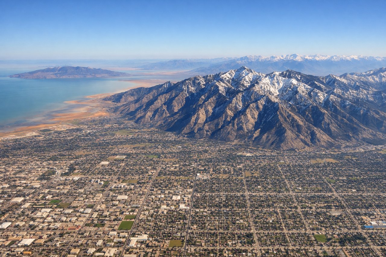
Takeoff from SLC
RIGHTSLC typically departs runways 16L/R or 34L/R depending on wind. Right seats offer views of the Wasatch Range's dramatic eastern escarpment rising directly above the airport, plus the Great Salt Lake's northern arm to the northwest. Left seats see the valley floor and urban sprawl.
Landing at PVR
LEFTApproaching PVR typically uses runways 03 or 21 depending on wind. Left seats provide views of the Pacific coastline, Banderas Bay's crescent shape, and the Sierra Madre Occidental foothills inland. Right seats see open ocean and less distinctive terrain.
Will your flight be in sunlight?
Pick a date and time in the Sun Map to watch the sun move across your whole flight.
About This Route
Which side of the plane should I sit on flying from Salt Lake City International (SLC) to Licenciado Gustavo Diaz Ordaz International (PVR)?
Sit on the Right side of the plane for the best views on flights from Salt Lake City to Puerto Vallarta. Right seats capture the dramatic Wasatch Range departure and maintain better views throughout the southbound flight path over Utah and Arizona terrain. While left seats excel at landing, the takeoff experience is more visually rewarding.
What can I see during takeoff from Salt Lake City International in Salt Lake City?
During takeoff from Salt Lake City International (SLC), sit on the Right side for the best views. SLC typically departs runways 16L/R or 34L/R depending on wind. Right seats offer views of the Wasatch Range's dramatic eastern escarpment rising directly above the airport, plus the Great Salt Lake's northern arm to the northwest. Left seats see the valley floor and urban sprawl. Notable sights include: Wasatch Range (eastern ridge), Great Salt Lake (northern portion), Antelope Island, Salt Lake City urban grid.
What can I see when landing at Licenciado Gustavo Diaz Ordaz International in Puerto Vallarta?
When landing at Licenciado Gustavo Diaz Ordaz International (PVR), sit on the Left side for the best views. Approaching PVR typically uses runways 03 or 21 depending on wind. Left seats provide views of the Pacific coastline, Banderas Bay's crescent shape, and the Sierra Madre Occidental foothills inland. Right seats see open ocean and less distinctive terrain. Notable sights include: Banderas Bay (water body), Pacific coastline, Sierra Madre Occidental (distant inland mountains), Puerto Vallarta city waterfront.
How long is the flight from Salt Lake City to Puerto Vallarta?
The flight from Salt Lake City International (SLC) to Licenciado Gustavo Diaz Ordaz International (PVR) takes about 3 hours 45 minutes. The shortest flight path between them is 1,444 miles (2,325 km); winds and air traffic control usually add a few percent.
What does the Salt Lake City to Puerto Vallarta flight path pass over?
The flight path crosses central Utah (Sevier Plateau, Fishlake National Forest visible as dark forested areas), then Arizona (Mogollon Rim, Colorado Plateau with visible canyon systems), before descending into Sonora, Mexico. The transition from high desert to tropical Pacific coast is gradual, with the Sierra Madre Occidental becoming increasingly prominent as you approach the coast. Lake Powell may be visible on clear days in the northern portion of the route.