While both sides score equally, the left side wins on takeoff drama with the immediate Wasatch Range spectacle, which is more visually compelling than the landing approach. The Wasatch departure provides genuine alpine scenery at close range, whereas the James River landing, though pleasant, is a more modest urban-river view. For a 4+ hour flight, the memorable start outweighs the modest finish.
Flown SLC to RIC? Did we get it right?
Flight Path
Salt Lake City to Richmond is 1,859 miles (2,992 km), a flight of about 4 hours 15 minutes.
The flight path crosses the Appalachian plateau and ridge-and-valley terrain of West Virginia and eastern Kentucky, with the Ohio River visible in sections near the Kentucky-Ohio border. The Appalachian Mountains appear as a series of parallel ridges running northeast-southwest, most prominent over central West Virginia. No major lakes or dramatic peaks are visible along the typical cruise altitude route, making the middle 2.5 hours relatively featureless compared to the endpoints.
Great circle distance and headings ›


Phase by phase
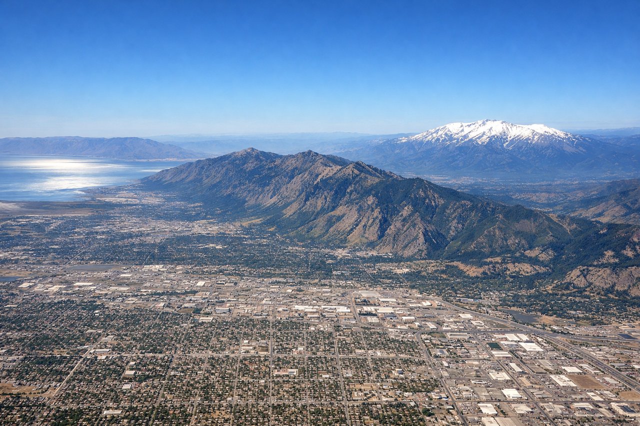
Takeoff from SLC
LEFTLeft side captures the Wasatch Range immediately west of Salt Lake City during climb-out, with dramatic peaks rising directly from the valley floor. Right side faces the flat Great Basin and offers minimal terrain interest during departure.
Landing at RIC
RIGHTRight side offers the James River approach into Richmond, with the river's distinctive meanders visible during descent and the city's downtown skyline appearing along the river corridor. Left side shows only flat Piedmont terrain with minimal visual interest.
Will your flight be in sunlight?
Pick a date and time in the Sun Map to watch the sun move across your whole flight.
About This Route
Which side of the plane should I sit on flying from Salt Lake City International (SLC) to Richmond International (RIC)?
Sit on the Left side of the plane for the best views on flights from Salt Lake City to Richmond. While both sides score equally, the left side wins on takeoff drama with the immediate Wasatch Range spectacle, which is more visually compelling than the landing approach. The Wasatch departure provides genuine alpine scenery at close range, whereas the James River landing, though pleasant, is a more modest urban-river view. For a 4+ hour flight, the memorable start outweighs the modest finish.
What can I see during takeoff from Salt Lake City International in Salt Lake City?
During takeoff from Salt Lake City International (SLC), sit on the Left side for the best views. Left side captures the Wasatch Range immediately west of Salt Lake City during climb-out, with dramatic peaks rising directly from the valley floor. Right side faces the flat Great Basin and offers minimal terrain interest during departure. Notable sights include: Wasatch Range peaks (including Mount Olympus and Lone Peak), Great Salt Lake shoreline to the northwest, Salt Lake City urban grid below.
What can I see when landing at Richmond International in Richmond?
When landing at Richmond International (RIC), sit on the Right side for the best views. Right side offers the James River approach into Richmond, with the river's distinctive meanders visible during descent and the city's downtown skyline appearing along the river corridor. Left side shows only flat Piedmont terrain with minimal visual interest. Notable sights include: James River with its characteristic bends through Richmond, downtown Richmond skyline along the river, Piedmont rolling terrain, Richmond International Airport runways.
How long is the flight from Salt Lake City to Richmond?
The flight from Salt Lake City International (SLC) to Richmond International (RIC) takes about 4 hours 15 minutes. The shortest flight path between them is 1,859 miles (2,992 km); winds and air traffic control usually add a few percent.
What does the Salt Lake City to Richmond flight path pass over?
The flight path crosses the Appalachian plateau and ridge-and-valley terrain of West Virginia and eastern Kentucky, with the Ohio River visible in sections near the Kentucky-Ohio border. The Appalachian Mountains appear as a series of parallel ridges running northeast-southwest, most prominent over central West Virginia. No major lakes or dramatic peaks are visible along the typical cruise altitude route, making the middle 2.5 hours relatively featureless compared to the endpoints.