Right-side seats capture the dramatic Wasatch Range during departure, which is the most visually striking segment. While left-side landing views are excellent, the takeoff scenery from the right side is more consistently impressive and geographically distinctive.
Flown SLC to SBA? Did we get it right?
Flight Path
Salt Lake City to Santa Barbara is 615 miles (989 km), a flight of about 2 hours 15 minutes.
The flight path heads southwest from Salt Lake City, crossing the Great Basin. Notable features include the San Rafael Swell and Book Cliffs to the southeast (visible from right side during early cruise), the Colorado Plateau terrain, and eventually the transition to the Mojave Desert region. The Sierra Nevada appears on the left (west) side during mid-cruise as a distant mountain range. As the aircraft approaches Southern California, the San Gabriel and San Bernardino Mountains become visible on the right side before the final descent toward the coast.
Great circle distance and headings ›

Phase by phase
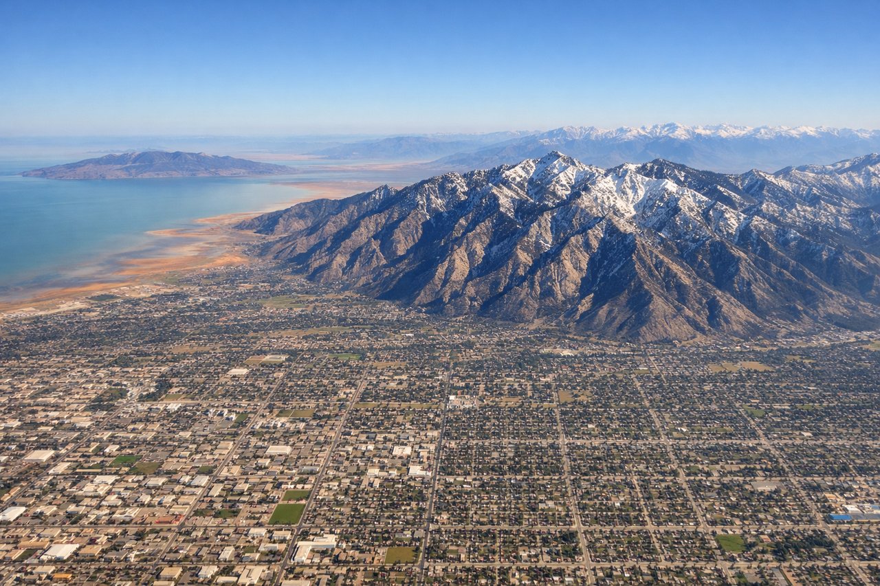
Takeoff from SLC
RIGHTRight-side seats offer immediate views of the Wasatch Range as the aircraft climbs southwestward from SLC. The mountains rise dramatically to the east and southeast of the airport, creating a striking backdrop during initial climb.
Landing at SBA
LEFTLeft-side seats provide excellent views during the descent approach into Santa Barbara. The aircraft typically descends from the north over the Santa Ynez Mountains and the Pacific coastline, with the Channel Islands visible offshore to the left and the Santa Barbara coast coming into view.
Will your flight be in sunlight?
Pick a date and time in the Sun Map to watch the sun move across your whole flight.
About This Route
Which side of the plane should I sit on flying from Salt Lake City International (SLC) to Santa Barbara Municipal Airport (SBA)?
Sit on the Right side of the plane for the best views on flights from Salt Lake City to Santa Barbara. Right-side seats capture the dramatic Wasatch Range during departure, which is the most visually striking segment. While left-side landing views are excellent, the takeoff scenery from the right side is more consistently impressive and geographically distinctive.
What can I see during takeoff from Salt Lake City International in Salt Lake City?
During takeoff from Salt Lake City International (SLC), sit on the Right side for the best views. Right-side seats offer immediate views of the Wasatch Range as the aircraft climbs southwestward from SLC. The mountains rise dramatically to the east and southeast of the airport, creating a striking backdrop during initial climb. Notable sights include: Wasatch Range (Lone Peak, Mount Olympus visible on clear days), Great Salt Lake to the northwest, Salt Lake City urban grid below, Oquirrh Mountains to the west.
What can I see when landing at Santa Barbara Municipal Airport in Santa Barbara?
When landing at Santa Barbara Municipal Airport (SBA), sit on the Left side for the best views. Left-side seats provide excellent views during the descent approach into Santa Barbara. The aircraft typically descends from the north over the Santa Ynez Mountains and the Pacific coastline, with the Channel Islands visible offshore to the left and the Santa Barbara coast coming into view. Notable sights include: Santa Ynez Mountains, Pacific Ocean and Santa Barbara coastline, Channel Islands (visible as distant landmasses offshore), Santa Barbara urban area.
How long is the flight from Salt Lake City to Santa Barbara?
The flight from Salt Lake City International (SLC) to Santa Barbara Municipal Airport (SBA) takes about 2 hours 15 minutes. The shortest flight path between them is 615 miles (989 km); winds and air traffic control usually add a few percent.
What does the Salt Lake City to Santa Barbara flight path pass over?
The flight path heads southwest from Salt Lake City, crossing the Great Basin. Notable features include the San Rafael Swell and Book Cliffs to the southeast (visible from right side during early cruise), the Colorado Plateau terrain, and eventually the transition to the Mojave Desert region. The Sierra Nevada appears on the left (west) side during mid-cruise as a distant mountain range. As the aircraft approaches Southern California, the San Gabriel and San Bernardino Mountains become visible on the right side before the final descent toward the coast.