Both sides open strong, but the left side closes the flight with a far more memorable sequence — Mount Rainier and Lake Washington on descent outweigh the right side's flatter, less distinctive arrival, giving the left more sustained scenic value across the whole trip.
Flown SLC to SEA? Did we get it right?
Flight Path
Salt Lake City to Seattle is 688 miles (1,107 km), a flight of about 1 hour 55 minutes.
Southern Idaho's Snake River Plain and the high desert plateau of eastern Oregon, mostly flat, arid farmland and sagebrush terrain with occasional glimpses of the Snake River, before the land begins rising into the forested Cascade foothills near the Washington border.
Great circle distance and headings ›

Phase by phase
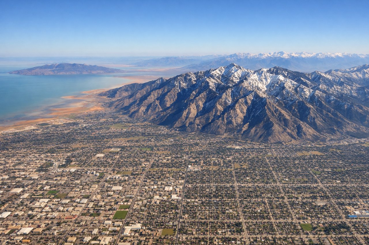
Takeoff from SLC
RIGHTClimbing out of Salt Lake City, the Wasatch Range wall rises abruptly just east of the runway, with peaks over 11,000 feet visible within seconds of liftoff. It's a steep, close mountain backdrop that dominates the right side while the valley and distant lake fall away on the left.
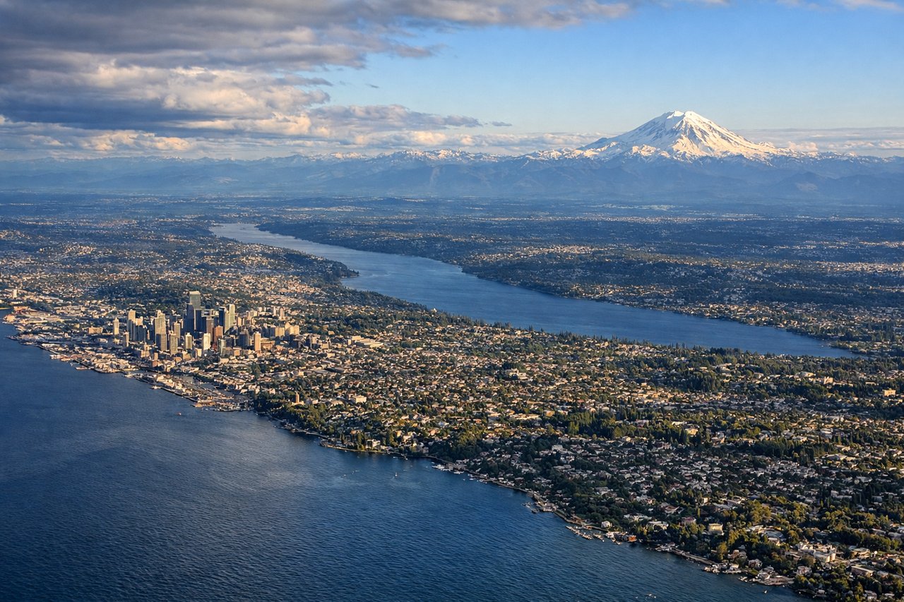
Landing at SEA
LEFTOn approach into Sea-Tac, left-side passengers get the classic Puget Sound-region payoff: Mount Rainier's massive snow-capped cone anchors the horizon to the south while Lake Washington and the Eastside suburbs unfold directly below during the final descent.
Will your flight be in sunlight?
Pick a date and time in the Sun Map to watch the sun move across your whole flight.
About This Route
Which side of the plane should I sit on flying from Salt Lake City International (SLC) to Seattle Tacoma International (SEA)?
Sit on the Left side of the plane for the best views on flights from Salt Lake City to Seattle. Both sides open strong, but the left side closes the flight with a far more memorable sequence — Mount Rainier and Lake Washington on descent outweigh the right side's flatter, less distinctive arrival, giving the left more sustained scenic value across the whole trip.
What can I see during takeoff from Salt Lake City International in Salt Lake City?
During takeoff from Salt Lake City International (SLC), sit on the Right side for the best views. Climbing out of Salt Lake City, the Wasatch Range wall rises abruptly just east of the runway, with peaks over 11,000 feet visible within seconds of liftoff. It's a steep, close mountain backdrop that dominates the right side while the valley and distant lake fall away on the left. Notable sights include: Wasatch Range (Mount Olympus, Twin Peaks, Lone Peak), Salt Lake Valley grid below, Wasatch foothill canyons.
What can I see when landing at Seattle Tacoma International in Seattle?
When landing at Seattle Tacoma International (SEA), sit on the Left side for the best views. On approach into Sea-Tac, left-side passengers get the classic Puget Sound-region payoff: Mount Rainier's massive snow-capped cone anchors the horizon to the south while Lake Washington and the Eastside suburbs unfold directly below during the final descent. Notable sights include: Mount Rainier, Lake Washington, Bellevue/Eastside shoreline, Cascade foothills.
How long is the flight from Salt Lake City to Seattle?
The flight from Salt Lake City International (SLC) to Seattle Tacoma International (SEA) takes about 1 hour 55 minutes. The shortest flight path between them is 688 miles (1,107 km); winds and air traffic control usually add a few percent.
What does the Salt Lake City to Seattle flight path pass over?
Southern Idaho's Snake River Plain and the high desert plateau of eastern Oregon, mostly flat, arid farmland and sagebrush terrain with occasional glimpses of the Snake River, before the land begins rising into the forested Cascade foothills near the Washington border.