Right-side seats deliver superior scenery for both segments: the Wasatch Range on departure and the red rock desert formations on arrival. This 90-minute flight is short enough that the right side wins both legs decisively.
Flown SLC to SGU? Did we get it right?
Flight Path
Salt Lake City to St George is 272 miles (438 km), a flight of about 1 hour 25 minutes.
Spanish Fork Canyon and the Wasatch Plateau as you climb southbound; the transition from the Great Basin's high desert into the Mojave Desert terrain; the Virgin River drainage system becomes visible as you descend toward St. George
Great circle distance and headings ›

Phase by phase
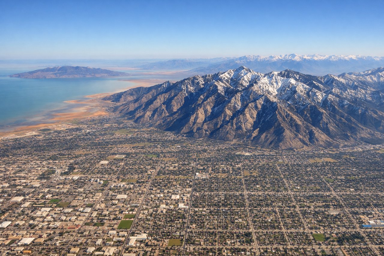
Takeoff from SLC
RIGHTRight-side seats capture the Wasatch Range immediately after departure. Salt Lake City's northbound and southbound departures typically climb out over the eastern bench, placing the dramatic Wasatch peaks directly to the right as you gain altitude.
Landing at SGU
RIGHTRight-side seats offer the best views during descent into St. George. The approach path brings aircraft over the Virgin River valley and the red rock formations of the Mojave Desert, which sit directly to the right as you descend toward the airport from the north.
Will your flight be in sunlight?
Pick a date and time in the Sun Map to watch the sun move across your whole flight.
About This Route
Which side of the plane should I sit on flying from Salt Lake City International (SLC) to St George Regional Airport (SGU)?
Sit on the Right side of the plane for the best views on flights from Salt Lake City to St George. Right-side seats deliver superior scenery for both segments: the Wasatch Range on departure and the red rock desert formations on arrival. This 90-minute flight is short enough that the right side wins both legs decisively.
What can I see during takeoff from Salt Lake City International in Salt Lake City?
During takeoff from Salt Lake City International (SLC), sit on the Right side for the best views. Right-side seats capture the Wasatch Range immediately after departure. Salt Lake City's northbound and southbound departures typically climb out over the eastern bench, placing the dramatic Wasatch peaks directly to the right as you gain altitude. Notable sights include: Wasatch Range (including Mount Olympus and Twin Peaks), Great Salt Lake to the northwest, Salt Lake Valley floor with city grid below.
What can I see when landing at St George Regional Airport in St George?
When landing at St George Regional Airport (SGU), sit on the Right side for the best views. Right-side seats offer the best views during descent into St. George. The approach path brings aircraft over the Virgin River valley and the red rock formations of the Mojave Desert, which sit directly to the right as you descend toward the airport from the north. Notable sights include: Red rock formations and Mojave Desert terrain, Virgin River valley, Hurricane Cliffs to the east.
How long is the flight from Salt Lake City to St George?
The flight from Salt Lake City International (SLC) to St George Regional Airport (SGU) takes about 1 hour 25 minutes. The shortest flight path between them is 272 miles (438 km); winds and air traffic control usually add a few percent.
What does the Salt Lake City to St George flight path pass over?
Spanish Fork Canyon and the Wasatch Plateau as you climb southbound; the transition from the Great Basin's high desert into the Mojave Desert terrain; the Virgin River drainage system becomes visible as you descend toward St. George