The takeoff view of the Wasatch Range is more dramatic and consistently visible than the landing approach. While the landing offers desert and mountain scenery, the right side during departure provides the most striking geological feature of the entire flight.
Flown SLC to SJD? Did we get it right?
Flight Path
Salt Lake City to San Jose Del Cabo is 1,226 miles (1,972 km), a flight of about 3 hours.
The flight path crosses the Great Basin and Nevada desert. Midway, you'll pass east of Las Vegas (visible as a bright cluster if flying at appropriate altitude and time of day), then continue over the Mojave Desert. The Colorado River and Lake Mead may be visible depending on exact routing. As you approach Baja California, the transition from high desert to lower coastal terrain becomes apparent, with the Sierra de la Laguna becoming increasingly prominent on the left side of the aircraft.
Great circle distance and headings ›


Phase by phase
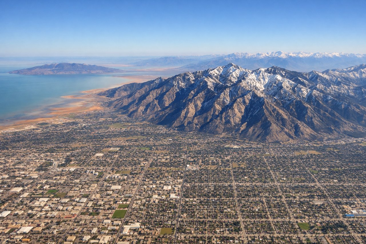
Takeoff from SLC
RIGHTSLC typically departs to the north or northeast. Right-side seats offer immediate views of the Wasatch Range's dramatic eastern escarpment rising directly from the valley floor, with the snow-covered peaks of the Uinta Mountains visible further northeast during winter months.
Landing at SJD
LEFTApproaching SJD from the north typically uses runways aligned roughly north-south. Left-side seats provide views of the Sierra de la Laguna mountain range and the dramatic desert terrain of the Baja California peninsula as you descend toward the coastal plain where the airport sits.
Will your flight be in sunlight?
Pick a date and time in the Sun Map to watch the sun move across your whole flight.
About This Route
Which side of the plane should I sit on flying from Salt Lake City International (SLC) to Los Cabos International (SJD)?
Sit on the Right side of the plane for the best views on flights from Salt Lake City to San Jose Del Cabo. The takeoff view of the Wasatch Range is more dramatic and consistently visible than the landing approach. While the landing offers desert and mountain scenery, the right side during departure provides the most striking geological feature of the entire flight.
What can I see during takeoff from Salt Lake City International in Salt Lake City?
During takeoff from Salt Lake City International (SLC), sit on the Right side for the best views. SLC typically departs to the north or northeast. Right-side seats offer immediate views of the Wasatch Range's dramatic eastern escarpment rising directly from the valley floor, with the snow-covered peaks of the Uinta Mountains visible further northeast during winter months. Notable sights include: Wasatch Range (east wall), Great Salt Lake (northwest, visible as you climb), Antelope Island (in the lake), Uinta Mountains (distant northeast).
What can I see when landing at Los Cabos International in San Jose Del Cabo?
When landing at Los Cabos International (SJD), sit on the Left side for the best views. Approaching SJD from the north typically uses runways aligned roughly north-south. Left-side seats provide views of the Sierra de la Laguna mountain range and the dramatic desert terrain of the Baja California peninsula as you descend toward the coastal plain where the airport sits. Notable sights include: Sierra de la Laguna (inland mountains), Baja California desert scrubland, Pacific Ocean (western horizon), Cape San Lucas area (southern tip).
How long is the flight from Salt Lake City to San Jose Del Cabo?
The flight from Salt Lake City International (SLC) to Los Cabos International (SJD) takes about 3 hours. The shortest flight path between them is 1,226 miles (1,972 km); winds and air traffic control usually add a few percent.
What does the Salt Lake City to San Jose Del Cabo flight path pass over?
The flight path crosses the Great Basin and Nevada desert. Midway, you'll pass east of Las Vegas (visible as a bright cluster if flying at appropriate altitude and time of day), then continue over the Mojave Desert. The Colorado River and Lake Mead may be visible depending on exact routing. As you approach Baja California, the transition from high desert to lower coastal terrain becomes apparent, with the Sierra de la Laguna becoming increasingly prominent on the left side of the aircraft.