The right side wins overall because the Great Salt Lake and Wasatch Range provide a dramatic, immediately recognizable spectacle right at departure, while the Sierra views on the left during landing are real but more distant and fleeting.
Flown SLC to SMF? Did we get it right?
Flight Path
Salt Lake City to Sacramento is 530 miles (854 km), a flight of about 1 hour 35 minutes.
Great Basin desert, Ruby Mountains of Nevada, Humboldt River valley, and the eastern edge of the Sierra Nevada
Great circle distance and headings ›

Phase by phase
Takeoff from SLC
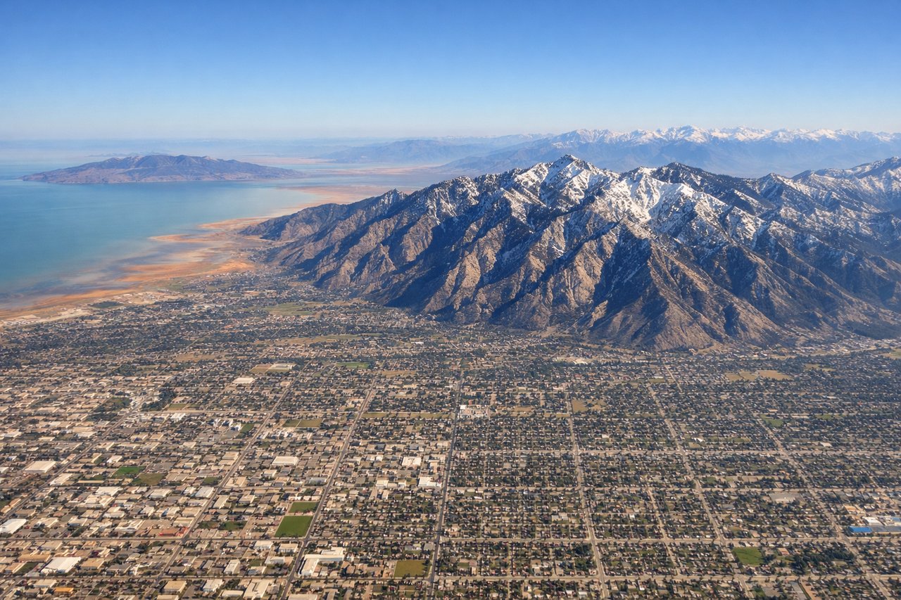
RIGHTDeparting SLC, the Wasatch Range rises sharply just east of the airport, and as the aircraft climbs and banks westward, the Great Salt Lake and its salt flats spread out to the north — both are visible on the right side during the initial climb.
Landing at SMF
LEFTOn approach into Sacramento from the east, the flight path crosses the Sierra Nevada north of Lake Tahoe, and the range's granite peaks and forested foothills are visible off the left side before the plane descends into the flat farmland of the Central Valley.
Will your flight be in sunlight?
Pick a date and time in the Sun Map to watch the sun move across your whole flight.
About This Route
Which side of the plane should I sit on flying from Salt Lake City International (SLC) to Sacramento International (SMF)?
Sit on the Right side of the plane for the best views on flights from Salt Lake City to Sacramento. The right side wins overall because the Great Salt Lake and Wasatch Range provide a dramatic, immediately recognizable spectacle right at departure, while the Sierra views on the left during landing are real but more distant and fleeting.
What can I see during takeoff from Salt Lake City International in Salt Lake City?
During takeoff from Salt Lake City International (SLC), sit on the Right side for the best views. Departing SLC, the Wasatch Range rises sharply just east of the airport, and as the aircraft climbs and banks westward, the Great Salt Lake and its salt flats spread out to the north — both are visible on the right side during the initial climb. Notable sights include: Wasatch Range, Great Salt Lake, Antelope Island, Salt Lake Valley.
What can I see when landing at Sacramento International in Sacramento?
When landing at Sacramento International (SMF), sit on the Left side for the best views. On approach into Sacramento from the east, the flight path crosses the Sierra Nevada north of Lake Tahoe, and the range's granite peaks and forested foothills are visible off the left side before the plane descends into the flat farmland of the Central Valley. Notable sights include: Sierra Nevada foothills, Sacramento River, Central Valley farmland, distant Coast Range.
How long is the flight from Salt Lake City to Sacramento?
The flight from Salt Lake City International (SLC) to Sacramento International (SMF) takes about 1 hour 35 minutes. The shortest flight path between them is 530 miles (854 km); winds and air traffic control usually add a few percent.
What does the Salt Lake City to Sacramento flight path pass over?
Great Basin desert, Ruby Mountains of Nevada, Humboldt River valley, and the eastern edge of the Sierra Nevada