Right-side seats offer superior views on both legs: the dramatic Wasatch Range during SLC departure and Lake Maracaibo's vast expanse plus the Perijá Mountains during STB approach. The left side provides less distinctive scenery on both segments.
Flight Path
The flight path crosses the continental United States southeastward, passing over the Colorado Plateau (visible as rust-colored terrain with canyon systems), the Rio Grande valley in New Mexico, and the Gulf of Mexico. Over the Gulf, the Yucatan Peninsula's flat limestone platform becomes visible. Approaching Venezuela, the Caribbean coastline and the Maracaibo Basin's distinctive geography dominate the final descent phase. Lake Maracaibo itself—the world's largest natural oil field and a massive inland sea—is the most striking midpoint/approach feature, visible for roughly 200 miles on the approach.
Great circle distance and headings ›
.jpg?width=600)
.jpg?width=600)


Phase by phase
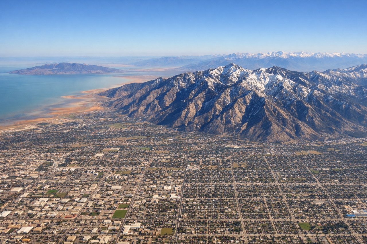
Takeoff from SLC
RIGHTSLC typically departs northbound (Runways 16L/R) or southbound (Runways 34L/R). Right-side seats offer the best view of the Wasatch Range's dramatic eastern escarpment and the Great Salt Lake's northern arm during initial climb. Left seats face the Salt Lake Valley floor and western benches.
Landing at STB
RIGHTApproaching Santa Barbara del Zulia from the north typically uses Runway 09 (eastbound) or Runway 27 (westbound). Right-side seats provide views of Lake Maracaibo's eastern shoreline, the Perijá Mountains, and the approach over water. Left seats face inland terrain with less distinctive features.
Landmarks on this routeAll landmarks →
Will your flight be in sunlight?
See exactly which side of the plane gets sun and shade at your departure time.
About This Route
Which side of the plane should I sit on flying from Salt Lake City International (SLC) to Santa Barbara Del Zulia (STB)?
Sit on the Right side of the plane for the best views on flights from Salt Lake City to Santa Barbara. Right-side seats offer superior views on both legs: the dramatic Wasatch Range during SLC departure and Lake Maracaibo's vast expanse plus the Perijá Mountains during STB approach. The left side provides less distinctive scenery on both segments.
What can I see during takeoff from Salt Lake City International in Salt Lake City?
During takeoff from Salt Lake City International (SLC), sit on the Right side for the best views. SLC typically departs northbound (Runways 16L/R) or southbound (Runways 34L/R). Right-side seats offer the best view of the Wasatch Range's dramatic eastern escarpment and the Great Salt Lake's northern arm during initial climb. Left seats face the Salt Lake Valley floor and western benches. Notable sights include: Wasatch Range (Lone Peak, Mount Olympus), Great Salt Lake (northern portion), Antelope Island, Salt Lake Valley urban grid.
What can I see when landing at Santa Barbara Del Zulia in Santa Barbara?
When landing at Santa Barbara Del Zulia (STB), sit on the Right side for the best views. Approaching Santa Barbara del Zulia from the north typically uses Runway 09 (eastbound) or Runway 27 (westbound). Right-side seats provide views of Lake Maracaibo's eastern shoreline, the Perijá Mountains, and the approach over water. Left seats face inland terrain with less distinctive features. Notable sights include: Lake Maracaibo (massive inland sea), Perijá Mountains (Venezuelan border range), Zulia State coastal lowlands, oil platform clusters.
How long is the flight from Salt Lake City to Santa Barbara?
The flight from Salt Lake City International (SLC) to Santa Barbara Del Zulia (STB) takes Approximately 5 hours 15 minutes.
What does the Salt Lake City to Santa Barbara flight path pass over?
The flight path crosses the continental United States southeastward, passing over the Colorado Plateau (visible as rust-colored terrain with canyon systems), the Rio Grande valley in New Mexico, and the Gulf of Mexico. Over the Gulf, the Yucatan Peninsula's flat limestone platform becomes visible. Approaching Venezuela, the Caribbean coastline and the Maracaibo Basin's distinctive geography dominate the final descent phase. Lake Maracaibo itself—the world's largest natural oil field and a massive inland sea—is the most striking midpoint/approach feature, visible for roughly 200 miles on the approach.