The takeoff experience from SLC with the dramatic Wasatch Range views outweighs the landing scenery. While the landing offers Puget Sound and foothills, the right side during takeoff captures one of the most visually distinctive mountain ranges in the western US at close range during the most photogenic phase of flight.
Flown SLC to TCM? Did we get it right?
Flight Path
Salt Lake City to Tacoma is 681 miles (1,096 km), a flight of about 2 hours 15 minutes.
The flight path crosses central Oregon and Washington. Notable features include the Blue Mountains (eastern Oregon), the Columbia River (visible as a ribbon cutting through high desert terrain in central Washington), and the transition from arid sagebrush steppe to increasingly forested terrain as you approach the Cascade Range. The Cascade Range itself becomes prominent in the final 45 minutes of flight, with peaks like Mount Hood (Oregon/Washington border) potentially visible on clear days.
Great circle distance and headings ›

Phase by phase
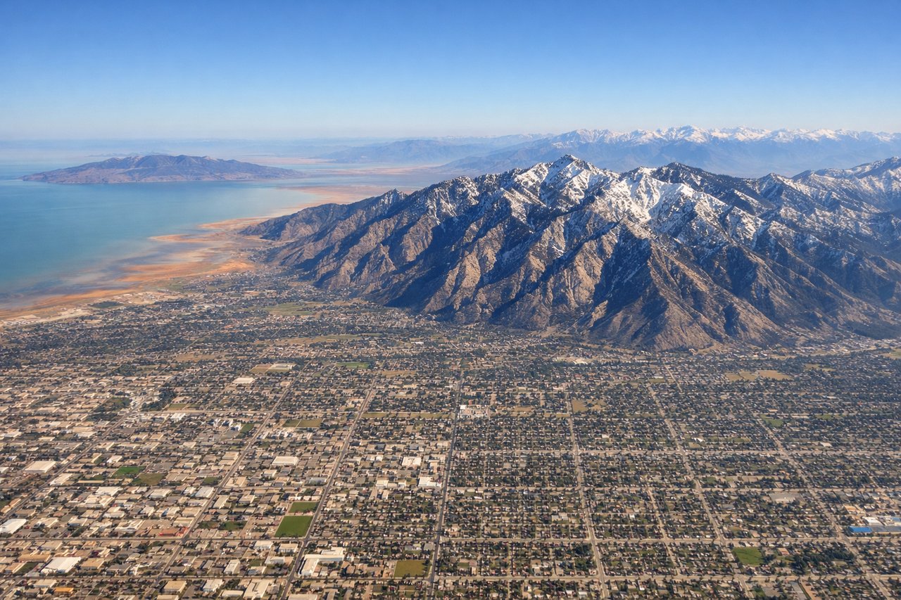
Takeoff from SLC
RIGHTRight-side seats offer immediate views of the Wasatch Range as the aircraft climbs northwestward from SLC. The mountains dominate the eastern skyline during initial climb, providing dramatic relief and snow-capped peaks (seasonal) that are far more visually striking than the western valley floor.
Landing at TCM
LEFTLeft-side seats provide excellent views during descent into McChord AFB near Tacoma. The approach typically brings the aircraft over Puget Sound and the Cascade Range foothills from the southeast, making the left side ideal for viewing the sound's waters, forested terrain, and Mount Rainier if visible.
Will your flight be in sunlight?
Pick a date and time in the Sun Map to watch the sun move across your whole flight.
About This Route
Which side of the plane should I sit on flying from Salt Lake City International (SLC) to Mc Chord Afb (TCM)?
Sit on the Right side of the plane for the best views on flights from Salt Lake City to Tacoma. The takeoff experience from SLC with the dramatic Wasatch Range views outweighs the landing scenery. While the landing offers Puget Sound and foothills, the right side during takeoff captures one of the most visually distinctive mountain ranges in the western US at close range during the most photogenic phase of flight.
What can I see during takeoff from Salt Lake City International in Salt Lake City?
During takeoff from Salt Lake City International (SLC), sit on the Right side for the best views. Right-side seats offer immediate views of the Wasatch Range as the aircraft climbs northwestward from SLC. The mountains dominate the eastern skyline during initial climb, providing dramatic relief and snow-capped peaks (seasonal) that are far more visually striking than the western valley floor. Notable sights include: Wasatch Range (immediately east), Great Salt Lake (northwest, visible as you climb), Salt Lake City urban grid (directly below, receding), Antelope Island (in the lake, visible as a dark mass).
What can I see when landing at Mc Chord Afb in Tacoma?
When landing at Mc Chord Afb (TCM), sit on the Left side for the best views. Left-side seats provide excellent views during descent into McChord AFB near Tacoma. The approach typically brings the aircraft over Puget Sound and the Cascade Range foothills from the southeast, making the left side ideal for viewing the sound's waters, forested terrain, and Mount Rainier if visible. Notable sights include: Puget Sound (major water body, directly visible on approach), Cascade Range foothills (forested ridgelines), Mount Rainier (visible on clear days, southeast of Tacoma), Tacoma/Seattle urban sprawl (visible as you descend below 5,000 feet).
How long is the flight from Salt Lake City to Tacoma?
The flight from Salt Lake City International (SLC) to Mc Chord Afb (TCM) takes about 2 hours 15 minutes. The shortest flight path between them is 681 miles (1,096 km); winds and air traffic control usually add a few percent.
What does the Salt Lake City to Tacoma flight path pass over?
The flight path crosses central Oregon and Washington. Notable features include the Blue Mountains (eastern Oregon), the Columbia River (visible as a ribbon cutting through high desert terrain in central Washington), and the transition from arid sagebrush steppe to increasingly forested terrain as you approach the Cascade Range. The Cascade Range itself becomes prominent in the final 45 minutes of flight, with peaks like Mount Hood (Oregon/Washington border) potentially visible on clear days.