Right side scores marginally higher due to the dramatic Wasatch Range scenery during takeoff, which is the most visually striking segment of this short flight. Landing views are equally modest on both sides, but the takeoff advantage on the right (east) outweighs the landing advantage on the left (west). This is a short, relatively flat regional flight with limited scenic drama overall.
Flown SLC to TWF? Did we get it right?
Flight Path
Salt Lake City to Twin Falls is 175 miles (281 km), a flight of about 50 minutes.
Camas Prairie, Soldier Mountain range (distant, south), Bruneau River drainage, high desert sagebrush plateau, scattered irrigated farmland in the Snake River Plain
Great circle distance and headings ›Phase by phase
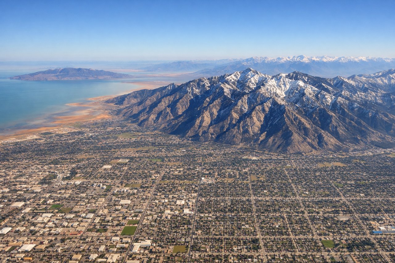
Takeoff from SLC
RIGHTRight side captures the Wasatch Range directly east of SLC during northbound climb-out, with dramatic peaks rising 6,000–8,000 feet above the valley floor. Left side shows the flat Salt Lake Valley and urban sprawl with minimal terrain drama.
Landing at TWF
LEFTLeft side (west) offers views of the Snake River Plain and the approach to Twin Falls from the southwest, with the Bruneau River canyon and surrounding high desert visible during descent. Right side (east) shows only open sagebrush plateau with minimal visual interest.
Will your flight be in sunlight?
Pick a date and time in the Sun Map to watch the sun move across your whole flight.
About This Route
Which side of the plane should I sit on flying from Salt Lake City International (SLC) to Joslin Field Magic Valley Regional Airport (TWF)?
Sit on the Right side of the plane for the best views on flights from Salt Lake City to Twin Falls. Right side scores marginally higher due to the dramatic Wasatch Range scenery during takeoff, which is the most visually striking segment of this short flight. Landing views are equally modest on both sides, but the takeoff advantage on the right (east) outweighs the landing advantage on the left (west). This is a short, relatively flat regional flight with limited scenic drama overall.
What can I see during takeoff from Salt Lake City International in Salt Lake City?
During takeoff from Salt Lake City International (SLC), sit on the Right side for the best views. Right side captures the Wasatch Range directly east of SLC during northbound climb-out, with dramatic peaks rising 6,000–8,000 feet above the valley floor. Left side shows the flat Salt Lake Valley and urban sprawl with minimal terrain drama. Notable sights include: Wasatch Range peaks (including Mount Olympus and Lone Peak), Great Salt Lake shoreline to the northwest, Salt Lake City downtown grid.
What can I see when landing at Joslin Field Magic Valley Regional Airport in Twin Falls?
When landing at Joslin Field Magic Valley Regional Airport (TWF), sit on the Left side for the best views. Left side (west) offers views of the Snake River Plain and the approach to Twin Falls from the southwest, with the Bruneau River canyon and surrounding high desert visible during descent. Right side (east) shows only open sagebrush plateau with minimal visual interest. Notable sights include: Snake River Plain, Bruneau River drainage, Twin Falls city lights and runway approach, high desert sagebrush terrain.
How long is the flight from Salt Lake City to Twin Falls?
The flight from Salt Lake City International (SLC) to Joslin Field Magic Valley Regional Airport (TWF) takes about 50 minutes. The shortest flight path between them is 175 miles (281 km); winds and air traffic control usually add a few percent.
What does the Salt Lake City to Twin Falls flight path pass over?
Camas Prairie, Soldier Mountain range (distant, south), Bruneau River drainage, high desert sagebrush plateau, scattered irrigated farmland in the Snake River Plain