While landing favors the left, the takeoff view of the Wasatch Range is more dramatic and immediate. The right side captures the most visually striking geography early in the flight, making it the better overall choice for this route.
Flown SLC to YYC? Did we get it right?
Flight Path
Salt Lake City to Calgary is 720 miles (1,159 km), a flight of about 2 hours 15 minutes.
The flight path crosses the Utah-Wyoming border near the Uinta Mountains (visible to the north around the 45-minute mark), then continues northeast over the high desert plateau of southwestern Wyoming. The Green River basin and scattered buttes appear in the midpoint section. As you approach the Wyoming-Idaho-Montana region, the terrain gradually transitions from high desert to rolling prairie. The flight passes east of the Teton Range and Absaroka Mountains (visible distantly to the northwest around the 90-minute mark). The final approach into Calgary crosses the foothills zone where the prairies begin to rise toward the Rocky Mountains.
Great circle distance and headings ›


Phase by phase
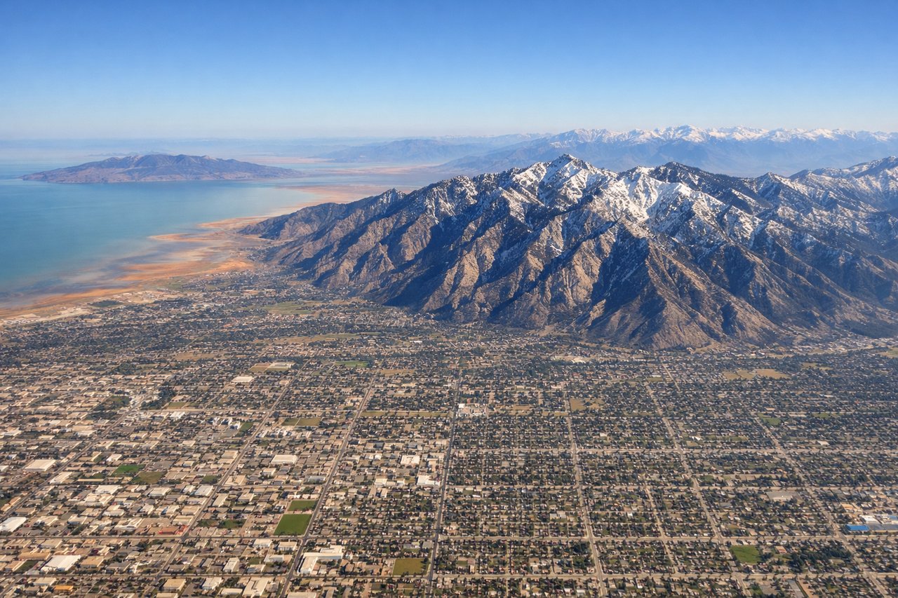
Takeoff from SLC
RIGHTRight-side seats capture the Wasatch Range immediately after departure, with the dramatic peaks rising directly alongside the climb-out path. SLC typically departs westbound (Runways 16L/R), so the eastern mountains are visible on the right as you gain altitude.
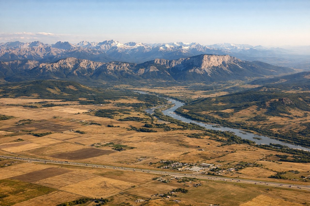
Landing at YYC
LEFTLeft-side seats offer the best views during approach to Calgary. Typical landing runways are 16 or 34 (north-south oriented), and left-side seats capture the Canadian Rockies to the west and the Bow River valley as you descend into the city.
Will your flight be in sunlight?
Pick a date and time in the Sun Map to watch the sun move across your whole flight.
About This Route
Which side of the plane should I sit on flying from Salt Lake City International (SLC) to Calgary International (YYC)?
Sit on the Right side of the plane for the best views on flights from Salt Lake City to Calgary. While landing favors the left, the takeoff view of the Wasatch Range is more dramatic and immediate. The right side captures the most visually striking geography early in the flight, making it the better overall choice for this route.
What can I see during takeoff from Salt Lake City International in Salt Lake City?
During takeoff from Salt Lake City International (SLC), sit on the Right side for the best views. Right-side seats capture the Wasatch Range immediately after departure, with the dramatic peaks rising directly alongside the climb-out path. SLC typically departs westbound (Runways 16L/R), so the eastern mountains are visible on the right as you gain altitude. Notable sights include: Wasatch Range (Mount Olympus, Mount Aire), Great Salt Lake to the northwest, Salt Lake Valley urban grid below, Antelope Island in the lake.
What can I see when landing at Calgary International in Calgary?
When landing at Calgary International (YYC), sit on the Left side for the best views. Left-side seats offer the best views during approach to Calgary. Typical landing runways are 16 or 34 (north-south oriented), and left-side seats capture the Canadian Rockies to the west and the Bow River valley as you descend into the city. Notable sights include: Canadian Rocky Mountains (visible as a distant ridge on the western horizon), Bow River valley and downtown Calgary, Nose Hill and surrounding foothills, prairies extending eastward.
How long is the flight from Salt Lake City to Calgary?
The flight from Salt Lake City International (SLC) to Calgary International (YYC) takes about 2 hours 15 minutes. The shortest flight path between them is 720 miles (1,159 km); winds and air traffic control usually add a few percent.
What does the Salt Lake City to Calgary flight path pass over?
The flight path crosses the Utah-Wyoming border near the Uinta Mountains (visible to the north around the 45-minute mark), then continues northeast over the high desert plateau of southwestern Wyoming. The Green River basin and scattered buttes appear in the midpoint section. As you approach the Wyoming-Idaho-Montana region, the terrain gradually transitions from high desert to rolling prairie. The flight passes east of the Teton Range and Absaroka Mountains (visible distantly to the northwest around the 90-minute mark). The final approach into Calgary crosses the foothills zone where the prairies begin to rise toward the Rocky Mountains.