Sacramento to Honolulu is 2,460 miles (3,960 km), a flight of about 5 hours 35 minutes.
Both sides face over five hours of empty Pacific Ocean during cruise, so the deciding factor is the arrival sequence. The left side's view of Diamond Head, Waikiki, and the Honolulu coastline during the final approach turn is far more distinctive than anything visible on departure from Sacramento, giving the left side the overall edge.
Flight Path
Open Pacific Ocean with no visible land; the route crosses deep ocean far north of any islands, offering only water, cloud shadows, and occasional ship wakes far below.
Great circle distance and headings ›

Phase by phase
Takeoff from SMF
RIGHTDeparting SMF and turning southwest toward the Pacific, the right side offers a brief look at the Sacramento River Delta, the edge of the Coast Range, and possibly the San Francisco Bay Area before the route heads out over open water. The left side only shows the Sierra Nevada foothills receding quickly as the plane turns away from them.
Landing at HNL
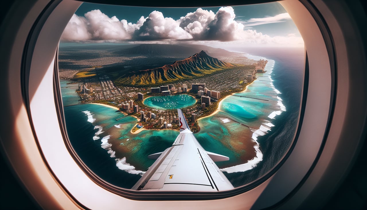
LEFTOn the approach into HNL from the mainland, aircraft typically curve around the south shore of Oahu to line up with the runway, putting Diamond Head, Waikiki Beach, and the Honolulu skyline directly in view on the left side. The right side mostly faces open ocean or the interior Koolau Range without the coastal detail.
Landmarks on this routeAll landmarks →
Will your flight be in sunlight?
Pick a date and time in the Sun Map to watch the sun move across your whole flight.
About This Route
Which side of the plane should I sit on flying from Sacramento International (SMF) to Honolulu International (HNL)?
Sit on the Left side of the plane for the best views on flights from Sacramento to Honolulu. Both sides face over five hours of empty Pacific Ocean during cruise, so the deciding factor is the arrival sequence. The left side's view of Diamond Head, Waikiki, and the Honolulu coastline during the final approach turn is far more distinctive than anything visible on departure from Sacramento, giving the left side the overall edge.
What can I see during takeoff from Sacramento International in Sacramento?
During takeoff from Sacramento International (SMF), sit on the Right side for the best views. Departing SMF and turning southwest toward the Pacific, the right side offers a brief look at the Sacramento River Delta, the edge of the Coast Range, and possibly the San Francisco Bay Area before the route heads out over open water. The left side only shows the Sierra Nevada foothills receding quickly as the plane turns away from them. Notable sights include: Sacramento River Delta, Coast Range foothills, distant San Francisco Bay, Central Valley farmland.
What can I see when landing at Honolulu International in Honolulu?
When landing at Honolulu International (HNL), sit on the Left side for the best views. On the approach into HNL from the mainland, aircraft typically curve around the south shore of Oahu to line up with the runway, putting Diamond Head, Waikiki Beach, and the Honolulu skyline directly in view on the left side. The right side mostly faces open ocean or the interior Koolau Range without the coastal detail. Notable sights include: Diamond Head crater, Waikiki Beach, Honolulu skyline, coral reefs along the south shore.
How long is the flight from Sacramento to Honolulu?
The flight from Sacramento International (SMF) to Honolulu International (HNL) takes about 5 hours 35 minutes. The shortest flight path between them is 2,460 miles (3,960 km); winds and air traffic control usually add a few percent.
What does the Sacramento to Honolulu flight path pass over?
Open Pacific Ocean with no visible land; the route crosses deep ocean far north of any islands, offering only water, cloud shadows, and occasional ship wakes far below.