Honolulu to Sacramento is 2,460 miles (3,960 km), a flight of about 5 hours 5 minutes.
The right side offers a scenic departure over Waikiki and Diamond Head plus a Sierra Nevada view on arrival, while the left side is dominated by featureless ocean and flat valley terrain for nearly the entire flight.
Flight Path
Open Pacific Ocean for the vast majority of the route, with no land visible between Hawaii and the California coast near San Francisco Bay.
Great circle distance and headings ›

Phase by phase
Takeoff from HNL
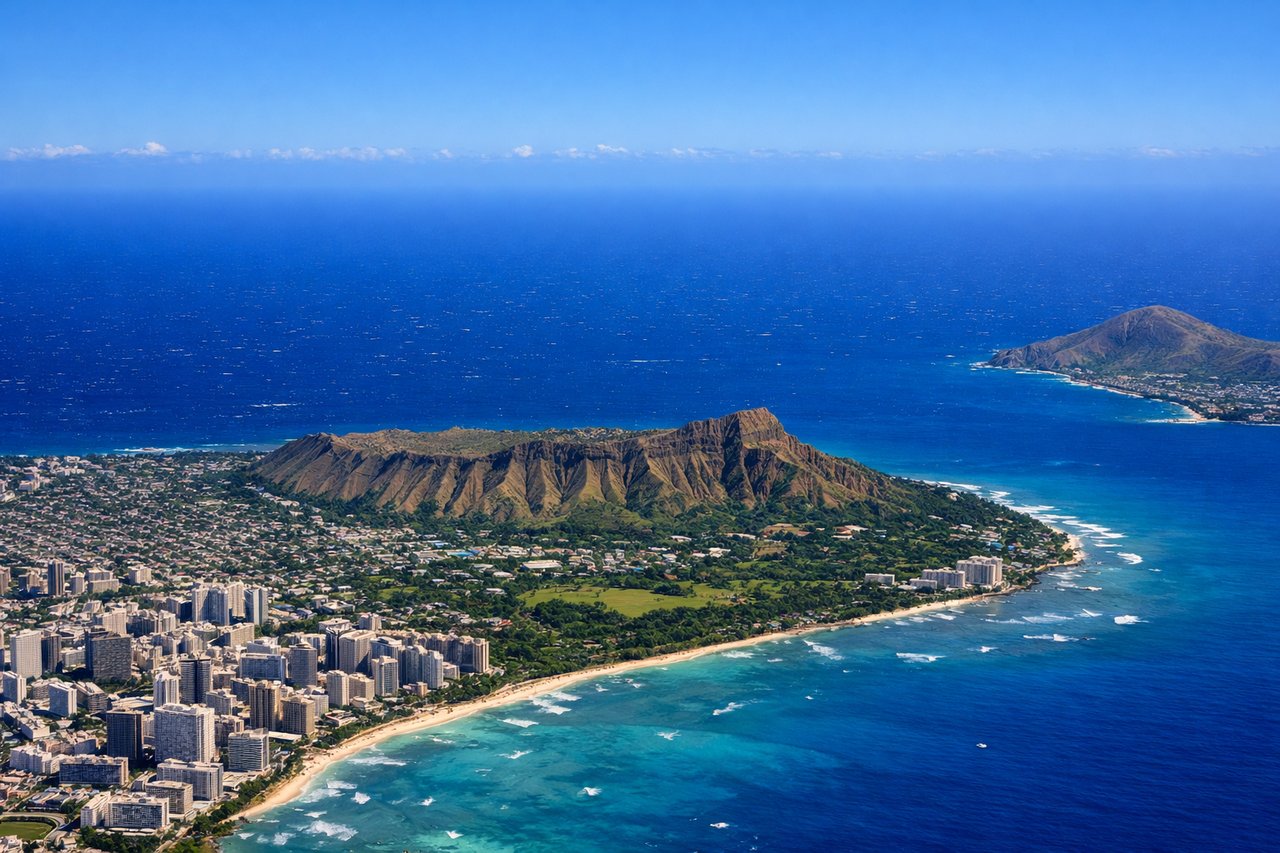
RIGHTDeparting HNL on the Reef Runway heading east-northeast before turning toward the mainland, the right side faces south across Waikiki, Diamond Head crater, and the Honolulu skyline as the aircraft climbs over the south shore of Oahu. The left side mostly shows open ocean and the less distinctive windward coastline.
Landing at SMF
RIGHTOn approach into Sacramento, the flight path crosses the Central Valley with the Sierra Nevada foothills and snow-capped peaks visible to the east on the right side, offering the most distinct terrain feature near SMF. The left side shows only the flat, uniform farmland of the Sacramento Valley.
Landmarks on this routeAll landmarks →
Will your flight be in sunlight?
Pick a date and time in the Sun Map to watch the sun move across your whole flight.
About This Route
Which side of the plane should I sit on flying from Honolulu International (HNL) to Sacramento International (SMF)?
Sit on the Right side of the plane for the best views on flights from Honolulu to Sacramento. The right side offers a scenic departure over Waikiki and Diamond Head plus a Sierra Nevada view on arrival, while the left side is dominated by featureless ocean and flat valley terrain for nearly the entire flight.
What can I see during takeoff from Honolulu International in Honolulu?
During takeoff from Honolulu International (HNL), sit on the Right side for the best views. Departing HNL on the Reef Runway heading east-northeast before turning toward the mainland, the right side faces south across Waikiki, Diamond Head crater, and the Honolulu skyline as the aircraft climbs over the south shore of Oahu. The left side mostly shows open ocean and the less distinctive windward coastline. Notable sights include: Diamond Head crater, Waikiki Beach, Honolulu skyline, Pacific coastline of Oahu.
What can I see when landing at Sacramento International in Sacramento?
When landing at Sacramento International (SMF), sit on the Right side for the best views. On approach into Sacramento, the flight path crosses the Central Valley with the Sierra Nevada foothills and snow-capped peaks visible to the east on the right side, offering the most distinct terrain feature near SMF. The left side shows only the flat, uniform farmland of the Sacramento Valley. Notable sights include: Sierra Nevada foothills, Sacramento River, Central Valley farmland, distant snow-capped peaks.
How long is the flight from Honolulu to Sacramento?
The flight from Honolulu International (HNL) to Sacramento International (SMF) takes about 5 hours 5 minutes. The shortest flight path between them is 2,460 miles (3,960 km); winds and air traffic control usually add a few percent.
What does the Honolulu to Sacramento flight path pass over?
Open Pacific Ocean for the vast majority of the route, with no land visible between Hawaii and the California coast near San Francisco Bay.