While the takeoff offers good river views from the right, the landing approach from the left provides more dramatic and geographically significant scenery—the Mississippi delta and Lake Pontchartrain are more visually distinctive than the initial climb-out. The left side captures the most iconic geography of this route.
Flown STL to MSY? Did we get it right?
Flight Path
St. Louis to New Orleans is 605 miles (974 km), a flight of about 1 hour 15 minutes.
The flight path crosses central Louisiana, passing over the Atchafalaya River basin (a major swamp and distributary system visible as a complex network of waterways and vegetation), followed by the transition into the Mississippi delta region. The Atchafalaya appears roughly 40 minutes into the flight and is visible as a large wetland system with meandering channels. No major mountain ranges or significant elevation changes occur along this route—the terrain remains flat throughout, with the primary visual interest being river systems, wetlands, and the gradual transition from upland forest to coastal marshland.
Great circle distance and headings ›Phase by phase

Takeoff from STL
RIGHTRight-side seats offer the best view of the Mississippi River as it curves through St. Louis immediately after departure. The river's distinctive meanders and the Gateway Arch are visible during the initial climb-out heading southeast.
Landing at MSY
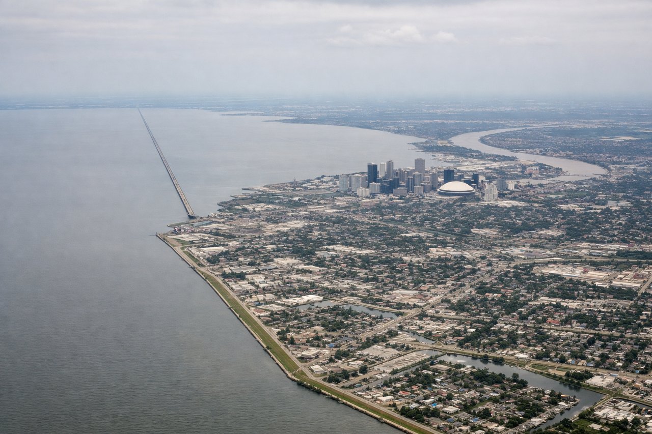
LEFTLeft-side seats provide excellent views of the Mississippi River delta and Lake Pontchartrain during descent into New Orleans. The river's final meanders and the distinctive crescent-shaped city layout are visible on approach from the north.
Will your flight be in sunlight?
Pick a date and time in the Sun Map to watch the sun move across your whole flight.
About This Route
Which side of the plane should I sit on flying from Lambert St Louis International (STL) to Louis Armstrong New Orleans International (MSY)?
Sit on the Left side of the plane for the best views on flights from St. Louis to New Orleans. While the takeoff offers good river views from the right, the landing approach from the left provides more dramatic and geographically significant scenery—the Mississippi delta and Lake Pontchartrain are more visually distinctive than the initial climb-out. The left side captures the most iconic geography of this route.
What can I see during takeoff from Lambert St Louis International in St. Louis?
During takeoff from Lambert St Louis International (STL), sit on the Right side for the best views. Right-side seats offer the best view of the Mississippi River as it curves through St. Louis immediately after departure. The river's distinctive meanders and the Gateway Arch are visible during the initial climb-out heading southeast. Notable sights include: Mississippi River (main channel and meanders), Gateway Arch, St. Louis urban grid, Illinois bluffs across the river.
What can I see when landing at Louis Armstrong New Orleans International in New Orleans?
When landing at Louis Armstrong New Orleans International (MSY), sit on the Left side for the best views. Left-side seats provide excellent views of the Mississippi River delta and Lake Pontchartrain during descent into New Orleans. The river's final meanders and the distinctive crescent-shaped city layout are visible on approach from the north. Notable sights include: Mississippi River delta (multiple distributaries), Lake Pontchartrain, New Orleans crescent bend, coastal wetlands and bayou.
How long is the flight from St. Louis to New Orleans?
The flight from Lambert St Louis International (STL) to Louis Armstrong New Orleans International (MSY) takes about 1 hour 15 minutes. The shortest flight path between them is 605 miles (974 km); winds and air traffic control usually add a few percent.
What does the St. Louis to New Orleans flight path pass over?
The flight path crosses central Louisiana, passing over the Atchafalaya River basin (a major swamp and distributary system visible as a complex network of waterways and vegetation), followed by the transition into the Mississippi delta region. The Atchafalaya appears roughly 40 minutes into the flight and is visible as a large wetland system with meandering channels. No major mountain ranges or significant elevation changes occur along this route—the terrain remains flat throughout, with the primary visual interest being river systems, wetlands, and the gradual transition from upland forest to coastal marshland.