The right side offers a more varied and dramatic full-flight experience, combining Taiwan's foothills at takeoff with the karst islands, coastline, and Red River Delta mountains on approach into Hanoi, while the left side is dominated by open water over the Taiwan Strait and Gulf of Tonkin.
Flown TPE to HAN? Did we get it right?
Flight Path
Taipei to Hanoi is 1,015 miles (1,633 km), a flight of about 2 hours 25 minutes.
Taiwan Strait, Hainan Strait near the Leizhou Peninsula, and the Gulf of Tonkin
Great circle distance and headings ›Phase by phase

Takeoff from TPE
RIGHTDeparting TPE to the southwest, the initial turn puts Taiwan's central mountain foothills and the green hills behind Taoyuan on the right side, while the left side faces flat urban sprawl and quickly disappears into the Taiwan Strait haze.
Landing at HAN
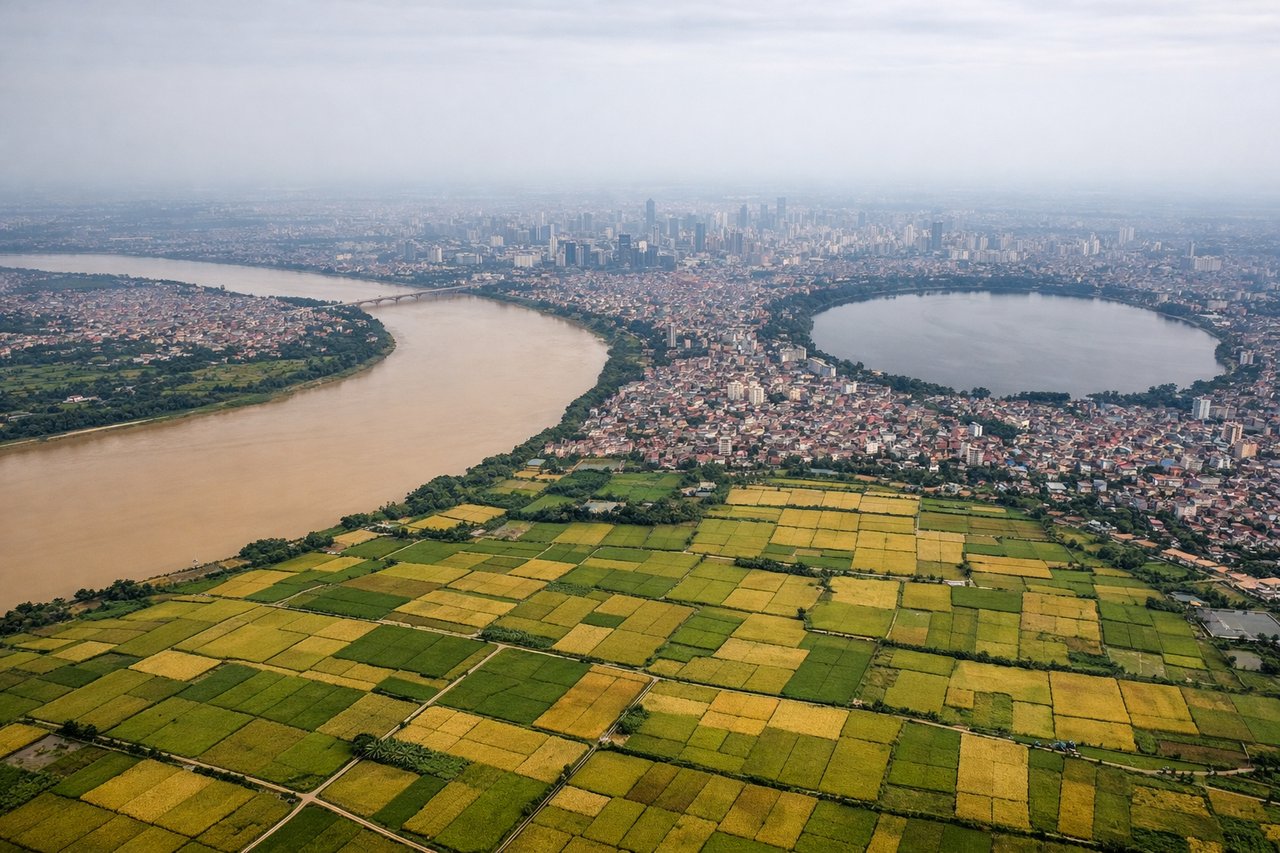
RIGHTOn approach into Hanoi from the east, the flight path crosses near the Gulf of Tonkin coastline where the limestone karst islands of the Ha Long Bay area are visible to the north, and later the Red River Delta opens up with the distant Hoang Lien Son mountains on the horizon to the northwest.
Will your flight be in sunlight?
Pick a date and time in the Sun Map to watch the sun move across your whole flight.
About This Route
Which side of the plane should I sit on flying from Chiang Kai Shek International (TPE) to Noibai International (HAN)?
Sit on the Right side of the plane for the best views on flights from Taipei to Hanoi. The right side offers a more varied and dramatic full-flight experience, combining Taiwan's foothills at takeoff with the karst islands, coastline, and Red River Delta mountains on approach into Hanoi, while the left side is dominated by open water over the Taiwan Strait and Gulf of Tonkin.
What can I see during takeoff from Chiang Kai Shek International in Taipei?
During takeoff from Chiang Kai Shek International (TPE), sit on the Right side for the best views. Departing TPE to the southwest, the initial turn puts Taiwan's central mountain foothills and the green hills behind Taoyuan on the right side, while the left side faces flat urban sprawl and quickly disappears into the Taiwan Strait haze. Notable sights include: Taoyuan urban plain, foothills of Taiwan's Central Mountain Range, Taiwan Strait coastline.
What can I see when landing at Noibai International in Hanoi?
When landing at Noibai International (HAN), sit on the Right side for the best views. On approach into Hanoi from the east, the flight path crosses near the Gulf of Tonkin coastline where the limestone karst islands of the Ha Long Bay area are visible to the north, and later the Red River Delta opens up with the distant Hoang Lien Son mountains on the horizon to the northwest. Notable sights include: Ha Long Bay karst islands, Gulf of Tonkin coastline, Red River and its delta, distant Hoang Lien Son mountain range.
How long is the flight from Taipei to Hanoi?
The flight from Chiang Kai Shek International (TPE) to Noibai International (HAN) takes about 2 hours 25 minutes. The shortest flight path between them is 1,015 miles (1,633 km); winds and air traffic control usually add a few percent.
What does the Taipei to Hanoi flight path pass over?
Taiwan Strait, Hainan Strait near the Leizhou Peninsula, and the Gulf of Tonkin