While takeoff favors the left for Andean views, the landing approach into Cartagena on the right side—with the Rosario Islands and Caribbean coastline—offers more dramatic and distinctive scenery. The right side captures the visual highlight of this route.
Flown UIO to CTG? Did we get it right?
Flight Path
Quito to Cartagena is 756 miles (1,216 km), a flight of about 2 hours 10 minutes.
The flight path crosses from the high Andes of Ecuador northwestward over the Pacific-facing western cordillera, then descends into the Cauca River valley and Caribbean lowlands of Colombia. Notable midpoint features include the descent from 13,000+ foot Andean terrain into tropical lowlands, the transition from highland cloud forest to coastal plains, and the Magdalena River delta region visible on approach to the Caribbean coast.
Great circle distance and headings ›

Phase by phase
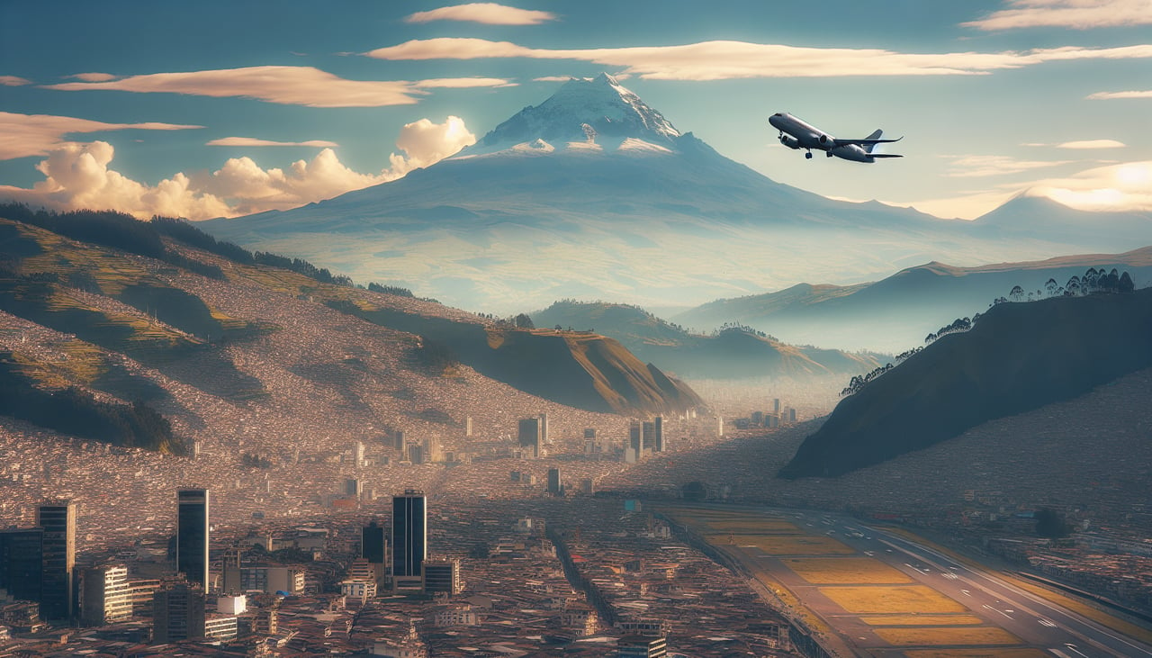
Takeoff from UIO
LEFTLeft-side seats offer the best view during climb-out from Quito. You'll see the Andes peaks that ring the city, particularly Pichincha volcano and the high plateau terrain to the west and northwest as the aircraft banks northward on its typical departure routing.
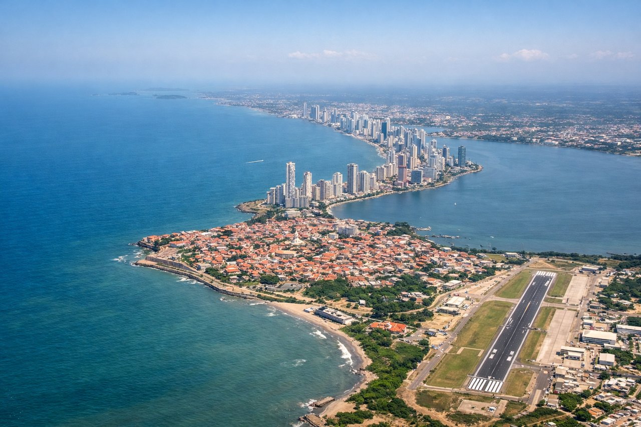
Landing at CTG
RIGHTRight-side seats provide superior views during the descent into Cartagena. As the aircraft approaches from the south and southwest, the right wing reveals the Caribbean coastline, the Rosario Islands archipelago, and the city's colonial waterfront on the Caribbean coast before final approach.
Will your flight be in sunlight?
Pick a date and time in the Sun Map to watch the sun move across your whole flight.
About This Route
Which side of the plane should I sit on flying from Mariscal Sucre International Airport (UIO) to Rafael Nunez (CTG)?
Sit on the Right side of the plane for the best views on flights from Quito to Cartagena. While takeoff favors the left for Andean views, the landing approach into Cartagena on the right side—with the Rosario Islands and Caribbean coastline—offers more dramatic and distinctive scenery. The right side captures the visual highlight of this route.
What can I see during takeoff from Mariscal Sucre International Airport in Quito?
During takeoff from Mariscal Sucre International Airport (UIO), sit on the Left side for the best views. Left-side seats offer the best view during climb-out from Quito. You'll see the Andes peaks that ring the city, particularly Pichincha volcano and the high plateau terrain to the west and northwest as the aircraft banks northward on its typical departure routing. Notable sights include: Pichincha volcano (5,897 m, visible on the immediate left during initial climb), the Quito basin and surrounding Andean ridges, the western cordillera escarpment dropping toward the Pacific lowlands.
What can I see when landing at Rafael Nunez in Cartagena?
When landing at Rafael Nunez (CTG), sit on the Right side for the best views. Right-side seats provide superior views during the descent into Cartagena. As the aircraft approaches from the south and southwest, the right wing reveals the Caribbean coastline, the Rosario Islands archipelago, and the city's colonial waterfront on the Caribbean coast before final approach. Notable sights include: Rosario Islands (Islas del Rosario) archipelago with turquoise shallow waters, Cartagena's walled old city and harbor on the Caribbean coast, the Magdalena River delta region to the south and inland.
How long is the flight from Quito to Cartagena?
The flight from Mariscal Sucre International Airport (UIO) to Rafael Nunez (CTG) takes about 2 hours 10 minutes. The shortest flight path between them is 756 miles (1,216 km); winds and air traffic control usually add a few percent.
What does the Quito to Cartagena flight path pass over?
The flight path crosses from the high Andes of Ecuador northwestward over the Pacific-facing western cordillera, then descends into the Cauca River valley and Caribbean lowlands of Colombia. Notable midpoint features include the descent from 13,000+ foot Andean terrain into tropical lowlands, the transition from highland cloud forest to coastal plains, and the Magdalena River delta region visible on approach to the Caribbean coast.