While takeoff from Port Vila favors the right, the Brisbane landing on the left provides more dramatic and extended views of major geographic features (Moreton Bay islands, Brisbane River delta, city skyline). The landing experience outweighs the takeoff advantage.
Flown VLI to BNE? Did we get it right?
Flight Path
Port Vila to Brisbane is 1,177 miles (1,894 km), a flight of about 3 hours 15 minutes.
The flight path crosses the Coral Sea heading southwest to northeast. Notable features include the New Hebrides Trench (not visible at altitude but defines the seabed), open ocean with occasional cumulus cloud formations, and the gradual transition from tropical island waters to the Australian continental shelf. Around midpoint, the flight passes east of the Great Barrier Reef region (not directly visible but the reef system influences water color patterns visible from altitude). The Australian coast becomes visible approximately 45 minutes before landing, with the Queensland coastline and Moreton Bay appearing first.
Great circle distance and headings ›Phase by phase
Takeoff from VLI
RIGHTPort Vila typically departs runway 20 (southwesterly). Right-side seats offer views of Efate Island's southern coastline and the immediate volcanic terrain surrounding the airport as you climb out over the channel toward the Coral Sea.
Landing at BNE
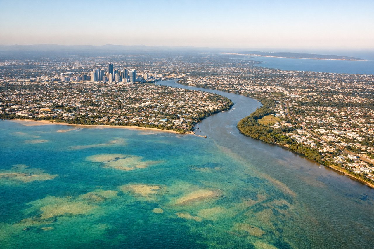
LEFTBrisbane typically lands runway 01L or 01R (northerly approaches). Left-side seats provide excellent views of Moreton Bay's islands and the Brisbane River delta as you descend through 8,000-10,000 feet on final approach, with the city skyline becoming visible ahead.
Will your flight be in sunlight?
Pick a date and time in the Sun Map to watch the sun move across your whole flight.
About This Route
Which side of the plane should I sit on flying from Port Vila Bauerfield (VLI) to Brisbane International (BNE)?
Sit on the Left side of the plane for the best views on flights from Port Vila to Brisbane. While takeoff from Port Vila favors the right, the Brisbane landing on the left provides more dramatic and extended views of major geographic features (Moreton Bay islands, Brisbane River delta, city skyline). The landing experience outweighs the takeoff advantage.
What can I see during takeoff from Port Vila Bauerfield in Port Vila?
During takeoff from Port Vila Bauerfield (VLI), sit on the Right side for the best views. Port Vila typically departs runway 20 (southwesterly). Right-side seats offer views of Efate Island's southern coastline and the immediate volcanic terrain surrounding the airport as you climb out over the channel toward the Coral Sea. Notable sights include: Efate Island's rugged southern coast, Port Vila harbor and waterfront, nearby volcanic ridges, Epi Island visible to the northwest across the channel.
What can I see when landing at Brisbane International in Brisbane?
When landing at Brisbane International (BNE), sit on the Left side for the best views. Brisbane typically lands runway 01L or 01R (northerly approaches). Left-side seats provide excellent views of Moreton Bay's islands and the Brisbane River delta as you descend through 8,000-10,000 feet on final approach, with the city skyline becoming visible ahead. Notable sights include: Moreton Bay and its islands (North Stradbroke, Moreton Island), Brisbane River winding through the city, Brisbane CBD skyline, Bayside suburbs and waterfront precincts.
How long is the flight from Port Vila to Brisbane?
The flight from Port Vila Bauerfield (VLI) to Brisbane International (BNE) takes about 3 hours 15 minutes. The shortest flight path between them is 1,177 miles (1,894 km); winds and air traffic control usually add a few percent.
What does the Port Vila to Brisbane flight path pass over?
The flight path crosses the Coral Sea heading southwest to northeast. Notable features include the New Hebrides Trench (not visible at altitude but defines the seabed), open ocean with occasional cumulus cloud formations, and the gradual transition from tropical island waters to the Australian continental shelf. Around midpoint, the flight passes east of the Great Barrier Reef region (not directly visible but the reef system influences water color patterns visible from altitude). The Australian coast becomes visible approximately 45 minutes before landing, with the Queensland coastline and Moreton Bay appearing first.