The landing approach into Budapest offers more dramatic and memorable geography—the Danube's meanders and the Buda Hills provide clear visual landmarks. Takeoff from Warsaw is relatively flat and less distinctive, making the landing experience the stronger choice for window-seat geography.
Flown WAW to BUD? Did we get it right?
Flight Path
Warsaw to Budapest is 336 miles (541 km), a flight of about 1 hour 25 minutes.
The flight path crosses the Carpathian foothills' northern approaches around the Slovakia-Hungary border. The terrain transitions from Polish plains (flat agricultural land) through southern Slovakia (low rolling hills and scattered forests) before descending into the Danube Basin. The Vág River valley in Slovakia may be visible on clear days as a linear feature cutting through forested terrain. No major mountain peaks are directly on the typical flight corridor, but the Carpathian range's northern edge appears as distant, low ridges on the southern horizon during cruise.
Great circle distance and headings ›
Phase by phase
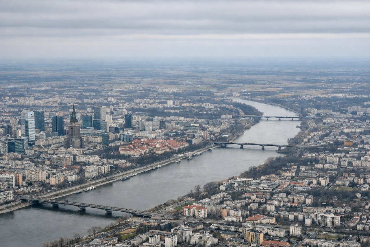
Takeoff from WAW
RIGHTWarsaw typically departs eastbound (runways 33L/33R). Right-side seats face south toward the Vistula River valley and the flat agricultural plains that dominate central Poland's landscape immediately after takeoff.
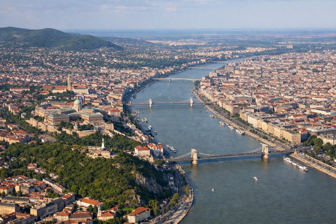
Landing at BUD
LEFTBudapest typically lands westbound (runways 04L/04R). Left-side seats descend toward the Danube River, which makes a dramatic horseshoe bend through Budapest's center. The river and the city's distinctive layout across both banks are the flight's most striking visual feature on approach.
Will your flight be in sunlight?
Pick a date and time in the Sun Map to watch the sun move across your whole flight.
About This Route
Which side of the plane should I sit on flying from Okecie (WAW) to Ferihegy (BUD)?
Sit on the Left side of the plane for the best views on flights from Warsaw to Budapest. The landing approach into Budapest offers more dramatic and memorable geography—the Danube's meanders and the Buda Hills provide clear visual landmarks. Takeoff from Warsaw is relatively flat and less distinctive, making the landing experience the stronger choice for window-seat geography.
What can I see during takeoff from Okecie in Warsaw?
During takeoff from Okecie (WAW), sit on the Right side for the best views. Warsaw typically departs eastbound (runways 33L/33R). Right-side seats face south toward the Vistula River valley and the flat agricultural plains that dominate central Poland's landscape immediately after takeoff. Notable sights include: Vistula River (visible as a meandering ribbon below), Warsaw city sprawl transitioning to farmland, Masovian Plain extending to the horizon.
What can I see when landing at Ferihegy in Budapest?
When landing at Ferihegy (BUD), sit on the Left side for the best views. Budapest typically lands westbound (runways 04L/04R). Left-side seats descend toward the Danube River, which makes a dramatic horseshoe bend through Budapest's center. The river and the city's distinctive layout across both banks are the flight's most striking visual feature on approach. Notable sights include: Danube River with its characteristic meanders, Budapest's Buda Hills (Buda side, west bank), Pest's flat terrain (east bank), Margaret Island in the river.
How long is the flight from Warsaw to Budapest?
The flight from Okecie (WAW) to Ferihegy (BUD) takes about 1 hour 25 minutes. The shortest flight path between them is 336 miles (541 km); winds and air traffic control usually add a few percent.
What does the Warsaw to Budapest flight path pass over?
The flight path crosses the Carpathian foothills' northern approaches around the Slovakia-Hungary border. The terrain transitions from Polish plains (flat agricultural land) through southern Slovakia (low rolling hills and scattered forests) before descending into the Danube Basin. The Vág River valley in Slovakia may be visible on clear days as a linear feature cutting through forested terrain. No major mountain peaks are directly on the typical flight corridor, but the Carpathian range's northern edge appears as distant, low ridges on the southern horizon during cruise.