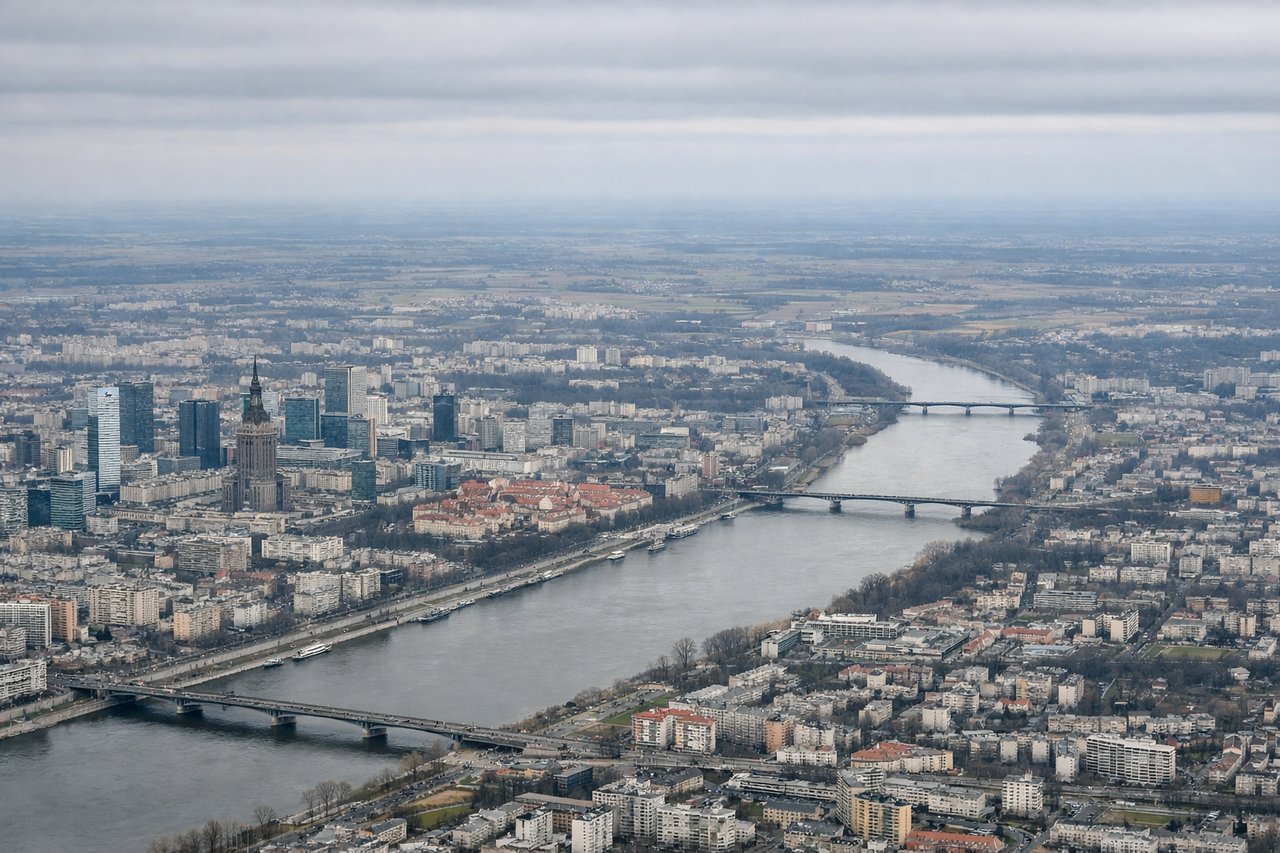
Right-side seats offer superior views on both legs: northbound departure over the Vistula and Masovian Plain, and the dramatic Dolomite descent into Bolzano. The landing view alone justifies the right side for this route.
Flown WAW to BZO? Did we get it right?
Flight Path
Warsaw to Bolzano is 586 miles (943 km), a flight of about 2 hours 15 minutes.
The flight crosses the Carpathian foothills and Moravian highlands (Czech-Polish border region), then enters the Alpine zone near the Austrian-Czech border. The Sudetes Mountains are visible to the left (south) during the midpoint. The flight path descends gradually from the North European Plain into increasingly mountainous terrain, with the Alps becoming dominant in the final 45 minutes. The Vltava River valley (Czech Republic) and later the Inn River valley (Austria) mark key geographic transitions along the route.
Great circle distance and headings ›

Phase by phase
Takeoff from WAW
RIGHTWarsaw typically departs eastbound (runways 33L/33R). Right-side seats face north initially, offering views of the Vistula River's northern course through Warsaw's suburbs and the flat Masovian Plain extending toward the Baltic direction. Left seats see the southern industrial suburbs and less distinctive terrain.
Landing at BZO
RIGHTBolzano typically lands westbound (runway 29). Right-side seats during descent offer dramatic views of the Dolomites' eastern faces and the Adige Valley approach. The Alps fill the right window as you descend into the valley, with Bolzano's position at the valley floor becoming visible. Left seats see only the western Alpine slopes and less distinctive terrain.
Will your flight be in sunlight?
Pick a date and time in the Sun Map to watch the sun move across your whole flight.
About This Route
Which side of the plane should I sit on flying from Okecie (WAW) to Bolzano (BZO)?
Sit on the Right side of the plane for the best views on flights from Warsaw to Bolzano. Right-side seats offer superior views on both legs: northbound departure over the Vistula and Masovian Plain, and the dramatic Dolomite descent into Bolzano. The landing view alone justifies the right side for this route.
What can I see during takeoff from Okecie in Warsaw?
During takeoff from Okecie (WAW), sit on the Right side for the best views. Warsaw typically departs eastbound (runways 33L/33R). Right-side seats face north initially, offering views of the Vistula River's northern course through Warsaw's suburbs and the flat Masovian Plain extending toward the Baltic direction. Left seats see the southern industrial suburbs and less distinctive terrain. Notable sights include: Vistula River (winding through Warsaw), Masovian Plain (flat agricultural landscape), Warsaw city grid (visible as urban sprawl), Narew River confluence (northeast of airport).
What can I see when landing at Bolzano in Bolzano?
When landing at Bolzano (BZO), sit on the Right side for the best views. Bolzano typically lands westbound (runway 29). Right-side seats during descent offer dramatic views of the Dolomites' eastern faces and the Adige Valley approach. The Alps fill the right window as you descend into the valley, with Bolzano's position at the valley floor becoming visible. Left seats see only the western Alpine slopes and less distinctive terrain. Notable sights include: Dolomites (UNESCO peaks, especially Tre Cime area to the northeast), Adige River Valley (the approach corridor), Bolzano city center (small but visible in the valley floor), Brenner Pass region (visible to the north as higher terrain).
How long is the flight from Warsaw to Bolzano?
The flight from Okecie (WAW) to Bolzano (BZO) takes about 2 hours 15 minutes. The shortest flight path between them is 586 miles (943 km); winds and air traffic control usually add a few percent.
What does the Warsaw to Bolzano flight path pass over?
The flight crosses the Carpathian foothills and Moravian highlands (Czech-Polish border region), then enters the Alpine zone near the Austrian-Czech border. The Sudetes Mountains are visible to the left (south) during the midpoint. The flight path descends gradually from the North European Plain into increasingly mountainous terrain, with the Alps becoming dominant in the final 45 minutes. The Vltava River valley (Czech Republic) and later the Inn River valley (Austria) mark key geographic transitions along the route.