While Warsaw's takeoff offers modest urban and river scenery, the landing approach into Nice is substantially more dramatic. The Esterel Massif, Mediterranean coastline, and Bay of Angels provide genuine alpine-to-sea visual drama that outweighs the flat Polish departure. The right side captures one of Europe's most scenic coastal approaches, elevating the overall flight experience despite a less interesting cruise segment.
Flown WAW to NCE? Did we get it right?
Flight Path
Warsaw to Nice is 864 miles (1,390 km), a flight of about 2 hours 35 minutes.
Carpathian Mountains (distant, eastern Slovakia), Danube River valley (Hungary/Austria border region), Alpine foothills (eastern France), Rhône Valley (southern France), Provence limestone plateaus
Great circle distance and headings ›


Phase by phase
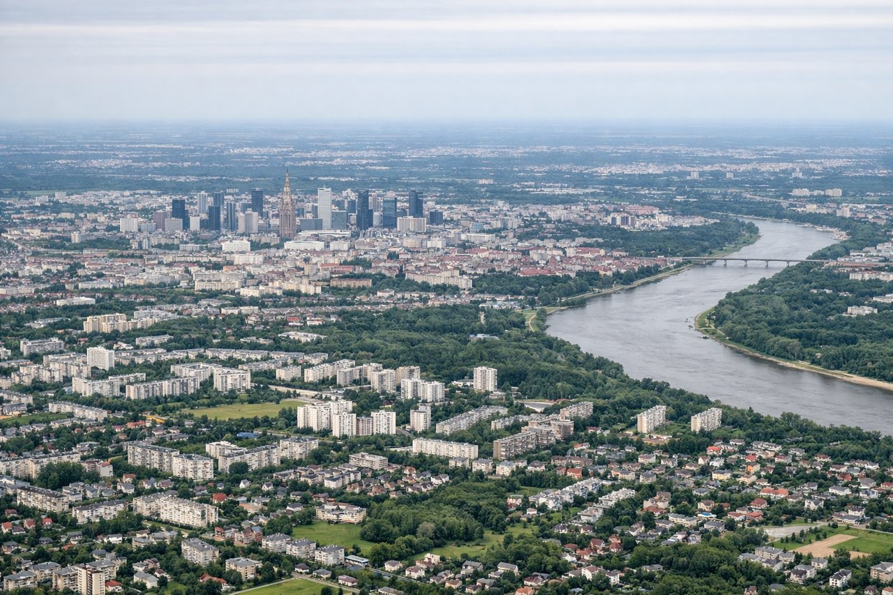
Takeoff from WAW
LEFTLeft side captures Warsaw's urban sprawl and the Vistula River valley during climb-out, with flat agricultural plains extending southward. Right side faces open countryside with minimal visual interest during initial ascent.
Landing at NCE
RIGHTRight side offers the dramatic Mediterranean approach: the Côte d'Azur coastline, the Esterel Massif's red rock formations, and the Bay of Angels with Nice's waterfront. Left side shows inland Provence hills and less distinctive terrain during descent.
Will your flight be in sunlight?
Pick a date and time in the Sun Map to watch the sun move across your whole flight.
About This Route
Which side of the plane should I sit on flying from Okecie (WAW) to Cote D Azur (NCE)?
Sit on the Right side of the plane for the best views on flights from Warsaw to Nice. While Warsaw's takeoff offers modest urban and river scenery, the landing approach into Nice is substantially more dramatic. The Esterel Massif, Mediterranean coastline, and Bay of Angels provide genuine alpine-to-sea visual drama that outweighs the flat Polish departure. The right side captures one of Europe's most scenic coastal approaches, elevating the overall flight experience despite a less interesting cruise segment.
What can I see during takeoff from Okecie in Warsaw?
During takeoff from Okecie (WAW), sit on the Left side for the best views. Left side captures Warsaw's urban sprawl and the Vistula River valley during climb-out, with flat agricultural plains extending southward. Right side faces open countryside with minimal visual interest during initial ascent. Notable sights include: Vistula River winding through Warsaw, Warsaw city center and Praga district, flat Masovian plains extending to the horizon.
What can I see when landing at Cote D Azur in Nice?
When landing at Cote D Azur (NCE), sit on the Right side for the best views. Right side offers the dramatic Mediterranean approach: the Côte d'Azur coastline, the Esterel Massif's red rock formations, and the Bay of Angels with Nice's waterfront. Left side shows inland Provence hills and less distinctive terrain during descent. Notable sights include: Esterel Massif with distinctive red-rock ridges, Bay of Angels and Nice's curved coastline, Mediterranean Sea, Promenade des Anglais waterfront.
How long is the flight from Warsaw to Nice?
The flight from Okecie (WAW) to Cote D Azur (NCE) takes about 2 hours 35 minutes. The shortest flight path between them is 864 miles (1,390 km); winds and air traffic control usually add a few percent.
What does the Warsaw to Nice flight path pass over?
Carpathian Mountains (distant, eastern Slovakia), Danube River valley (Hungary/Austria border region), Alpine foothills (eastern France), Rhône Valley (southern France), Provence limestone plateaus